Tizapán el Alto elevation
Tizapán el Alto (Jalisco), Mexico elevation is 1542 meters and Tizapán el Alto elevation in feet is 5059 ft above sea level [src 1]. Tizapán el Alto is a seat of a second-order administrative division (feature code) with elevation that is 228 meters (748 ft) bigger than average city elevation in Mexico.
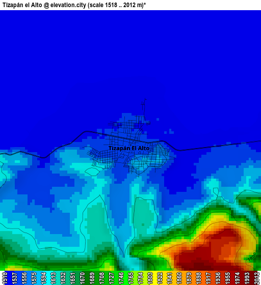
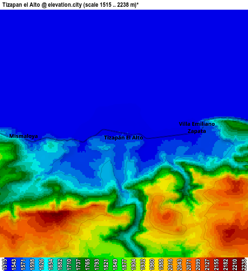
Below is the Elevation map of Tizapán el Alto, which displays elevation range with different colors. Scale of the first map is from 1518 to 2012 m (4980 to 6601 ft) with average elevation of 1575.9 meters (=5170 ft) [note 1]
These maps also provides idea of topography and contour of this city, they are displayed at different zoom levels. More info about maps, scale and edge coordinates you can find below images.
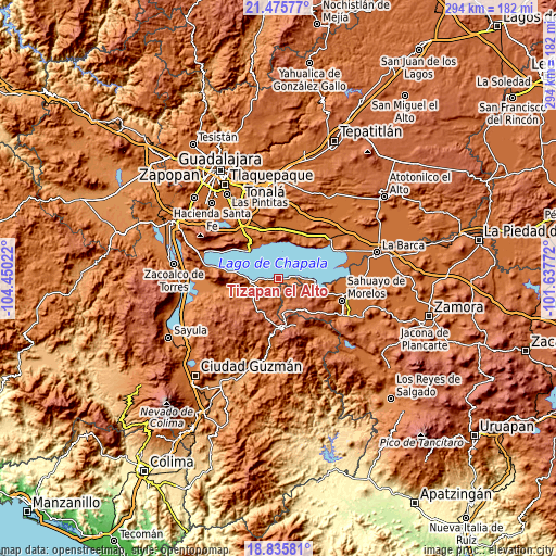
| \ | Map #1 | Map #2 | Topo.Map |
| Scale [m] | 1518..2012 m | 1515..2238 m | × |
| Scale [ft] | 4980..6601 ft | 4970..7343 ft | × |
| Average | 1575.9 m = 5170 ft | 1671.2 m = 5483 ft | × |
| Width | 9.17 km = 5.7 mi | 18.35 km = 11.4 mi | 293.5 km = 182.4 mi |
| Height | 9.17 km = 5.7 mi | 18.35 km = 11.4 mi | 293.6 km = 182.4 mi |
| ↑Max Latitude | 20.202617° | 20.243853° | 21.47577° |
| Latitude at center | 20.16137° | 20.16137° | 20.16137° |
| ↓Min Latitude | 20.120112° | 20.078843° | 18.83581° |
| ← Min Longitude | -103.087915° | -103.131861° | -104.45022° |
| Longitude center | -103.04397° | -103.04397° | -103.04397° |
| →Max Longitude | -103.000025° | -102.956079° | -101.63772° |
Nearby cities:
Cities around Tizapán el Alto sort by population:
• Chapala elevation 1539 m
21.5 km,  314°
314°
• San José de Gracia 2001 m
19.2 km,  173°
173°
• Cojumatlán de Régules 1549 m
20.6 km,  103°
103°
• San Pedro Itzicán 1538 m
19.7 km,  28°
28°
• Mezcala 1536 m
19.6 km,  8°
8°
• Villa Emiliano Zapata 1544 m
5.5 km,  84°
84°
• La Manzanilla de la Paz 2057 m
20.9 km,  213°
213°
• San Juan Tecomatlán 1532 m
19.5 km,  342°
342°
• Santa Cruz de la Soledad 1543 m
21.1 km,  325°
325°
• San Nicolás de Ibarra 1535 m
20.7 km, 334°
• Tuxcueca 1534 m
14.7 km,  266°
266°
• Ojo de Rana 2169 m
20.1 km,  128°
128°
Multilingual:
 En español:
Tizapán el Alto elevación 1542 m.
 En France:
Tizapán el Alto élévation 1542 m.
 Auf Deutsch:
Tizapán el Alto höhe über dem Meeresspiegel ist 1542 m.

Sources and notes:
- [note 1] Map square and city borders are not equal. Map elevation data is calculated only from area inside that square.
- [src 1] Elevation data from geonames database provided with same terms of usage.
- [src 2] The elevation map of Tizapán el Alto is generated using elevation data from NASA's 3 arcsec (90m) resolution SRTM data.
- [src 3] Base (background) map © OpenStreetMap contributors tiles are generated by Geofabrik and OpenTopoMap.
Copyright & License:
This Tizapán el Alto Elevation Map is licensed under CC BY-SA. You may reuse any part from this page, if you give a proper credit by linking to this URL:
 More info on terms of use page.