Valtierrilla elevation
Valtierrilla (Guanajuato, Salamanca), Mexico elevation is 1719 meters and Valtierrilla elevation in feet is 5640 ft above sea level [src 1]. Valtierrilla is a populated place (feature code) with elevation that is 405 meters (1329 ft) bigger than average city elevation in Mexico.
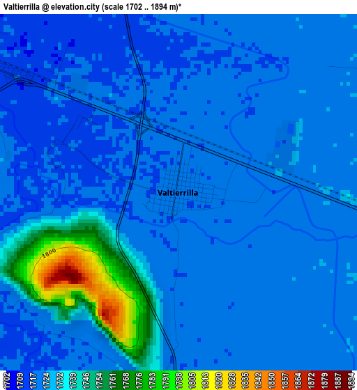
Below is the Elevation map of Valtierrilla, which displays elevation range with different colors. Scale of the first map is from 1702 to 1894 m (5584 to 6214 ft) with average elevation of 1726.7 meters (=5665 ft) [note 1]
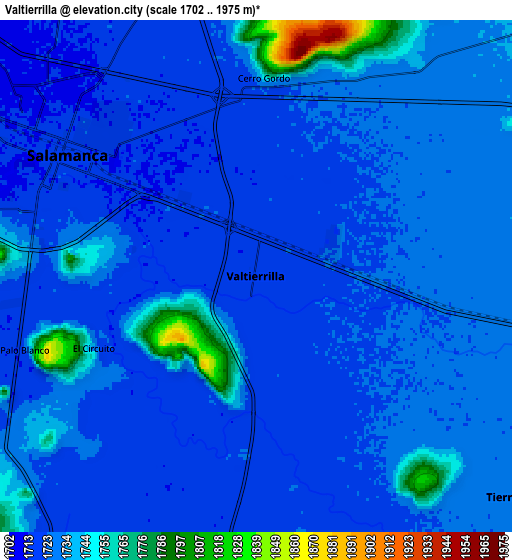
These maps also provides idea of topography and contour of this city, they are displayed at different zoom levels. More info about maps, scale and edge coordinates you can find below images.
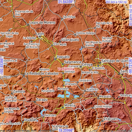
| \ | Map #1 | Map #2 | Topo.Map |
| Scale [m] | 1702..1894 m | 1702..1975 m | × |
| Scale [ft] | 5584..6214 ft | 5584..6480 ft | × |
| Average | 1726.7 m = 5665 ft | 1727.8 m = 5669 ft | × |
| Width | 9.15 km = 5.7 mi | 18.3 km = 11.4 mi | 292.8 km = 181.9 mi |
| Height | 9.15 km = 5.7 mi | 18.3 km = 11.4 mi | 292.9 km = 182 mi |
| ↑Max Latitude | 20.573588° | 20.614725° | 21.84359° |
| Latitude at center | 20.53244° | 20.53244° | 20.53244° |
| ↓Min Latitude | 20.491281° | 20.450111° | 19.20996° |
| ← Min Longitude | -101.171555° | -101.215501° | -102.53386° |
| Longitude center | -101.12761° | -101.12761° | -101.12761° |
| →Max Longitude | -101.083665° | -101.039719° | -99.72136° |
Nearby cities:
Cities around Valtierrilla sort by population:
• Salamanca elevation 1714 m
8 km,  303°
303°
• Mexicanos 1724 m
5.9 km,  93°
93°
• Cerro Gordo 1723 m
6.7 km,  0°
0°
• Sarabia 1722 m
7 km,  99°
99°
• El Divisador 1714 m
5.9 km,  327°
327°
• La Luz 1717 m
6 km,  293°
293°
• Colonia 18 de Marzo 1734 m
9.9 km,  74°
74°
• Valencia de Cerro Gordo 1742 m
9 km,  31°
31°
• Sotelo 1722 m
9.8 km,  147°
147°
• San Bernardo 1721 m
7.2 km, 154°
• San José de la Montaña 1736 m
9.5 km,  37°
37°
• Zapote de Palomas 1722 m
5.9 km,  12°
12°
Multilingual:
 En español:
Valtierrilla elevación 1719 m.
 En France:
Valtierrilla élévation 1719 m.
 Auf Deutsch:
Valtierrilla höhe über dem Meeresspiegel ist 1719 m.

Sources and notes:
- [note 1] Map square and city borders are not equal. Map elevation data is calculated only from area inside that square.
- [src 1] Elevation data from geonames database provided with same terms of usage.
- [src 2] The elevation map of Valtierrilla is generated using elevation data from NASA's 3 arcsec (90m) resolution SRTM data.
- [src 3] Base (background) map © OpenStreetMap contributors tiles are generated by Geofabrik and OpenTopoMap.
Copyright & License:
This Valtierrilla Elevation Map is licensed under CC BY-SA. You may reuse any part from this page, if you give a proper credit by linking to this URL:
 More info on terms of use page.