Viesca elevation
Viesca (Coahuila), Mexico elevation is 1098 meters and Viesca elevation in feet is 3602 ft above sea level [src 1]. Viesca is a seat of a second-order administrative division (feature code) with elevation that is 216 meters (709 ft) smaller than average city elevation in Mexico.
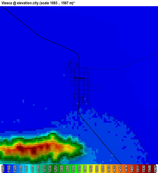
Below is the Elevation map of Viesca, which displays elevation range with different colors. Scale of the first map is from 1083 to 1567 m (3553 to 5141 ft) with average elevation of 1116.5 meters (=3663 ft) [note 1]
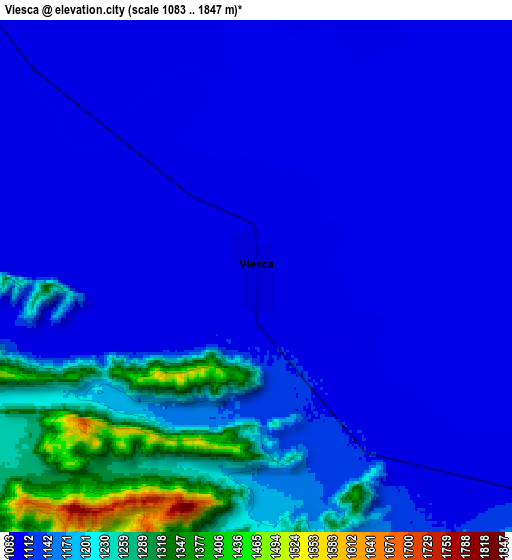
These maps also provides idea of topography and contour of this city, they are displayed at different zoom levels. More info about maps, scale and edge coordinates you can find below images.
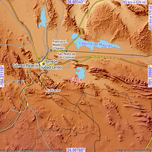
| \ | Map #1 | Map #2 | Topo.Map |
| Scale [m] | 1083..1567 m | 1083..1847 m | × |
| Scale [ft] | 3553..5141 ft | 3553..6060 ft | × |
| Average | 1116.5 m = 3663 ft | 1144.7 m = 3756 ft | × |
| Width | 8.83 km = 5.5 mi | 17.66 km = 11 mi | 282.6 km = 175.6 mi |
| Height | 8.83 km = 5.5 mi | 17.66 km = 11 mi | 282.6 km = 175.6 mi |
| ↑Max Latitude | 25.378941° | 25.418639° | 26.60343° |
| Latitude at center | 25.33923° | 25.33923° | 25.33923° |
| ↓Min Latitude | 25.299506° | 25.259769° | 24.06168° |
| ← Min Longitude | -102.848875° | -102.892821° | -104.21118° |
| Longitude center | -102.80493° | -102.80493° | -102.80493° |
| →Max Longitude | -102.760985° | -102.717039° | -101.39868° |
Nearby cities:
Cities around Viesca sort by population:
• Matamoros elevation 1117 m
47.4 km,  296°
296°
• San Pedro 1126 m
42.7 km,  284°
284°
• Ejido Venustiano Carranza 1101 m
15.3 km,  274°
274°
• Hidalgo 1112 m
37.7 km, 296°
• Mayran 1096 m
37.3 km,  354°
354°
• Tacubaya 1109 m
46.5 km,  325°
325°
• Gilita 1133 m
40.1 km, 278°
• San Miguel 1101 m
42.6 km,  339°
339°
• San Esteban de Abajo 1102 m
45.6 km, 334°
• San Marcos 1105 m
41.8 km, 330°
• Las Mieleras 1143 m
46.9 km, 278°
• El Nilo 1101 m
46 km, 342°
Multilingual:
 En español:
Viesca elevación 1098 m.
 En France:
Viesca élévation 1098 m.


Sources and notes:
- [note 1] Map square and city borders are not equal. Map elevation data is calculated only from area inside that square.
- [src 1] Elevation data from geonames database provided with same terms of usage.
- [src 2] The elevation map of Viesca is generated using elevation data from NASA's 3 arcsec (90m) resolution SRTM data.
- [src 3] Base (background) map © OpenStreetMap contributors tiles are generated by Geofabrik and OpenTopoMap.
Copyright & License:
This Viesca Elevation Map is licensed under CC BY-SA. You may reuse any part from this page, if you give a proper credit by linking to this URL:
 More info on terms of use page.