Villa Zaragoza elevation
Villa Zaragoza (San Luis Potosí, Zaragoza), Mexico elevation is 1977 meters and Villa Zaragoza elevation in feet is 6486 ft above sea level [src 1]. Villa Zaragoza is a seat of a second-order administrative division (feature code) with elevation that is 663 meters (2175 ft) bigger than average city elevation in Mexico.
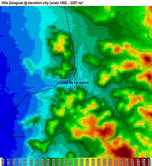
Below is the Elevation map of Villa Zaragoza, which displays elevation range with different colors. Scale of the first map is from 1902 to 2297 m (6240 to 7536 ft) with average elevation of 2027.3 meters (=6651 ft) [note 1]
These maps also provides idea of topography and contour of this city, they are displayed at different zoom levels. More info about maps, scale and edge coordinates you can find below images.
| \ | Map #1 | Map #2 | Topo.Map |
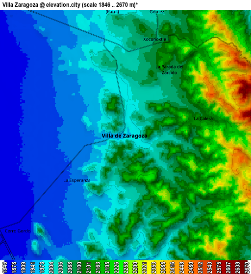
| Scale [m] | 1902..2297 m | 1846..2670 m | × |
| Scale [ft] | 6240..7536 ft | 6056..8760 ft | × |
| Average | 2027.3 m = 6651 ft | 2050.2 m = 6726 ft | × |
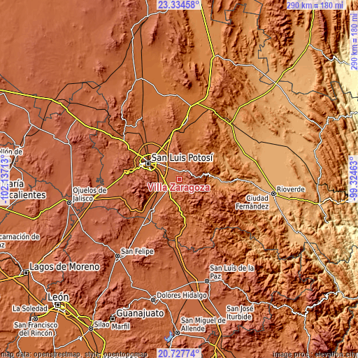
| Width | 9.06 km = 5.6 mi | 18.12 km = 11.3 mi | 289.9 km = 180.1 mi |
| Height | 9.06 km = 5.6 mi | 18.12 km = 11.3 mi | 289.9 km = 180.1 mi |
| ↑Max Latitude | 22.077889° | 22.118606° | 23.33458° |
| Latitude at center | 22.03716° | 22.03716° | 22.03716° |
| ↓Min Latitude | 21.996419° | 21.955667° | 20.72774° |
| ← Min Longitude | -100.774825° | -100.818771° | -102.13713° |
| Longitude center | -100.73088° | -100.73088° | -100.73088° |
| →Max Longitude | -100.686935° | -100.642989° | -99.32463° |
Nearby cities:
Cities around Villa Zaragoza sort by population:
• La Pila elevation 1868 m
14.1 km,  268°
268°
• Laguna de San Vicente 1820 m
16.7 km,  232°
232°
• Laguna de Santa Rita 1842 m
14.7 km,  305°
305°
• Cerro Gordo 1862 m
10.5 km, 228°
• La Esperanza 1921 m
4.8 km, 227°
• Ciudad Satélite 1907 m
10.6 km,  320°
320°
• Arroyos 1899 m
18.1 km,  276°
276°
• Enramadas 1817 m
17.9 km,  197°
197°
• Portezuelo 1892 m
17.7 km,  326°
326°
• Ojo Caliente 1754 m
21.3 km,  186°
186°
• El Jaralito 1864 m
9.3 km, 270°
• Cerro de San Pedro 2040 m
21.3 km,  340°
340°
Multilingual:
 En español:
Villa Zaragoza, Villa de Zaragoza elevación 1977 m.
 En France:
Villa Zaragoza élévation 1977 m.
 Auf Deutsch:
Villa Zaragoza höhe über dem Meeresspiegel ist 1977 m.

Sources and notes:
- [note 1] Map square and city borders are not equal. Map elevation data is calculated only from area inside that square.
- [src 1] Elevation data from geonames database provided with same terms of usage.
- [src 2] The elevation map of Villa Zaragoza is generated using elevation data from NASA's 3 arcsec (90m) resolution SRTM data.
- [src 3] Base (background) map © OpenStreetMap contributors tiles are generated by Geofabrik and OpenTopoMap.
Copyright & License:
This Villa Zaragoza Elevation Map is licensed under CC BY-SA. You may reuse any part from this page, if you give a proper credit by linking to this URL:
 More info on terms of use page.