San Ignacio Río Muerto elevation
San Ignacio Río Muerto (Sonora), Mexico elevation is 11 meters and San Ignacio Río Muerto elevation in feet is 36 ft above sea level [src 1]. San Ignacio Río Muerto is a seat of a second-order administrative division (feature code) with elevation that is 1303 meters (4275 ft) smaller than average city elevation in Mexico.
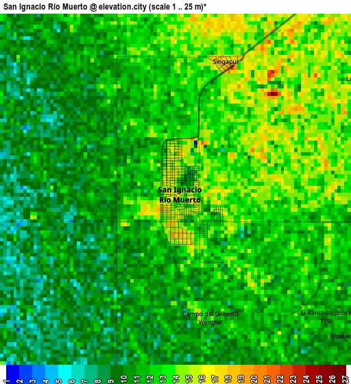
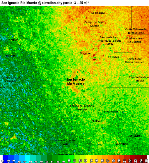
Below is the Elevation map of San Ignacio Río Muerto, which displays elevation range with different colors. Scale of the first map is from 1 to 25 m (3 to 82 ft) with average elevation of 11.3 meters (=37 ft) [note 1]
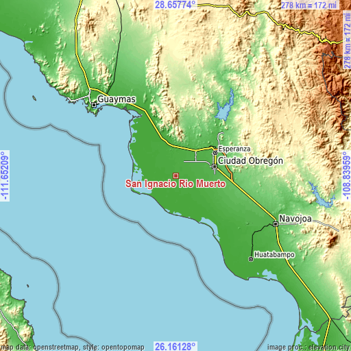
These maps also provides idea of topography and contour of this city, they are displayed at different zoom levels. More info about maps, scale and edge coordinates you can find below images.
| \ | Map #1 | Map #2 | Topo.Map |
| Scale [m] | 1..25 m | -3..25 m | × |
| Scale [ft] | 3..82 ft | -10..82 ft | × |
| Average | 11.3 m = 37 ft | 10.5 m = 34 ft | × |
| Width | 8.67 km = 5.4 mi | 17.35 km = 10.8 mi | 277.6 km = 172.5 mi |
| Height | 8.67 km = 5.4 mi | 17.35 km = 10.8 mi | 277.6 km = 172.5 mi |
| ↑Max Latitude | 27.455563° | 27.494551° | 28.65774° |
| Latitude at center | 27.41656° | 27.41656° | 27.41656° |
| ↓Min Latitude | 27.377544° | 27.338514° | 26.16128° |
| ← Min Longitude | -110.289785° | -110.333731° | -111.65209° |
| Longitude center | -110.24584° | -110.24584° | -110.24584° |
| →Max Longitude | -110.201895° | -110.157949° | -108.83959° |
Nearby cities:
Cities around San Ignacio Río Muerto sort by population:
• Pueblo Yaqui elevation 21 m
22 km,  108°
108°
• Francisco Javier Mina 21 m
14.4 km,  69°
69°
• Campo Sesenta 20 m
14.9 km,  75°
75°
• San José de Bacum 23 m
14.9 km,  42°
42°
• Bácum 27 m
22 km,  46°
46°
• Bahía de Lobos 1 m
21.8 km,  250°
250°
• Cuauhtémoc (Campo Cinco) 29 m
22.7 km,  85°
85°
• Primero de Mayo 15 m
12.7 km,  104°
104°
• Loma de Bácum 29 m
24.7 km, 39°
• 31 de Octubre 16 m
24.6 km,  123°
123°
• Progreso (Campo 47) 16 m
17.3 km, 119°
• Mora Villalobos 27 m
21.5 km,  60°
60°
Multilingual:
 En español:
San Ignacio Río Muerto elevación 11 m.
 En France:
San Ignacio Río Muerto élévation 11 m.
 Auf Deutsch:
San Ignacio Río Muerto höhe über dem Meeresspiegel ist 11 m.
 На русском:
San Ignacio Río Muerto высота над уровнем моря 11 м
Sources and notes:
- [note 1] Map square and city borders are not equal. Map elevation data is calculated only from area inside that square.
- [src 1] Elevation data from geonames database provided with same terms of usage.
- [src 2] The elevation map of San Ignacio Río Muerto is generated using elevation data from NASA's 3 arcsec (90m) resolution SRTM data.
- [src 3] Base (background) map © OpenStreetMap contributors tiles are generated by Geofabrik and OpenTopoMap.
Copyright & License:
This San Ignacio Río Muerto Elevation Map is licensed under CC BY-SA. You may reuse any part from this page, if you give a proper credit by linking to this URL:
 More info on terms of use page.