San Mateo Atarasquíllo elevation
San Mateo Atarasquíllo (Morelos), Mexico elevation is 2621 meters and San Mateo Atarasquíllo elevation in feet is 8599 ft above sea level [src 1]. San Mateo Atarasquíllo is a populated place (feature code) with elevation that is 1307 meters (4288 ft) bigger than average city elevation in Mexico.
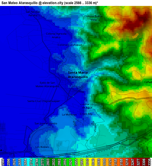
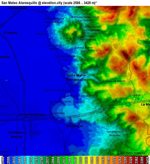
Below is the Elevation map of San Mateo Atarasquíllo, which displays elevation range with different colors. Scale of the first map is from 2566 to 3336 m (8419 to 10945 ft) with average elevation of 2724 meters (=8937 ft) [note 1]
These maps also provides idea of topography and contour of this city, they are displayed at different zoom levels. More info about maps, scale and edge coordinates you can find below images.
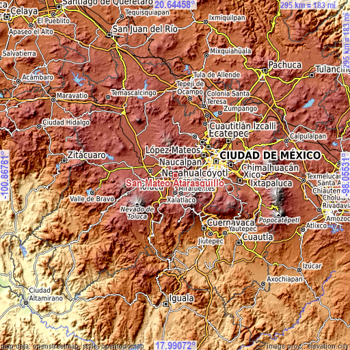
| \ | Map #1 | Map #2 | Topo.Map |
| Scale [m] | 2566..3336 m | 2566..3428 m | × |
| Scale [ft] | 8419..10945 ft | 8419..11247 ft | × |
| Average | 2724 m = 8937 ft | 2772.5 m = 9096 ft | × |
| Width | 9.22 km = 5.7 mi | 18.44 km = 11.5 mi | 295.1 km = 183.4 mi |
| Height | 9.22 km = 5.7 mi | 18.44 km = 11.5 mi | 295.1 km = 183.4 mi |
| ↑Max Latitude | 19.364505° | 19.405958° | 20.64458° |
| Latitude at center | 19.32304° | 19.32304° | 19.32304° |
| ↓Min Latitude | 19.281565° | 19.240079° | 17.99072° |
| ← Min Longitude | -99.505505° | -99.549451° | -100.86781° |
| Longitude center | -99.46156° | -99.46156° | -99.46156° |
| →Max Longitude | -99.417615° | -99.373669° | -98.05531° |
Nearby cities:
Cities around San Mateo Atarasquíllo sort by population:
• Ocoyoacac elevation 2597 m
5.8 km,  176°
176°
• Santa María Atarasquillo 2633 m
1 km,  306°
306°
• San Miguel Ameyalco 2587 m
1.8 km,  170°
170°
• San Nicolás Peralta 2584 m
4.8 km,  328°
328°
• San Francisco Xochicuautla 2800 m
5.8 km,  17°
17°
• Santiago Analco 2694 m
1.3 km,  47°
47°
• Fraccionamiento y Club de Golf los Encinos 2642 m
4.2 km,  207°
207°
• Colonia Agrícola Analco 2586 m
3.3 km, 334°
• San José el Llanito 2582 m
2.9 km,  220°
220°
• Colonia Juárez 2682 m
4.2 km,  187°
187°
• San Antonio el Llanito 2574 m
6.2 km, 214°
• Nueva Ameyalco 2575 m
5.3 km,  238°
238°
Multilingual:
 En español:
San Mateo Atarasquíllo elevación 2621 m.
 En France:
San Mateo Atarasquíllo élévation 2621 m.
 Auf Deutsch:
San Mateo Atarasquíllo höhe über dem Meeresspiegel ist 2621 m.
 На русском:
San Mateo Atarasquíllo высота над уровнем моря 2621 м
Sources and notes:
- [note 1] Map square and city borders are not equal. Map elevation data is calculated only from area inside that square.
- [src 1] Elevation data from geonames database provided with same terms of usage.
- [src 2] The elevation map of San Mateo Atarasquíllo is generated using elevation data from NASA's 3 arcsec (90m) resolution SRTM data.
- [src 3] Base (background) map © OpenStreetMap contributors tiles are generated by Geofabrik and OpenTopoMap.
Copyright & License:
This San Mateo Atarasquíllo Elevation Map is licensed under CC BY-SA. You may reuse any part from this page, if you give a proper credit by linking to this URL:
 More info on terms of use page.