Tlachaloya elevation
Tlachaloya (Morelos), Mexico elevation is 2583 meters and Tlachaloya elevation in feet is 8474 ft above sea level [src 1]. Tlachaloya is a populated place (feature code) with elevation that is 1269 meters (4163 ft) bigger than average city elevation in Mexico.
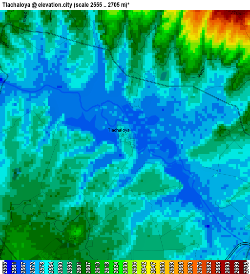
Below is the Elevation map of Tlachaloya, which displays elevation range with different colors. Scale of the first map is from 2555 to 2705 m (8383 to 8875 ft) with average elevation of 2589.1 meters (=8494 ft) [note 1]
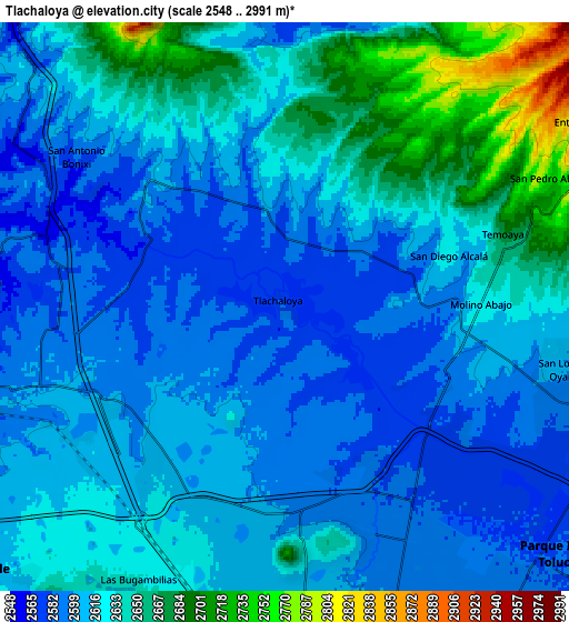
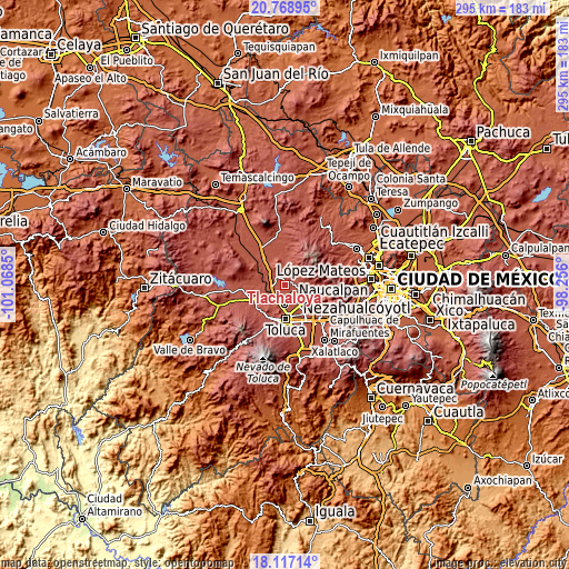
These maps also provides idea of topography and contour of this city, they are displayed at different zoom levels. More info about maps, scale and edge coordinates you can find below images.
| \ | Map #1 | Map #2 | Topo.Map |
| Scale [m] | 2555..2705 m | 2548..2991 m | × |
| Scale [ft] | 8383..8875 ft | 8360..9813 ft | × |
| Average | 2589.1 m = 8494 ft | 2621.7 m = 8601 ft | × |
| Width | 9.21 km = 5.7 mi | 18.43 km = 11.5 mi | 294.9 km = 183.2 mi |
| Height | 9.21 km = 5.7 mi | 18.43 km = 11.5 mi | 294.9 km = 183.2 mi |
| ↑Max Latitude | 19.489893° | 19.531315° | 20.76895° |
| Latitude at center | 19.44846° | 19.44846° | 19.44846° |
| ↓Min Latitude | 19.407017° | 19.365563° | 18.11714° |
| ← Min Longitude | -99.706195° | -99.750141° | -101.0685° |
| Longitude center | -99.66225° | -99.66225° | -99.66225° |
| →Max Longitude | -99.618305° | -99.574359° | -98.256° |
Nearby cities:
Cities around Tlachaloya sort by population:
• Molino Abajo elevation 2627 m
6.3 km,  88°
88°
• San Diego Alcalá 2595 m
4.3 km, 85°
• Fraccionamiento Real de San Pablo 2593 m
6.7 km,  167°
167°
• Ejido de Dolores 2591 m
5.5 km,  110°
110°
• San José Comalco 2594 m
4.5 km,  56°
56°
• Galaxias Toluca 2592 m
5.7 km, 167°
• Pothé 2649 m
6.8 km,  65°
65°
• San José Pathé 2582 m
3.6 km, 114°
• San José las Lomas 2606 m
3.5 km,  345°
345°
• Calle Real 2688 m
6.8 km,  48°
48°
• Barrio del Cajón 2597 m
6.4 km,  176°
176°
• San Antonio del Puente 2579 m
5.8 km,  125°
125°
Multilingual:
 En español:
Tlachaloya, Primera Sección elevación 2583 m.
 En France:
Tlachaloya élévation 2583 m.
 Auf Deutsch:
Tlachaloya höhe über dem Meeresspiegel ist 2583 m.

Sources and notes:
- [note 1] Map square and city borders are not equal. Map elevation data is calculated only from area inside that square.
- [src 1] Elevation data from geonames database provided with same terms of usage.
- [src 2] The elevation map of Tlachaloya is generated using elevation data from NASA's 3 arcsec (90m) resolution SRTM data.
- [src 3] Base (background) map © OpenStreetMap contributors tiles are generated by Geofabrik and OpenTopoMap.
Copyright & License:
This Tlachaloya Elevation Map is licensed under CC BY-SA. You may reuse any part from this page, if you give a proper credit by linking to this URL:
 More info on terms of use page.