Nuevo Progreso elevation
Nuevo Progreso (Campeche, Carmen), Mexico elevation is 3 meters and Nuevo Progreso elevation in feet is 10 ft above sea level [src 1]. Nuevo Progreso is a populated place (feature code) with elevation that is 1311 meters (4301 ft) smaller than average city elevation in Mexico.
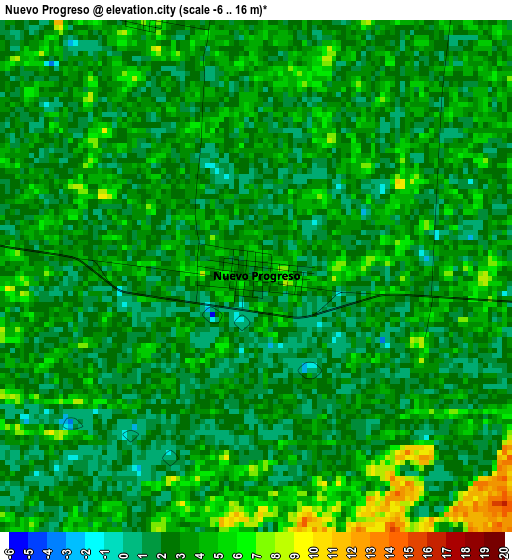
Below is the Elevation map of Nuevo Progreso, which displays elevation range with different colors. Scale of the first map is from -6 to 16 m (-20 to 52 ft) with average elevation of 2.8 meters (=9 ft) [note 1]
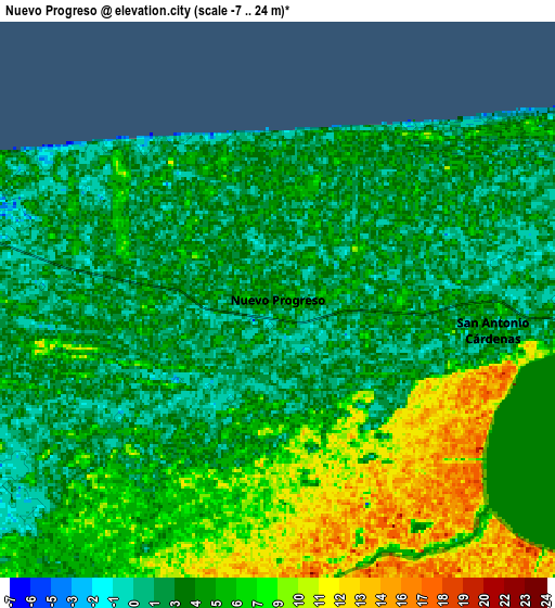
These maps also provides idea of topography and contour of this city, they are displayed at different zoom levels. More info about maps, scale and edge coordinates you can find below images.
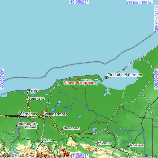
| \ | Map #1 | Map #2 | Topo.Map |
| Scale [m] | -6..16 m | -7..24 m | × |
| Scale [ft] | -20..52 ft | -23..79 ft | × |
| Average | 2.8 m = 9 ft | 4.8 m = 16 ft | × |
| Width | 9.26 km = 5.8 mi | 18.52 km = 11.5 mi | 296.3 km = 184.1 mi |
| Height | 9.26 km = 5.8 mi | 18.52 km = 11.5 mi | 296.3 km = 184.1 mi |
| ↑Max Latitude | 18.664579° | 18.706208° | 19.95023° |
| Latitude at center | 18.62294° | 18.62294° | 18.62294° |
| ↓Min Latitude | 18.581291° | 18.539631° | 17.28521° |
| ← Min Longitude | -92.335185° | -92.379131° | -93.69749° |
| Longitude center | -92.29124° | -92.29124° | -92.29124° |
| →Max Longitude | -92.247295° | -92.203349° | -90.88499° |
Nearby cities:
Cities around Nuevo Progreso sort by population:
• Ciudad del Carmen elevation 6 m
48.7 km,  86°
86°
• Frontera 5 m
38.4 km,  256°
256°
• San Antonio Cárdenas 2 m
7.2 km,  97°
97°
• Palizada 5 m
46 km,  152°
152°
• Atasta 4 m
19.8 km, 91°
• Benito Juárez 7 m
58.2 km,  247°
247°
• Chichicastle 1ra. Sección 2 m
38.4 km,  202°
202°
• Colonia Emiliano Zapata 3 m
5.1 km,  336°
336°
• Álvaro Obregón (Santa Cruz) 4 m
59.3 km,  244°
244°
• La Victoria 3 m
36.2 km, 264°
• La Estrella 4 m
30.8 km,  265°
265°
• Álvaro Obregón 2da. Sección (El Lechugal) 4 m
58.6 km, 244°
Multilingual:
 En español:
Nuevo Progreso elevación 3 m.
 En France:
Nuevo Progreso élévation 3 m.
 Auf Deutsch:
Nuevo Progreso höhe über dem Meeresspiegel ist 3 m.

Sources and notes:
- [note 1] Map square and city borders are not equal. Map elevation data is calculated only from area inside that square.
- [src 1] Elevation data from geonames database provided with same terms of usage.
- [src 2] The elevation map of Nuevo Progreso is generated using elevation data from NASA's 3 arcsec (90m) resolution SRTM data.
- [src 3] Base (background) map © OpenStreetMap contributors tiles are generated by Geofabrik and OpenTopoMap.
Copyright & License:
This Nuevo Progreso Elevation Map is licensed under CC BY-SA. You may reuse any part from this page, if you give a proper credit by linking to this URL:
 More info on terms of use page.