Tepetlixpa elevation
Tepetlixpa (State of Mexico), Mexico elevation is 2336 meters and Tepetlixpa elevation in feet is 7664 ft above sea level [src 1]. Tepetlixpa is a seat of a second-order administrative division (feature code) with elevation that is 1022 meters (3353 ft) bigger than average city elevation in Mexico.
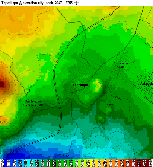
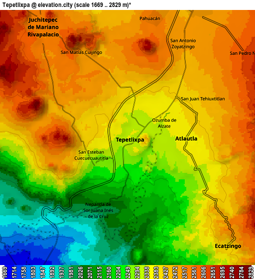
Below is the Elevation map of Tepetlixpa, which displays elevation range with different colors. Scale of the first map is from 2037 to 2755 m (6683 to 9039 ft) with average elevation of 2337.6 meters (=7669 ft) [note 1]
These maps also provides idea of topography and contour of this city, they are displayed at different zoom levels. More info about maps, scale and edge coordinates you can find below images.
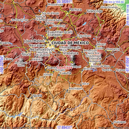
| \ | Map #1 | Map #2 | Topo.Map |
| Scale [m] | 2037..2755 m | 1669..2829 m | × |
| Scale [ft] | 6683..9039 ft | 5476..9281 ft | × |
| Average | 2337.6 m = 7669 ft | 2350.9 m = 7713 ft | × |
| Width | 9.24 km = 5.7 mi | 18.48 km = 11.5 mi | 295.6 km = 183.7 mi |
| Height | 9.24 km = 5.7 mi | 18.48 km = 11.5 mi | 295.6 km = 183.7 mi |
| ↑Max Latitude | 19.070469° | 19.111997° | 20.35291° |
| Latitude at center | 19.02893° | 19.02893° | 19.02893° |
| ↓Min Latitude | 18.987381° | 18.945821° | 17.69431° |
| ← Min Longitude | -98.865235° | -98.909181° | -100.22754° |
| Longitude center | -98.82129° | -98.82129° | -98.82129° |
| →Max Longitude | -98.777345° | -98.733399° | -97.41504° |
Nearby cities:
Cities around Tepetlixpa sort by population:
• Ozumba de Alzate elevation 2342 m
2.9 km,  72°
72°
• Atlautla 2365 m
4.6 km,  99°
99°
• San Juan Tehuixtitlán 2446 m
6.3 km,  63°
63°
• San Juan Tepecoculco 2192 m
6.2 km,  145°
145°
• San Andrés Tlalamac 2073 m
7 km,  168°
168°
• San Mateo Tecalco 2374 m
3.8 km,  44°
44°
• San Vicente Chimalhuacán 2306 m
2.1 km,  105°
105°
• Nepantla de Sor Juana Inés de la Cruz 1991 m
5.8 km,  200°
200°
• Santiago Mamalhuazuca 2196 m
4.5 km,  143°
143°
• Cuecuecuatitla 2274 m
2.9 km,  233°
233°
• San José Tlacotitlán 2156 m
5.1 km,  161°
161°
• Popo Park 2433 m
5.8 km,  46°
46°
Multilingual:
 En español:
San EstebanTepetlixpa elevación 2336 m.
 En France:
Tepetlixpa élévation 2336 m.
 Auf Deutsch:
Tepetlixpa höhe über dem Meeresspiegel ist 2336 m.

Sources and notes:
- [note 1] Map square and city borders are not equal. Map elevation data is calculated only from area inside that square.
- [src 1] Elevation data from geonames database provided with same terms of usage.
- [src 2] The elevation map of Tepetlixpa is generated using elevation data from NASA's 3 arcsec (90m) resolution SRTM data.
- [src 3] Base (background) map © OpenStreetMap contributors tiles are generated by Geofabrik and OpenTopoMap.
Copyright & License:
This Tepetlixpa Elevation Map is licensed under CC BY-SA. You may reuse any part from this page, if you give a proper credit by linking to this URL:
 More info on terms of use page.