Lomantán elevation
Lomantán (Chiapas, Las Margaritas), Mexico elevation is 1776 meters and Lomantán elevation in feet is 5827 ft above sea level [src 1]. Lomantán is a populated place (feature code) with elevation that is 462 meters (1516 ft) bigger than average city elevation in Mexico.
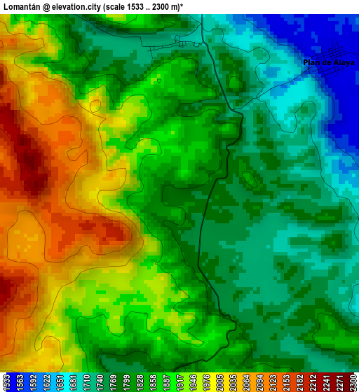
Below is the Elevation map of Lomantán, which displays elevation range with different colors. Scale of the first map is from 1533 to 2300 m (5030 to 7546 ft) with average elevation of 1853.3 meters (=6080 ft) [note 1]
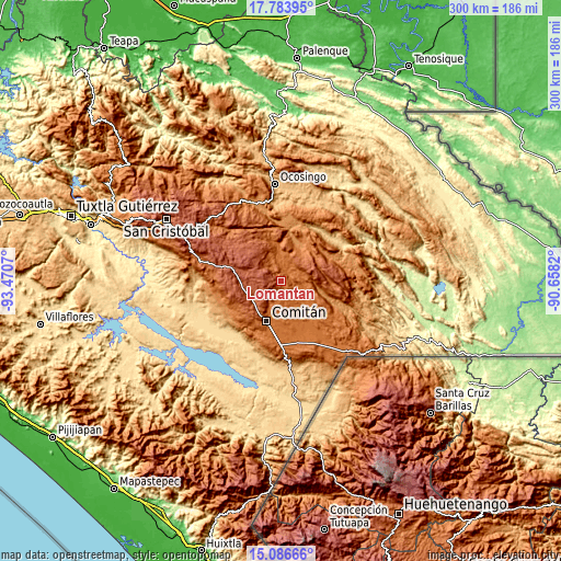
These maps also provides idea of topography and contour of this city, they are displayed at different zoom levels. More info about maps, scale and edge coordinates you can find below images.
| \ | Map #1 | Topo.Map |
| Scale [m] | 1533..2300 m | × |
| Scale [ft] | 5030..7546 ft | × |
| Average | 1853.3 m = 6080 ft | × |
| Width | 9.37 km = 5.8 mi | 299.9 km = 186.3 mi |
| Height | 9.37 km = 5.8 mi | 299.9 km = 186.3 mi |
| ↑Max Latitude | 16.482134° | 17.78395° |
| Latitude at center | 16.43999° | 16.43999° |
| ↓Min Latitude | 16.397837° | 15.08666° |
| ← Min Longitude | -92.108395° | -93.4707° |
| Longitude center | -92.06445° | -92.06445° |
| →Max Longitude | -92.020505° | -90.6582° |
Nearby cities:
Cities around Lomantán sort by population:
• Plan de Ayala elevation 1550 m
5.3 km,  48°
48°
• Villahermosa Yaluma 1728 m
11.9 km,  186°
186°
• Jalisco 1635 m
9.6 km,  96°
96°
• Yasha 1749 m
5.4 km,  184°
184°
• Los Riegos 1589 m
16.4 km,  202°
202°
• Bajucu 1718 m
3.9 km,  359°
359°
• Justo Sierra 1593 m
11.4 km,  3°
3°
• Zaragoza la Montaña 2224 m
15.2 km,  260°
260°
• Saltillo 1526 m
13.4 km,  112°
112°
• El Vergel 1581 m
15.6 km,  353°
353°
• Rafael Ramírez 1659 m
12.9 km,  79°
79°
• Veracruz 1559 m
8 km,  119°
119°
Multilingual:
 En español:
Lomantán elevación 1776 m.
 En France:
Lomantán élévation 1776 m.
 Auf Deutsch:
Lomantán höhe über dem Meeresspiegel ist 1776 m.

Sources and notes:
- [note 1] Map square and city borders are not equal. Map elevation data is calculated only from area inside that square.
- [src 1] Elevation data from geonames database provided with same terms of usage.
- [src 2] The elevation map of Lomantán is generated using elevation data from NASA's 3 arcsec (90m) resolution SRTM data.
- [src 3] Base (background) map © OpenStreetMap contributors tiles are generated by Geofabrik and OpenTopoMap.
Copyright & License:
This Lomantán Elevation Map is licensed under CC BY-SA. You may reuse any part from this page, if you give a proper credit by linking to this URL:
 More info on terms of use page.