Juárez elevation
Juárez (Chiapas), Mexico elevation is 131 meters and Juárez elevation in feet is 430 ft above sea level [src 1]. Juárez is a seat of a second-order administrative division (feature code) with elevation that is 1183 meters (3881 ft) smaller than average city elevation in Mexico.
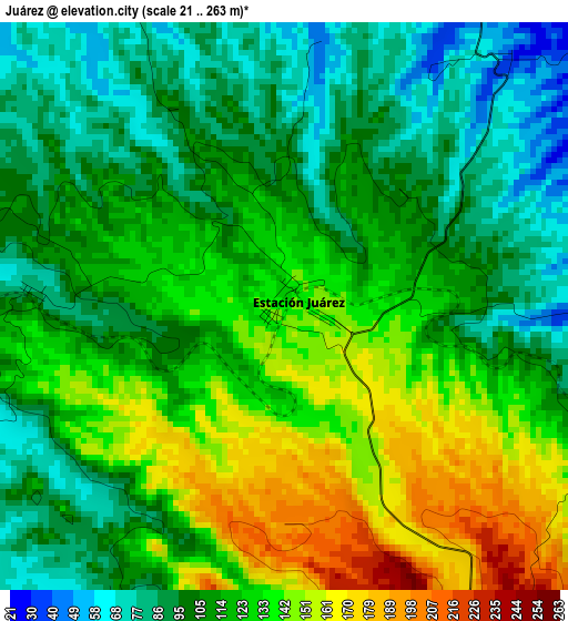
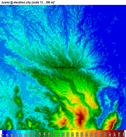
Below is the Elevation map of Juárez, which displays elevation range with different colors. Scale of the first map is from 21 to 263 m (69 to 863 ft) with average elevation of 116.8 meters (=383 ft) [note 1]
These maps also provides idea of topography and contour of this city, they are displayed at different zoom levels. More info about maps, scale and edge coordinates you can find below images.
| \ | Map #1 | Map #2 | Topo.Map |
| Scale [m] | 21..263 m | 13..390 m | × |
| Scale [ft] | 69..863 ft | 43..1280 ft | × |
| Average | 116.8 m = 383 ft | 90.1 m = 296 ft | × |
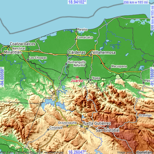
| Width | 9.31 km = 5.8 mi | 18.63 km = 11.6 mi | 298 km = 185.2 mi |
| Height | 9.31 km = 5.8 mi | 18.63 km = 11.6 mi | 298.1 km = 185.2 mi |
| ↑Max Latitude | 17.647602° | 17.689474° | 18.94102° |
| Latitude at center | 17.60572° | 17.60572° | 17.60572° |
| ↓Min Latitude | 17.563828° | 17.521927° | 16.26047° |
| ← Min Longitude | -93.238275° | -93.282221° | -94.60058° |
| Longitude center | -93.19433° | -93.19433° | -93.19433° |
| →Max Longitude | -93.150385° | -93.106439° | -91.78808° |
Nearby cities:
Cities around Juárez sort by population:
• Pichucalco elevation 44 m
13.5 km,  142°
142°
• Ixtacomitán 154 m
22 km,  152°
152°
• Juan Aldama 21 m
17.6 km,  88°
88°
• Nuevo Xochimilco 270 m
25 km,  227°
227°
• Nuevo Nicapa 19 m
13.3 km,  76°
76°
• Estación San Manuel 50 m
20.8 km,  284°
284°
• Ixtapangajoya 106 m
23.7 km,  120°
120°
• Nuevo Volcán Chichonal 43 m
20.6 km,  25°
25°
• El Triunfo 1ra. Sección (Cardona) 83 m
4.1 km,  273°
273°
• Andrés Quintana Roo 17 m
22.5 km,  59°
59°
• Caobanal 1ra. Sección (Mezcalapa) 44 m
21.8 km, 282°
• Sunuapa 105 m
13.7 km,  202°
202°
Multilingual:
 En español:
Estación Juárez, Juárez elevación 131 m.
 En France:
Juárez élévation 131 m.


Sources and notes:
- [note 1] Map square and city borders are not equal. Map elevation data is calculated only from area inside that square.
- [src 1] Elevation data from geonames database provided with same terms of usage.
- [src 2] The elevation map of Juárez is generated using elevation data from NASA's 3 arcsec (90m) resolution SRTM data.
- [src 3] Base (background) map © OpenStreetMap contributors tiles are generated by Geofabrik and OpenTopoMap.
Copyright & License:
This Juárez Elevation Map is licensed under CC BY-SA. You may reuse any part from this page, if you give a proper credit by linking to this URL:
 More info on terms of use page.