San Ildefonso elevation
San Ildefonso (Hidalgo, Tepeji del Río de Ocampo), Mexico elevation is 2206 meters and San Ildefonso elevation in feet is 7238 ft above sea level [src 1]. San Ildefonso is a populated place (feature code) with elevation that is 892 meters (2927 ft) bigger than average city elevation in Mexico.
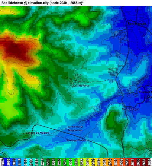
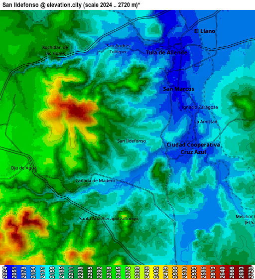
Below is the Elevation map of San Ildefonso, which displays elevation range with different colors. Scale of the first map is from 2040 to 2686 m (6693 to 8812 ft) with average elevation of 2205.2 meters (=7235 ft) [note 1]
These maps also provides idea of topography and contour of this city, they are displayed at different zoom levels. More info about maps, scale and edge coordinates you can find below images.
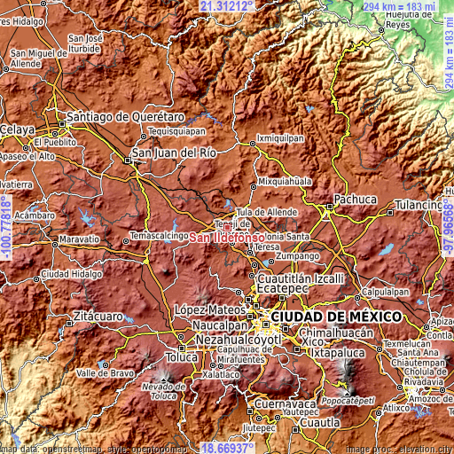
| \ | Map #1 | Map #2 | Topo.Map |
| Scale [m] | 2040..2686 m | 2024..2720 m | × |
| Scale [ft] | 6693..8812 ft | 6640..8924 ft | × |
| Average | 2205.2 m = 7235 ft | 2214.6 m = 7266 ft | × |
| Width | 9.18 km = 5.7 mi | 18.37 km = 11.4 mi | 293.8 km = 182.6 mi |
| Height | 9.18 km = 5.7 mi | 18.37 km = 11.4 mi | 293.9 km = 182.6 mi |
| ↑Max Latitude | 20.037581° | 20.07886° | 21.31212° |
| Latitude at center | 19.99629° | 19.99629° | 19.99629° |
| ↓Min Latitude | 19.954989° | 19.913676° | 18.66937° |
| ← Min Longitude | -99.415875° | -99.459821° | -100.77818° |
| Longitude center | -99.37193° | -99.37193° | -99.37193° |
| →Max Longitude | -99.327985° | -99.284039° | -97.96568° |
Nearby cities:
Cities around San Ildefonso sort by population:
• San Marcos elevation 2048 m
5.4 km,  44°
44°
• San Miguel Vindho 2134 m
5.7 km,  92°
92°
• Santa María Ilucan 2105 m
3.4 km,  97°
97°
• Ignacio Zaragoza 2092 m
5.7 km,  67°
67°
• Santiago Tlautla 2110 m
3.8 km,  175°
175°
• Santa María Magdalena 2126 m
2.5 km, 184°
• Cañada de Madero 2128 m
4.1 km,  213°
213°
• Nantzha 2068 m
6.3 km,  3°
3°
• Monte Alegre 2077 m
3.5 km,  115°
115°
• Santa Ana Azcapotzaltongo 2194 m
6.1 km,  195°
195°
• La Amistad 2101 m
5.6 km,  76°
76°
• Colonia Sesenta y Dos 2127 m
2.9 km, 69°
Multilingual:
 En español:
San Ildefonso elevación 2206 m.
 En France:
San Ildefonso élévation 2206 m.
 Auf Deutsch:
San Ildefonso höhe über dem Meeresspiegel ist 2206 m.

Sources and notes:
- [note 1] Map square and city borders are not equal. Map elevation data is calculated only from area inside that square.
- [src 1] Elevation data from geonames database provided with same terms of usage.
- [src 2] The elevation map of San Ildefonso is generated using elevation data from NASA's 3 arcsec (90m) resolution SRTM data.
- [src 3] Base (background) map © OpenStreetMap contributors tiles are generated by Geofabrik and OpenTopoMap.
Copyright & License:
This San Ildefonso Elevation Map is licensed under CC BY-SA. You may reuse any part from this page, if you give a proper credit by linking to this URL:
 More info on terms of use page.