Playas del Rosario elevation
Playas del Rosario (Tabasco, Centro), Mexico elevation is 18 meters and Playas del Rosario elevation in feet is 59 ft above sea level [src 1]. Playas del Rosario is a populated place (feature code) with elevation that is 1296 meters (4252 ft) smaller than average city elevation in Mexico.
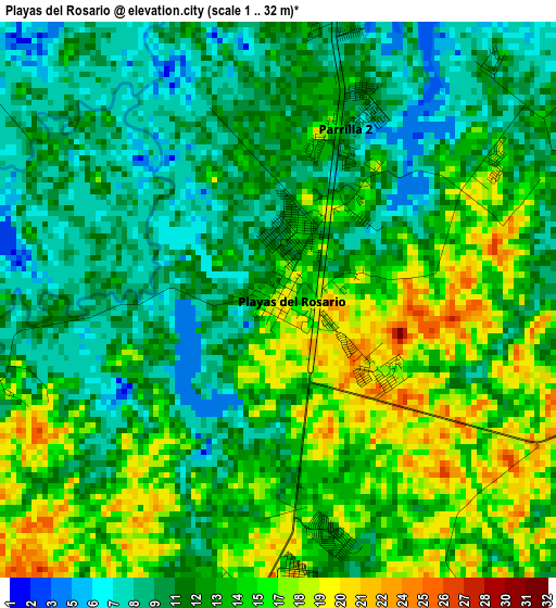
Below is the Elevation map of Playas del Rosario, which displays elevation range with different colors. Scale of the first map is from 1 to 32 m (3 to 105 ft) with average elevation of 12.6 meters (=41 ft) [note 1]
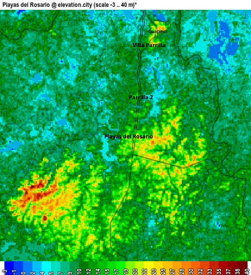
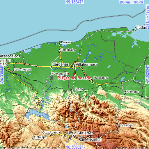
These maps also provides idea of topography and contour of this city, they are displayed at different zoom levels. More info about maps, scale and edge coordinates you can find below images.
| \ | Map #1 | Map #2 | Topo.Map |
| Scale [m] | 1..32 m | -3..40 m | × |
| Scale [ft] | 3..105 ft | -10..131 ft | × |
| Average | 12.6 m = 41 ft | 11.2 m = 37 ft | × |
| Width | 9.3 km = 5.8 mi | 18.6 km = 11.6 mi | 297.6 km = 184.9 mi |
| Height | 9.3 km = 5.8 mi | 18.6 km = 11.6 mi | 297.7 km = 185 mi |
| ↑Max Latitude | 17.894904° | 17.936719° | 19.18647° |
| Latitude at center | 17.85308° | 17.85308° | 17.85308° |
| ↓Min Latitude | 17.811246° | 17.769402° | 16.50962° |
| ← Min Longitude | -92.976135° | -93.020081° | -94.33844° |
| Longitude center | -92.93219° | -92.93219° | -92.93219° |
| →Max Longitude | -92.888245° | -92.844299° | -91.52594° |
Nearby cities:
Cities around Playas del Rosario sort by population:
• Villahermosa elevation 23 m
14.9 km,  0°
0°
• Río de Teapa 12 m
8.4 km,  156°
156°
• Parrilla II 13 m
3.1 km,  19°
19°
• Parilla 18 m
7.1 km,  13°
13°
• Río Viejo Primera Sección 12 m
10.8 km,  332°
332°
• Luis Gil Pérez 20 m
14.9 km,  279°
279°
• Huapinol 23 m
8.1 km, 16°
• La Lima 11 m
6.4 km,  358°
358°
• Pueblo Nuevo de las Raíces 19 m
5.7 km,  98°
98°
• Gaviotas Sur (El Cedral) 11 m
12 km, 21°
• Pablo L. Sidar 9 m
11.5 km,  297°
297°
• Astapa 15 m
11.8 km,  132°
132°
Multilingual:
 En español:
Playas del Rosario, García elevación 18 m.
 En France:
Playas del Rosario élévation 18 m.
 Auf Deutsch:
Playas del Rosario höhe über dem Meeresspiegel ist 18 m.

Sources and notes:
- [note 1] Map square and city borders are not equal. Map elevation data is calculated only from area inside that square.
- [src 1] Elevation data from geonames database provided with same terms of usage.
- [src 2] The elevation map of Playas del Rosario is generated using elevation data from NASA's 3 arcsec (90m) resolution SRTM data.
- [src 3] Base (background) map © OpenStreetMap contributors tiles are generated by Geofabrik and OpenTopoMap.
Copyright & License:
This Playas del Rosario Elevation Map is licensed under CC BY-SA. You may reuse any part from this page, if you give a proper credit by linking to this URL:
 More info on terms of use page.