Chicahua elevation
Chicahua (Oaxaca, San Miguel Chicahua), Mexico elevation is 2309 meters and Chicahua elevation in feet is 7575 ft above sea level [src 1]. Chicahua is a seat of a second-order administrative division (feature code) with elevation that is 995 meters (3264 ft) bigger than average city elevation in Mexico.
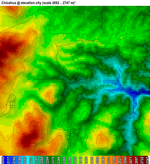
Below is the Elevation map of Chicahua, which displays elevation range with different colors. Scale of the first map is from 2092 to 2747 m (6864 to 9012 ft) with average elevation of 2402.5 meters (=7882 ft) [note 1]
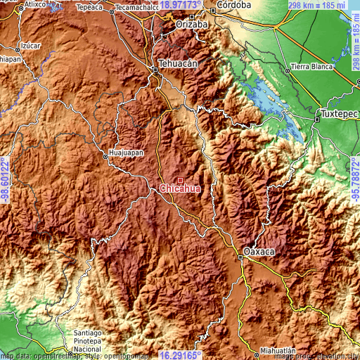
These maps also provides idea of topography and contour of this city, they are displayed at different zoom levels. More info about maps, scale and edge coordinates you can find below images.
| \ | Map #1 | Topo.Map |
| Scale [m] | 2092..2747 m | × |
| Scale [ft] | 6864..9012 ft | × |
| Average | 2402.5 m = 7882 ft | × |
| Width | 9.31 km = 5.8 mi | 298 km = 185.2 mi |
| Height | 9.31 km = 5.8 mi | 298 km = 185.2 mi |
| ↑Max Latitude | 17.678545° | 18.97173° |
| Latitude at center | 17.63667° | 17.63667° |
| ↓Min Latitude | 17.594785° | 16.29165° |
| ← Min Longitude | -97.238915° | -98.60122° |
| Longitude center | -97.19497° | -97.19497° |
| →Max Longitude | -97.151025° | -95.78872° |
Nearby cities:
Cities around Chicahua sort by population:
• Texcatitlán elevation 1503 m
16 km,  58°
58°
• Coixtlahuaca 2115 m
16.1 km,  305°
305°
• Santo Domingo Yanhuitlán 2154 m
19.7 km,  232°
232°
• Yucuita 2081 m
16.1 km,  209°
209°
• Jaltepetongo 1799 m
17.8 km,  71°
71°
• Santa María Chachoápam 2106 m
15.5 km,  217°
217°
• Santa María Apazco 2178 m
10 km,  91°
91°
• San Pedro Coxcaltepec Cántaros 2264 m
16.4 km,  158°
158°
• Nativitas 2178 m
15.2 km,  280°
280°
• Apoala 1980 m
6.4 km,  78°
78°
• San Miguel Huautla 1932 m
13.6 km,  26°
26°
• Soyaltepec 2277 m
13 km,  247°
247°
Multilingual:
 En español:
San Miguel Chicahua, Chicahua elevación 2309 m.
 En France:
Chicahua élévation 2309 m.
 Auf Deutsch:
Chicahua höhe über dem Meeresspiegel ist 2309 m.

Sources and notes:
- [note 1] Map square and city borders are not equal. Map elevation data is calculated only from area inside that square.
- [src 1] Elevation data from geonames database provided with same terms of usage.
- [src 2] The elevation map of Chicahua is generated using elevation data from NASA's 3 arcsec (90m) resolution SRTM data.
- [src 3] Base (background) map © OpenStreetMap contributors tiles are generated by Geofabrik and OpenTopoMap.
Copyright & License:
This Chicahua Elevation Map is licensed under CC BY-SA. You may reuse any part from this page, if you give a proper credit by linking to this URL:
 More info on terms of use page.