Aquiles Serdán elevation
Aquiles Serdán (Tabasco, Macuspana), Mexico elevation is 6 meters and Aquiles Serdán elevation in feet is 20 ft above sea level [src 1]. Aquiles Serdán is a populated place (feature code) with elevation that is 1308 meters (4291 ft) smaller than average city elevation in Mexico.
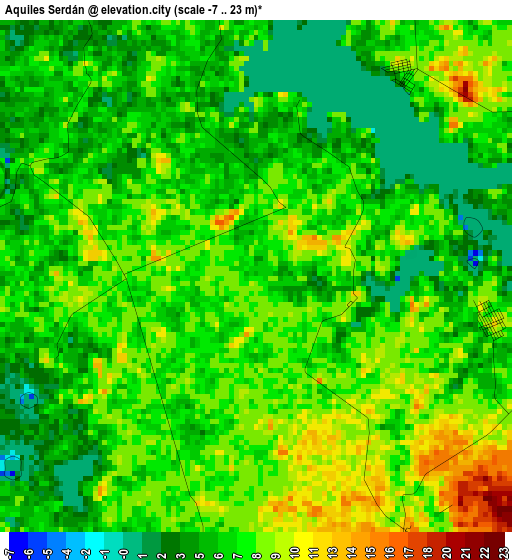
Below is the Elevation map of Aquiles Serdán, which displays elevation range with different colors. Scale of the first map is from -7 to 23 m (-23 to 75 ft) with average elevation of 6.6 meters (=22 ft) [note 1]
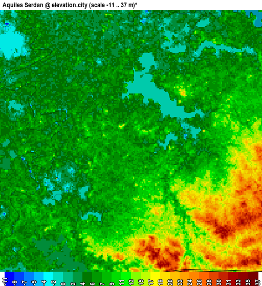
These maps also provides idea of topography and contour of this city, they are displayed at different zoom levels. More info about maps, scale and edge coordinates you can find below images.
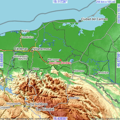
| \ | Map #1 | Map #2 | Topo.Map |
| Scale [m] | -7..23 m | -11..37 m | × |
| Scale [ft] | -23..75 ft | -36..121 ft | × |
| Average | 6.6 m = 22 ft | 8.3 m = 27 ft | × |
| Width | 9.31 km = 5.8 mi | 18.61 km = 11.6 mi | 297.8 km = 185 mi |
| Height | 9.31 km = 5.8 mi | 18.61 km = 11.6 mi | 297.8 km = 185 mi |
| ↑Max Latitude | 17.825171° | 17.867001° | 19.11726° |
| Latitude at center | 17.78333° | 17.78333° | 17.78333° |
| ↓Min Latitude | 17.74148° | 17.699619° | 16.43936° |
| ← Min Longitude | -92.327275° | -92.371221° | -93.68958° |
| Longitude center | -92.28333° | -92.28333° | -92.28333° |
| →Max Longitude | -92.239385° | -92.195439° | -90.87708° |
Nearby cities:
Cities around Aquiles Serdán sort by population:
• Ciudad Pemex elevation 16 m
23.9 km,  297°
297°
• La Curva 9 m
23.5 km,  292°
292°
• Aquiles Serdán (San Fernando) 17 m
22 km,  276°
276°
• Monte Grande 6 m
17 km,  6°
6°
• El Congo 22 m
17.1 km, 285°
• Buena Vista (Apasco) 27 m
22.2 km,  230°
230°
• Nueva División del Bayo (Guatemala) 10 m
22.7 km, 286°
• Palomas 30 m
25.1 km,  235°
235°
• La Unión 19 m
23.7 km, 287°
• Tepetitán 8 m
10.3 km, 293°
• Punta Arena 8 m
24.1 km,  99°
99°
• Loma Bonita 22 m
21.9 km,  88°
88°
Multilingual:
 En español:
Aquiles Serdán elevación 6 m.
 En France:
Aquiles Serdán élévation 6 m.
 Auf Deutsch:
Aquiles Serdán höhe über dem Meeresspiegel ist 6 m.

Sources and notes:
- [note 1] Map square and city borders are not equal. Map elevation data is calculated only from area inside that square.
- [src 1] Elevation data from geonames database provided with same terms of usage.
- [src 2] The elevation map of Aquiles Serdán is generated using elevation data from NASA's 3 arcsec (90m) resolution SRTM data.
- [src 3] Base (background) map © OpenStreetMap contributors tiles are generated by Geofabrik and OpenTopoMap.
Copyright & License:
This Aquiles Serdán Elevation Map is licensed under CC BY-SA. You may reuse any part from this page, if you give a proper credit by linking to this URL:
 More info on terms of use page.