San Antonio Atotonilco elevation
San Antonio Atotonilco (Puebla), Mexico elevation is 2320 meters and San Antonio Atotonilco elevation in feet is 7612 ft above sea level [src 1]. San Antonio Atotonilco is a populated place (feature code) with elevation that is 1006 meters (3301 ft) bigger than average city elevation in Mexico.
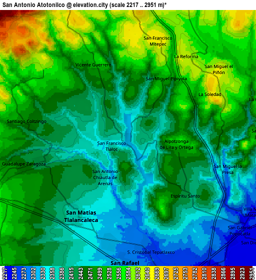
Below is the Elevation map of San Antonio Atotonilco, which displays elevation range with different colors. Scale of the first map is from 2289 to 2601 m (7510 to 8533 ft) with average elevation of 2417.2 meters (=7930 ft) [note 1]
These maps also provides idea of topography and contour of this city, they are displayed at different zoom levels. More info about maps, scale and edge coordinates you can find below images.

| \ | Map #1 | Map #2 | Topo.Map |
| Scale [m] | 2289..2601 m | 2217..2951 m | × |
| Scale [ft] | 7510..8533 ft | 7274..9682 ft | × |
| Average | 2417.2 m = 7930 ft | 2459.6 m = 8070 ft | × |
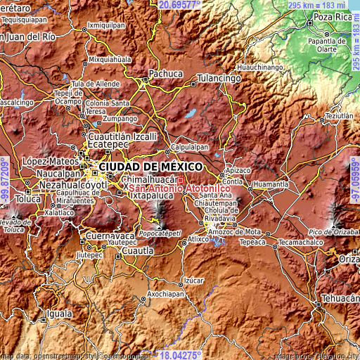
| Width | 9.22 km = 5.7 mi | 18.44 km = 11.5 mi | 295 km = 183.3 mi |
| Height | 9.22 km = 5.7 mi | 18.44 km = 11.5 mi | 295 km = 183.3 mi |
| ↑Max Latitude | 19.416111° | 19.457552° | 20.69577° |
| Latitude at center | 19.37466° | 19.37466° | 19.37466° |
| ↓Min Latitude | 19.333198° | 19.291726° | 18.04275° |
| ← Min Longitude | -98.509785° | -98.553731° | -99.87209° |
| Longitude center | -98.46584° | -98.46584° | -98.46584° |
| →Max Longitude | -98.421895° | -98.377949° | -97.05959° |
Nearby cities:
Cities around San Antonio Atotonilco sort by population:
• San Martin Texmelucan de Labastida elevation 2260 m
10.4 km,  164°
164°
• San Rafael Tlanalapan 2294 m
9.2 km,  181°
181°
• San Matias Tlalancaleca 2364 m
6.5 km,  212°
212°
• San Lucas el Grande 2315 m
7.8 km,  189°
189°
• Villa Mariano Matamoros 2241 m
10.6 km,  120°
120°
• San Miguel Tianguistenco 2459 m
11.3 km,  217°
217°
• Santiago Coltzingo 2467 m
7.3 km,  277°
277°
• Juárez Coronaco 2430 m
6.4 km,  255°
255°
• Guadalupe Zaragoza 2459 m
7.7 km, 256°
• Españita 2653 m
10.7 km,  23°
23°
• San Francisco Tláloc 2364 m
1.3 km,  245°
245°
• San Pedro Matamoros 2542 m
9.3 km,  266°
266°
Multilingual:
 En español:
San Antonio Atotonilco elevación 2320 m.
 En France:
San Antonio Atotonilco élévation 2320 m.
 Auf Deutsch:
San Antonio Atotonilco höhe über dem Meeresspiegel ist 2320 m.
 На русском:
San Antonio Atotonilco высота над уровнем моря 2320 м
Sources and notes:
- [note 1] Map square and city borders are not equal. Map elevation data is calculated only from area inside that square.
- [src 1] Elevation data from geonames database provided with same terms of usage.
- [src 2] The elevation map of San Antonio Atotonilco is generated using elevation data from NASA's 3 arcsec (90m) resolution SRTM data.
- [src 3] Base (background) map © OpenStreetMap contributors tiles are generated by Geofabrik and OpenTopoMap.
Copyright & License:
This San Antonio Atotonilco Elevation Map is licensed under CC BY-SA. You may reuse any part from this page, if you give a proper credit by linking to this URL:
 More info on terms of use page.