Calkiní elevation
Calkiní (Campeche), Mexico elevation is 14 meters and Calkiní elevation in feet is 46 ft above sea level [src 1]. Calkiní is a seat of a second-order administrative division (feature code) with elevation that is 1300 meters (4265 ft) smaller than average city elevation in Mexico.
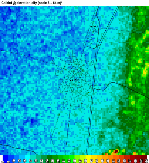
Below is the Elevation map of Calkiní, which displays elevation range with different colors. Scale of the first map is from 6 to 64 m (20 to 210 ft) with average elevation of 17 meters (=56 ft) [note 1]
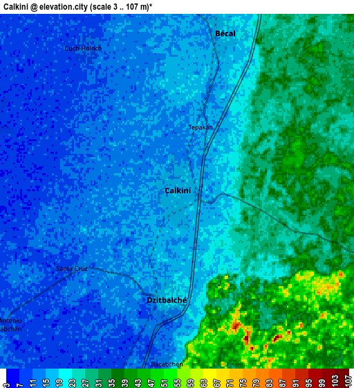
These maps also provides idea of topography and contour of this city, they are displayed at different zoom levels. More info about maps, scale and edge coordinates you can find below images.
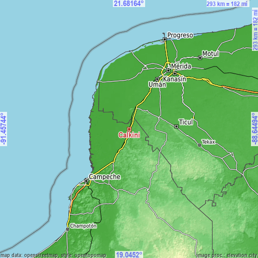
| \ | Map #1 | Map #2 | Topo.Map |
| Scale [m] | 6..64 m | 3..107 m | × |
| Scale [ft] | 20..210 ft | 10..351 ft | × |
| Average | 17 m = 56 ft | 20.6 m = 68 ft | × |
| Width | 9.16 km = 5.7 mi | 18.32 km = 11.4 mi | 293.1 km = 182.1 mi |
| Height | 9.16 km = 5.7 mi | 18.32 km = 11.4 mi | 293.2 km = 182.2 mi |
| ↑Max Latitude | 20.410242° | 20.451423° | 21.68164° |
| Latitude at center | 20.36905° | 20.36905° | 20.36905° |
| ↓Min Latitude | 20.327847° | 20.286633° | 19.0452° |
| ← Min Longitude | -90.095135° | -90.139081° | -91.45744° |
| Longitude center | -90.05119° | -90.05119° | -90.05119° |
| →Max Longitude | -90.007245° | -89.963299° | -88.64494° |
Nearby cities:
Cities around Calkiní sort by population:
• Dzitbalché elevation 17 m
5.6 km,  185°
185°
• Halachó 10 m
12.5 km,  345°
345°
• Bécal 16 m
8.5 km,  17°
17°
• Nunkiní 10 m
10.7 km,  289°
289°
• Cepeda 11 m
16.4 km,  338°
338°
• Bacabchén 13 m
8.9 km,  183°
183°
• Cuch Holoch 12 m
8.7 km,  326°
326°
• Santa Cruz Pueblo 10 m
6.7 km,  234°
234°
• Tepakán 16 m
3.3 km, 19°
• San Antonio Sahcabchén 7 m
11.4 km, 232°
• Pocboc 11 m
15.8 km,  199°
199°
• Santa Cruz 9 m
19.7 km, 200°
Multilingual:
 En español:
Calkiní elevación 14 m.
 En France:
Calkiní élévation 14 m.


Sources and notes:
- [note 1] Map square and city borders are not equal. Map elevation data is calculated only from area inside that square.
- [src 1] Elevation data from geonames database provided with same terms of usage.
- [src 2] The elevation map of Calkiní is generated using elevation data from NASA's 3 arcsec (90m) resolution SRTM data.
- [src 3] Base (background) map © OpenStreetMap contributors tiles are generated by Geofabrik and OpenTopoMap.
Copyright & License:
This Calkiní Elevation Map is licensed under CC BY-SA. You may reuse any part from this page, if you give a proper credit by linking to this URL:
 More info on terms of use page.