Cintalapa de Figueroa elevation
Cintalapa de Figueroa (Chiapas, Cintalapa), Mexico elevation is 577 meters and Cintalapa de Figueroa elevation in feet is 1893 ft above sea level [src 1]. Cintalapa de Figueroa is a populated place (feature code) with elevation that is 737 meters (2418 ft) smaller than average city elevation in Mexico.
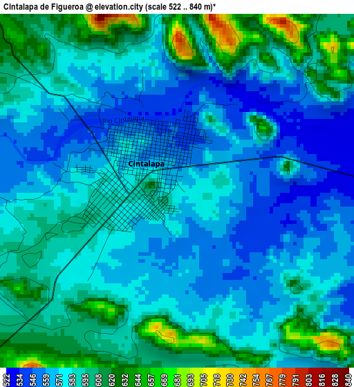
Below is the Elevation map of Cintalapa de Figueroa, which displays elevation range with different colors. Scale of the first map is from 522 to 840 m (1713 to 2756 ft) with average elevation of 583.1 meters (=1913 ft) [note 1]
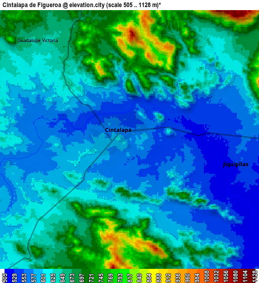
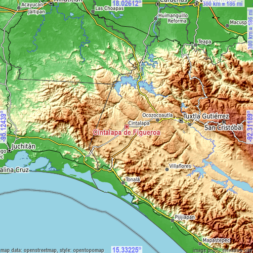
These maps also provides idea of topography and contour of this city, they are displayed at different zoom levels. More info about maps, scale and edge coordinates you can find below images.
| \ | Map #1 | Map #2 | Topo.Map |
| Scale [m] | 522..840 m | 505..1128 m | × |
| Scale [ft] | 1713..2756 ft | 1657..3701 ft | × |
| Average | 583.1 m = 1913 ft | 632.2 m = 2074 ft | × |
| Width | 9.36 km = 5.8 mi | 18.72 km = 11.6 mi | 299.5 km = 186.1 mi |
| Height | 9.36 km = 5.8 mi | 18.72 km = 11.6 mi | 299.6 km = 186.2 mi |
| ↑Max Latitude | 16.726021° | 16.768102° | 18.02612° |
| Latitude at center | 16.68393° | 16.68393° | 16.68393° |
| ↓Min Latitude | 16.64183° | 16.599721° | 15.33225° |
| ← Min Longitude | -93.762085° | -93.806031° | -95.12439° |
| Longitude center | -93.71814° | -93.71814° | -93.71814° |
| →Max Longitude | -93.674195° | -93.630249° | -92.31189° |
Nearby cities:
Cities around Cintalapa de Figueroa sort by population:
• Jiquipilas elevation 531 m
7.8 km,  103°
103°
• Lázaro Cárdenas 615 m
11.8 km,  221°
221°
• Cereso 14 (El Amate) 612 m
13.4 km, 222°
• José María Pino Suárez 627 m
19.9 km,  186°
186°
• Emiliano Zapata 625 m
10.9 km,  295°
295°
• Pomposo Castellanos 620 m
19 km,  236°
236°
• Francisco I. Madero 733 m
14 km,  342°
342°
• Mérida 664 m
16.7 km, 219°
• Vicente Guerrero 507 m
14.6 km, 100°
• Cuauhtémoc 582 m
14.9 km,  179°
179°
• Quintana Roo 553 m
18.7 km,  117°
117°
• Alfonso Moguel 903 m
22.6 km,  94°
94°
Multilingual:
 En español:
Cintalapa de Figueroa elevación 577 m.
 En France:
Cintalapa de Figueroa élévation 577 m.
 Auf Deutsch:
Cintalapa de Figueroa höhe über dem Meeresspiegel ist 577 m.
 На русском:
Cintalapa de Figueroa высота над уровнем моря 577 м
Sources and notes:
- [note 1] Map square and city borders are not equal. Map elevation data is calculated only from area inside that square.
- [src 1] Elevation data from geonames database provided with same terms of usage.
- [src 2] The elevation map of Cintalapa de Figueroa is generated using elevation data from NASA's 3 arcsec (90m) resolution SRTM data.
- [src 3] Base (background) map © OpenStreetMap contributors tiles are generated by Geofabrik and OpenTopoMap.
Copyright & License:
This Cintalapa de Figueroa Elevation Map is licensed under CC BY-SA. You may reuse any part from this page, if you give a proper credit by linking to this URL:
 More info on terms of use page.