Comalcalco elevation
Comalcalco (Tabasco), Mexico elevation is 12 meters and Comalcalco elevation in feet is 39 ft above sea level [src 1]. Comalcalco is a seat of a second-order administrative division (feature code) with elevation that is 1302 meters (4272 ft) smaller than average city elevation in Mexico.
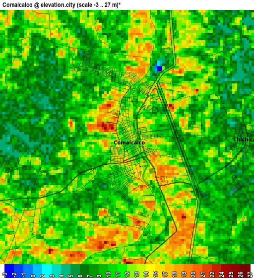
Below is the Elevation map of Comalcalco, which displays elevation range with different colors. Scale of the first map is from -3 to 27 m (-10 to 89 ft) with average elevation of 10.9 meters (=36 ft) [note 1]
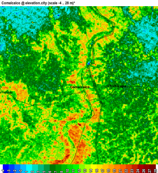
These maps also provides idea of topography and contour of this city, they are displayed at different zoom levels. More info about maps, scale and edge coordinates you can find below images.
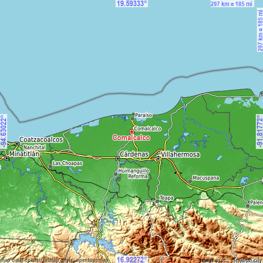
| \ | Map #1 | Map #2 | Topo.Map |
| Scale [m] | -3..27 m | -4..28 m | × |
| Scale [ft] | -10..89 ft | -13..92 ft | × |
| Average | 10.9 m = 36 ft | 9.9 m = 32 ft | × |
| Width | 9.28 km = 5.8 mi | 18.56 km = 11.5 mi | 296.9 km = 184.5 mi |
| Height | 9.28 km = 5.8 mi | 18.56 km = 11.5 mi | 297 km = 184.5 mi |
| ↑Max Latitude | 18.304887° | 18.346603° | 19.59333° |
| Latitude at center | 18.26316° | 18.26316° | 18.26316° |
| ↓Min Latitude | 18.221423° | 18.179677° | 16.92272° |
| ← Min Longitude | -93.267915° | -93.311861° | -94.63022° |
| Longitude center | -93.22397° | -93.22397° | -93.22397° |
| →Max Longitude | -93.180025° | -93.136079° | -91.81772° |
Nearby cities:
Cities around Comalcalco sort by population:
• Chichicapa elevation 11 m
4.4 km,  91°
91°
• Francisco I. Madero 14 m
8.7 km,  9°
9°
• Oriente 1ra. Sección 14 m
8.8 km,  16°
16°
• Huapacal 2da. Sección (Punta Brava) 13 m
9.2 km,  143°
143°
• Gobernadores 7 m
4.5 km,  113°
113°
• Norte 1ra. Sección (San Julián) 11 m
4.5 km, 19°
• Oriente 1ra. Sección (Santo Domingo) 9 m
2.2 km, 87°
• Oriente 2da. Sección (Palma Huaca) 13 m
8.4 km,  29°
29°
• Occidente (San Francisco) 10 m
8.1 km,  338°
338°
• El Tortuguero 11 m
8.6 km,  311°
311°
• Oriente 2da. Sección (San Cayetano) 17 m
8.5 km,  183°
183°
• Occidente 4ta. Sección 10 m
4.6 km,  346°
346°
Multilingual:
 En español:
Comalcalco elevación 12 m.
 En France:
Comalcalco élévation 12 m.
 Auf Deutsch:
Comalcalco höhe über dem Meeresspiegel ist 12 m.

Sources and notes:
- [note 1] Map square and city borders are not equal. Map elevation data is calculated only from area inside that square.
- [src 1] Elevation data from geonames database provided with same terms of usage.
- [src 2] The elevation map of Comalcalco is generated using elevation data from NASA's 3 arcsec (90m) resolution SRTM data.
- [src 3] Base (background) map © OpenStreetMap contributors tiles are generated by Geofabrik and OpenTopoMap.
Copyright & License:
This Comalcalco Elevation Map is licensed under CC BY-SA. You may reuse any part from this page, if you give a proper credit by linking to this URL:
 More info on terms of use page.