Copala elevation
Copala (Guerrero), Mexico elevation is 49 meters and Copala elevation in feet is 161 ft above sea level [src 1]. Copala is a seat of a second-order administrative division (feature code) with elevation that is 1265 meters (4150 ft) smaller than average city elevation in Mexico.
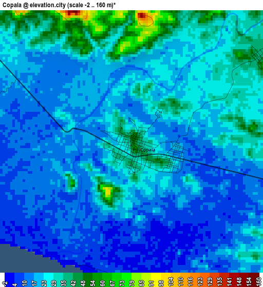
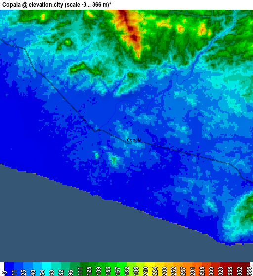
Below is the Elevation map of Copala, which displays elevation range with different colors. Scale of the first map is from -2 to 160 m (-7 to 525 ft) with average elevation of 22.1 meters (=73 ft) [note 1]
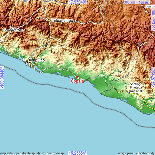
These maps also provides idea of topography and contour of this city, they are displayed at different zoom levels. More info about maps, scale and edge coordinates you can find below images.
| \ | Map #1 | Map #2 | Topo.Map |
| Scale [m] | -2..160 m | -3..366 m | × |
| Scale [ft] | -7..525 ft | -10..1201 ft | × |
| Average | 22.1 m = 73 ft | 49.7 m = 163 ft | × |
| Width | 9.36 km = 5.8 mi | 18.73 km = 11.6 mi | 299.7 km = 186.2 mi |
| Height | 9.36 km = 5.8 mi | 18.73 km = 11.6 mi | 299.7 km = 186.2 mi |
| ↑Max Latitude | 16.649847° | 16.691946° | 17.95049° |
| Latitude at center | 16.60774° | 16.60774° | 16.60774° |
| ↓Min Latitude | 16.565623° | 16.523497° | 15.25554° |
| ← Min Longitude | -99.022155° | -99.066101° | -100.38446° |
| Longitude center | -98.97821° | -98.97821° | -98.97821° |
| →Max Longitude | -98.934265° | -98.890319° | -97.57196° |
Nearby cities:
Cities around Copala sort by population:
• Cruz Grande elevation 52 m
20.1 km,  309°
309°
• Marquelia 13 m
17.4 km,  98°
98°
• Cuautepec 200 m
16 km,  350°
350°
• La Azozuca 219 m
24.7 km,  344°
344°
• Jalapa 45 m
14.3 km,  324°
324°
• Coacoyulichán 409 m
21.3 km,  12°
12°
• El Polvorín 28 m
19.1 km, 99°
• Ahuacachahue (Ndog'yo Itún Tichi) 666 m
24.6 km,  358°
358°
• La Dicha 336 m
18.1 km, 348°
• Barra de Tecoanapa 6 m
28.4 km,  112°
112°
• Zoyatlán 160 m
28.4 km,  66°
66°
• El Mesón 262 m
27.8 km, 342°
Multilingual:
 En español:
Copala elevación 49 m.
 En France:
Copala élévation 49 m.


Sources and notes:
- [note 1] Map square and city borders are not equal. Map elevation data is calculated only from area inside that square.
- [src 1] Elevation data from geonames database provided with same terms of usage.
- [src 2] The elevation map of Copala is generated using elevation data from NASA's 3 arcsec (90m) resolution SRTM data.
- [src 3] Base (background) map © OpenStreetMap contributors tiles are generated by Geofabrik and OpenTopoMap.
Copyright & License:
This Copala Elevation Map is licensed under CC BY-SA. You may reuse any part from this page, if you give a proper credit by linking to this URL:
 More info on terms of use page.