Cristóbal Obregón elevation
Cristóbal Obregón (Chiapas, Villaflores), Mexico elevation is 676 meters and Cristóbal Obregón elevation in feet is 2218 ft above sea level [src 1]. Cristóbal Obregón is a populated place (feature code) with elevation that is 638 meters (2093 ft) smaller than average city elevation in Mexico.
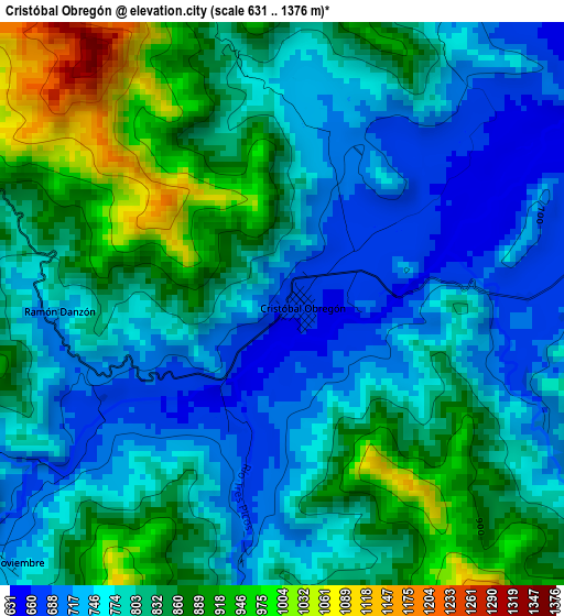
Below is the Elevation map of Cristóbal Obregón, which displays elevation range with different colors. Scale of the first map is from 631 to 1376 m (2070 to 4514 ft) with average elevation of 806.1 meters (=2645 ft) [note 1]
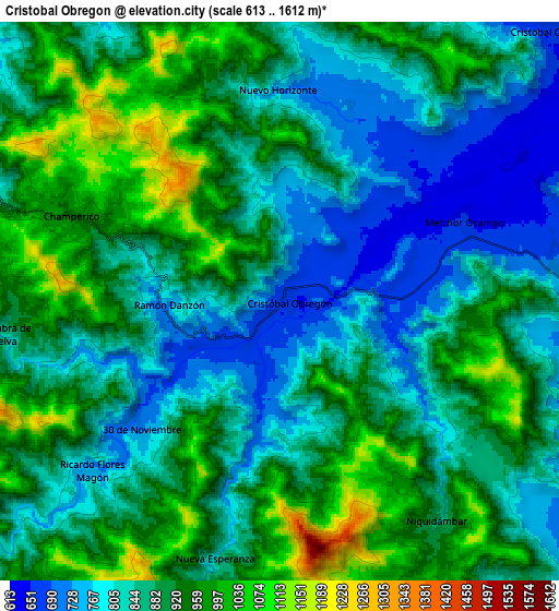
These maps also provides idea of topography and contour of this city, they are displayed at different zoom levels. More info about maps, scale and edge coordinates you can find below images.
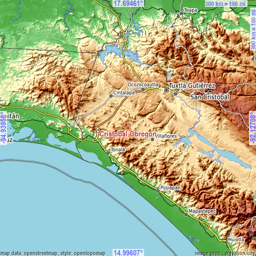
| \ | Map #1 | Map #2 | Topo.Map |
| Scale [m] | 631..1376 m | 613..1612 m | × |
| Scale [ft] | 2070..4514 ft | 2011..5289 ft | × |
| Average | 806.1 m = 2645 ft | 884 m = 2900 ft | × |
| Width | 9.38 km = 5.8 mi | 18.75 km = 11.7 mi | 300 km = 186.4 mi |
| Height | 9.38 km = 5.8 mi | 18.75 km = 11.7 mi | 300.1 km = 186.5 mi |
| ↑Max Latitude | 16.392164° | 16.434318° | 17.69461° |
| Latitude at center | 16.35° | 16.35° | 16.35° |
| ↓Min Latitude | 16.307827° | 16.265645° | 14.99607° |
| ← Min Longitude | -93.577275° | -93.621221° | -94.93958° |
| Longitude center | -93.53333° | -93.53333° | -93.53333° |
| →Max Longitude | -93.489385° | -93.445439° | -92.12708° |
Nearby cities:
Cities around Cristóbal Obregón sort by population:
• Jesús María Garza elevation 630 m
26.1 km,  78°
78°
• Cristóbal Obregón 662 m
12.3 km,  41°
41°
• Benito Juárez 615 m
24.1 km,  69°
69°
• Nuevo México 686 m
16.7 km, 37°
• Doctor Domingo Chanona 663 m
12.5 km,  91°
91°
• Joaquín Miguel Gutiérrez 636 m
18 km, 82°
• Francisco Villa 606 m
25.8 km,  125°
125°
• Libertad Melchor Ocampo 653 m
6.8 km, 66°
• Julián Grajales 610 m
21.2 km,  294°
294°
• Agrónomos Mexicanos 668 m
0.4 km, 90°
• Nueva Palestina 599 m
19.1 km,  326°
326°
• Calzada Larga 709 m
23.3 km, 89°
Multilingual:
 En español:
Cristóbal Obregón elevación 676 m.
 En France:
Cristóbal Obregón élévation 676 m.
 Auf Deutsch:
Cristóbal Obregón höhe über dem Meeresspiegel ist 676 m.

Sources and notes:
- [note 1] Map square and city borders are not equal. Map elevation data is calculated only from area inside that square.
- [src 1] Elevation data from geonames database provided with same terms of usage.
- [src 2] The elevation map of Cristóbal Obregón is generated using elevation data from NASA's 3 arcsec (90m) resolution SRTM data.
- [src 3] Base (background) map © OpenStreetMap contributors tiles are generated by Geofabrik and OpenTopoMap.
Copyright & License:
This Cristóbal Obregón Elevation Map is licensed under CC BY-SA. You may reuse any part from this page, if you give a proper credit by linking to this URL:
 More info on terms of use page.