El Castillo elevation
El Castillo (Veracruz, Xalapa), Mexico elevation is 1167 meters and El Castillo elevation in feet is 3829 ft above sea level [src 1]. El Castillo is a populated place (feature code) with elevation that is 147 meters (482 ft) smaller than average city elevation in Mexico.
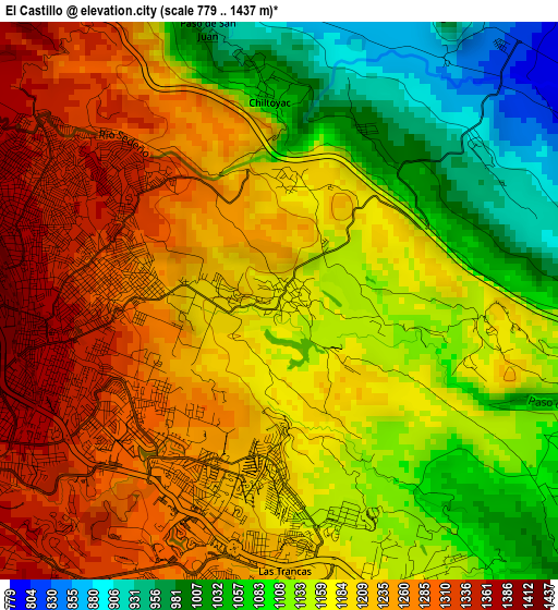
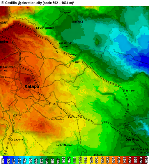
Below is the Elevation map of El Castillo, which displays elevation range with different colors. Scale of the first map is from 779 to 1437 m (2556 to 4715 ft) with average elevation of 1174.7 meters (=3854 ft) [note 1]
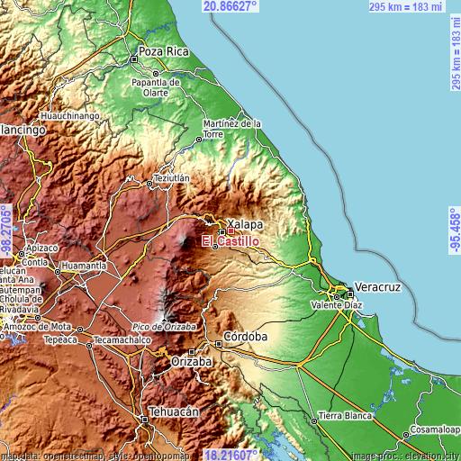
These maps also provides idea of topography and contour of this city, they are displayed at different zoom levels. More info about maps, scale and edge coordinates you can find below images.
| \ | Map #1 | Map #2 | Topo.Map |
| Scale [m] | 779..1437 m | 592..1634 m | × |
| Scale [ft] | 2556..4715 ft | 1942..5361 ft | × |
| Average | 1174.7 m = 3854 ft | 1131.4 m = 3712 ft | × |
| Width | 9.21 km = 5.7 mi | 18.42 km = 11.4 mi | 294.7 km = 183.1 mi |
| Height | 9.21 km = 5.7 mi | 18.42 km = 11.4 mi | 294.7 km = 183.1 mi |
| ↑Max Latitude | 19.588017° | 19.629414° | 20.86627° |
| Latitude at center | 19.54661° | 19.54661° | 19.54661° |
| ↓Min Latitude | 19.505192° | 19.463763° | 18.21607° |
| ← Min Longitude | -96.908195° | -96.952141° | -98.2705° |
| Longitude center | -96.86425° | -96.86425° | -96.86425° |
| →Max Longitude | -96.820305° | -96.776359° | -95.458° |
Nearby cities:
Cities around El Castillo sort by population:
• Xalapa de Enríquez elevation 1396 m
5.7 km,  252°
252°
• Colonia Santa Bárbara 1277 m
5.2 km,  196°
196°
• Jacarandas 1198 m
5.8 km,  168°
168°
• Lomas Verdes 1315 m
5.4 km,  208°
208°
• La Concepción 1092 m
7.6 km,  330°
330°
• Fraccionamiento las Fuentes 1325 m
6.1 km, 202°
• Pacho Nuevo 1166 m
7.9 km,  190°
190°
• Chiltoyac 1051 m
3.4 km,  355°
355°
• El Lencero 1017 m
8.1 km,  141°
141°
• El Terrero 1065 m
6.9 km,  98°
98°
• Las Trancas 1218 m
4.7 km,  180°
180°
• Tronconal 1188 m
1.9 km,  3°
3°
Multilingual:
 En español:
El Castillo elevación 1167 m.
 En France:
El Castillo élévation 1167 m.
 Auf Deutsch:
El Castillo höhe über dem Meeresspiegel ist 1167 m.

Sources and notes:
- [note 1] Map square and city borders are not equal. Map elevation data is calculated only from area inside that square.
- [src 1] Elevation data from geonames database provided with same terms of usage.
- [src 2] The elevation map of El Castillo is generated using elevation data from NASA's 3 arcsec (90m) resolution SRTM data.
- [src 3] Base (background) map © OpenStreetMap contributors tiles are generated by Geofabrik and OpenTopoMap.
Copyright & License:
This El Castillo Elevation Map is licensed under CC BY-SA. You may reuse any part from this page, if you give a proper credit by linking to this URL:
 More info on terms of use page.