Felipe Carrillo Puerto elevation
Felipe Carrillo Puerto (Quintana Roo), Mexico elevation is 15 meters and Felipe Carrillo Puerto elevation in feet is 49 ft above sea level [src 1]. Felipe Carrillo Puerto is a seat of a second-order administrative division (feature code) with elevation that is 1299 meters (4262 ft) smaller than average city elevation in Mexico.
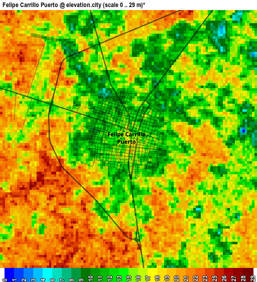
Below is the Elevation map of Felipe Carrillo Puerto, which displays elevation range with different colors. Scale of the first map is from 0 to 29 m (0 to 95 ft) with average elevation of 16.8 meters (=55 ft) [note 1]
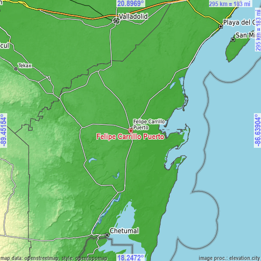
These maps also provides idea of topography and contour of this city, they are displayed at different zoom levels. More info about maps, scale and edge coordinates you can find below images.
| \ | Map #1 | Map #2 | Topo.Map |
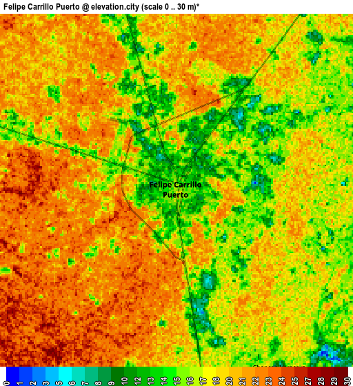
| Scale [m] | 0..29 m | 0..30 m | × |
| Scale [ft] | 0..95 ft | 0..98 ft | × |
| Average | 16.8 m = 55 ft | 18.7 m = 61 ft | × |
| Width | 9.21 km = 5.7 mi | 18.42 km = 11.4 mi | 294.6 km = 183.1 mi |
| Height | 9.21 km = 5.7 mi | 18.42 km = 11.4 mi | 294.6 km = 183.1 mi |
| ↑Max Latitude | 19.618899° | 19.660288° | 20.8969° |
| Latitude at center | 19.5775° | 19.5775° | 19.5775° |
| ↓Min Latitude | 19.53609° | 19.494669° | 18.2472° |
| ← Min Longitude | -88.089235° | -88.133181° | -89.45154° |
| Longitude center | -88.04529° | -88.04529° | -88.04529° |
| →Max Longitude | -88.001345° | -87.957399° | -86.63904° |
Nearby cities:
Cities around Felipe Carrillo Puerto sort by population:
• José María Morelos elevation 23 m
72 km,  285°
285°
• Chunhuhub 14 m
57.3 km,  270°
270°
• Señor 22 m
31.1 km,  342°
342°
• Saban 30 m
72.4 km,  314°
314°
• X-Hazil Sur 14 m
20.9 km,  188°
188°
• Huay Max 27 m
72.1 km,  315°
315°
• X-pichil 26 m
37.1 km, 290°
• Polyuc 21 m
54.2 km, 273°
• Dzula 25 m
38.9 km, 274°
• Los Divorciados 38 m
70.4 km,  217°
217°
• Santa Rosa Segundo 26 m
50 km,  332°
332°
• Presidente Juárez 31 m
60.8 km,  242°
242°
Multilingual:
 En español:
Felipe Carrillo Puerto elevación 15 m.
 En France:
Felipe Carrillo Puerto élévation 15 m.
 Auf Deutsch:
Felipe Carrillo Puerto höhe über dem Meeresspiegel ist 15 m.
 На русском:
Felipe Carrillo Puerto высота над уровнем моря 15 м
Sources and notes:
- [note 1] Map square and city borders are not equal. Map elevation data is calculated only from area inside that square.
- [src 1] Elevation data from geonames database provided with same terms of usage.
- [src 2] The elevation map of Felipe Carrillo Puerto is generated using elevation data from NASA's 3 arcsec (90m) resolution SRTM data.
- [src 3] Base (background) map © OpenStreetMap contributors tiles are generated by Geofabrik and OpenTopoMap.
Copyright & License:
This Felipe Carrillo Puerto Elevation Map is licensed under CC BY-SA. You may reuse any part from this page, if you give a proper credit by linking to this URL:
 More info on terms of use page.