Comalapa elevation
Comalapa (Chiapas, Frontera Comalapa), Mexico elevation is 657 meters and Comalapa elevation in feet is 2156 ft above sea level [src 1]. Comalapa is a seat of a second-order administrative division (feature code) with elevation that is 657 meters (2156 ft) smaller than average city elevation in Mexico.
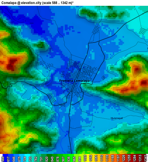
Below is the Elevation map of Comalapa, which displays elevation range with different colors. Scale of the first map is from 588 to 1342 m (1929 to 4403 ft) with average elevation of 761.4 meters (=2498 ft) [note 1]
These maps also provides idea of topography and contour of this city, they are displayed at different zoom levels. More info about maps, scale and edge coordinates you can find below images.
| \ | Map #1 | Map #2 | Topo.Map |
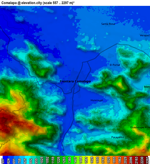
| Scale [m] | 588..1342 m | 557..2297 m | × |
| Scale [ft] | 1929..4403 ft | 1827..7536 ft | × |
| Average | 761.4 m = 2498 ft | 921.7 m = 3024 ft | × |
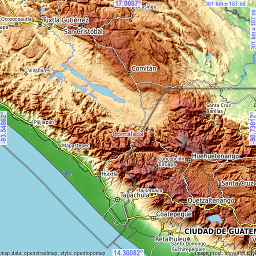
| Width | 9.41 km = 5.8 mi | 18.82 km = 11.7 mi | 301.1 km = 187.1 mi |
| Height | 9.41 km = 5.8 mi | 18.82 km = 11.7 mi | 301.1 km = 187.1 mi |
| ↑Max Latitude | 15.70155° | 15.743851° | 17.0087° |
| Latitude at center | 15.65924° | 15.65924° | 15.65924° |
| ↓Min Latitude | 15.616921° | 15.574594° | 14.30082° |
| ← Min Longitude | -92.186315° | -92.230261° | -93.54862° |
| Longitude center | -92.14237° | -92.14237° | -92.14237° |
| →Max Longitude | -92.098425° | -92.054479° | -90.73612° |
Nearby cities:
Cities around Comalapa sort by population:
• Verapaz elevation 702 m
10.4 km,  55°
55°
• Guadalupe Victoria 1213 m
10.3 km,  124°
124°
• Agua Zarca 661 m
2.8 km,  185°
185°
• Nueva Libertad 711 m
12.5 km,  329°
329°
• Las Chicharras 650 m
7.4 km,  280°
280°
• El Triunfo de las Tres Maravillas 681 m
2 km,  227°
227°
• Emiliano Zapata 625 m
10.4 km, 276°
• Monte Redondo 773 m
9.9 km,  94°
94°
• San José las Chicharras 1510 m
7.1 km,  255°
255°
• Guadalupe Grijalva 634 m
5 km, 332°
• Nueva Morelia 664 m
4.6 km,  183°
183°
• El Portal 701 m
5.4 km,  68°
68°
Multilingual:
 En español:
Comalapa elevación 657 m.
 En France:
Comalapa élévation 657 m.
 Auf Deutsch:
Comalapa höhe über dem Meeresspiegel ist 657 m.

Sources and notes:
- [note 1] Map square and city borders are not equal. Map elevation data is calculated only from area inside that square.
- [src 1] Elevation data from geonames database provided with same terms of usage.
- [src 2] The elevation map of Comalapa is generated using elevation data from NASA's 3 arcsec (90m) resolution SRTM data.
- [src 3] Base (background) map © OpenStreetMap contributors tiles are generated by Geofabrik and OpenTopoMap.
Copyright & License:
This Comalapa Elevation Map is licensed under CC BY-SA. You may reuse any part from this page, if you give a proper credit by linking to this URL:
 More info on terms of use page.