Huejutla de Reyes elevation
Huejutla de Reyes (Hidalgo), Mexico elevation is 152 meters and Huejutla de Reyes elevation in feet is 499 ft above sea level [src 1]. Huejutla de Reyes is a populated place (feature code) with elevation that is 1162 meters (3812 ft) smaller than average city elevation in Mexico.
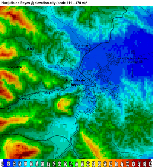
Below is the Elevation map of Huejutla de Reyes, which displays elevation range with different colors. Scale of the first map is from 111 to 470 m (364 to 1542 ft) with average elevation of 210.8 meters (=692 ft) [note 1]
These maps also provides idea of topography and contour of this city, they are displayed at different zoom levels. More info about maps, scale and edge coordinates you can find below images.
| \ | Map #1 | Map #2 | Topo.Map |
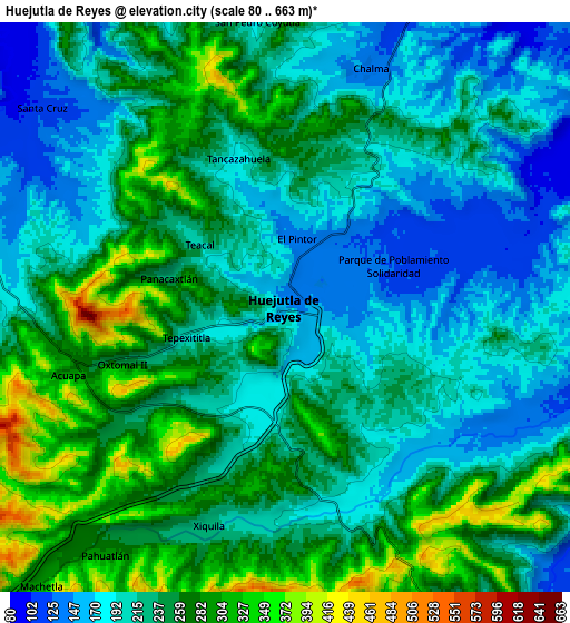
| Scale [m] | 111..470 m | 80..663 m | × |
| Scale [ft] | 364..1542 ft | 262..2175 ft | × |
| Average | 210.8 m = 692 ft | 233 m = 764 ft | × |
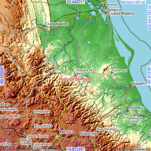
| Width | 9.11 km = 5.7 mi | 18.23 km = 11.3 mi | 291.7 km = 181.3 mi |
| Height | 9.11 km = 5.7 mi | 18.23 km = 11.3 mi | 291.7 km = 181.3 mi |
| ↑Max Latitude | 21.180982° | 21.221953° | 22.44571° |
| Latitude at center | 21.14° | 21.14° | 21.14° |
| ↓Min Latitude | 21.099006° | 21.058002° | 19.82268° |
| ← Min Longitude | -98.463385° | -98.507331° | -99.82569° |
| Longitude center | -98.41944° | -98.41944° | -98.41944° |
| →Max Longitude | -98.375495° | -98.331549° | -97.01319° |
Nearby cities:
Cities around Huejutla de Reyes sort by population:
• Chililico elevation 179 m
1.8 km,  249°
249°
• Chalma 150 m
8 km,  16°
16°
• Pahuatlán 278 m
9.8 km,  217°
217°
• Xiquila 228 m
7.3 km,  199°
199°
• Parque de Poblamiento Solidaridad 124 m
3.7 km,  68°
68°
• El Pintor 145 m
2.3 km, 17°
• Chalahuiyapa 115 m
5.8 km,  78°
78°
• Tancazahuela 182 m
5 km,  341°
341°
• Acoapa 277 m
7.3 km, 253°
• Tepexititla 194 m
3 km, 253°
• San Pedro Coyutla 182 m
9.4 km,  353°
353°
• Santa Catarina 164 m
6 km,  137°
137°
Multilingual:
 En español:
Huejutla de Reyes elevación 152 m.
 En France:
Huejutla de Reyes élévation 152 m.
 Auf Deutsch:
Huejutla de Reyes höhe über dem Meeresspiegel ist 152 m.

Sources and notes:
- [note 1] Map square and city borders are not equal. Map elevation data is calculated only from area inside that square.
- [src 1] Elevation data from geonames database provided with same terms of usage.
- [src 2] The elevation map of Huejutla de Reyes is generated using elevation data from NASA's 3 arcsec (90m) resolution SRTM data.
- [src 3] Base (background) map © OpenStreetMap contributors tiles are generated by Geofabrik and OpenTopoMap.
Copyright & License:
This Huejutla de Reyes Elevation Map is licensed under CC BY-SA. You may reuse any part from this page, if you give a proper credit by linking to this URL:
 More info on terms of use page.