Villa Independencia elevation
Villa Independencia (Veracruz, Martínez de la Torre), Mexico elevation is 71 meters and Villa Independencia elevation in feet is 233 ft above sea level [src 1]. Villa Independencia is a populated place (feature code) with elevation that is 1243 meters (4078 ft) smaller than average city elevation in Mexico.
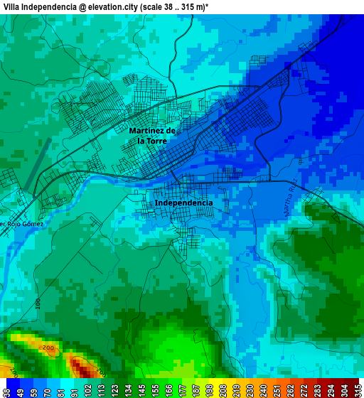
Below is the Elevation map of Villa Independencia, which displays elevation range with different colors. Scale of the first map is from 38 to 315 m (125 to 1033 ft) with average elevation of 94 meters (=308 ft) [note 1]
These maps also provides idea of topography and contour of this city, they are displayed at different zoom levels. More info about maps, scale and edge coordinates you can find below images.
| \ | Map #1 | Map #2 | Topo.Map |
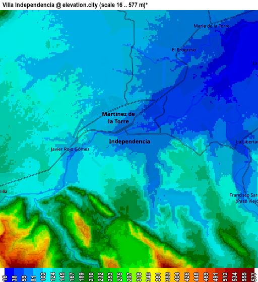
| Scale [m] | 38..315 m | 16..577 m | × |
| Scale [ft] | 125..1033 ft | 52..1893 ft | × |
| Average | 94 m = 308 ft | 124.9 m = 410 ft | × |
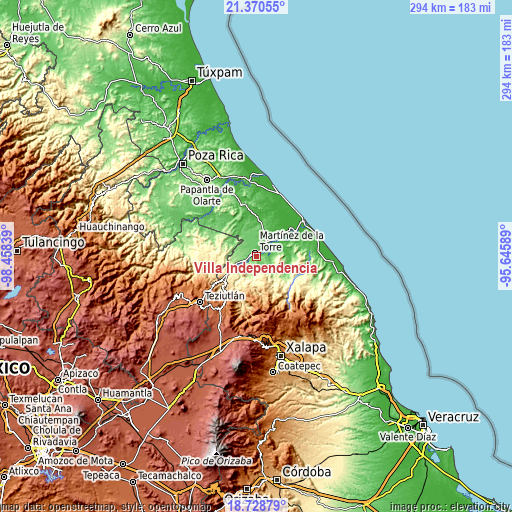
| Width | 9.18 km = 5.7 mi | 18.36 km = 11.4 mi | 293.7 km = 182.5 mi |
| Height | 9.18 km = 5.7 mi | 18.36 km = 11.4 mi | 293.8 km = 182.6 mi |
| ↑Max Latitude | 20.096505° | 20.137769° | 21.37055° |
| Latitude at center | 20.05523° | 20.05523° | 20.05523° |
| ↓Min Latitude | 20.013944° | 19.972647° | 18.72879° |
| ← Min Longitude | -97.096085° | -97.140031° | -98.45839° |
| Longitude center | -97.05214° | -97.05214° | -97.05214° |
| →Max Longitude | -97.008195° | -96.964249° | -95.64589° |
Nearby cities:
Cities around Villa Independencia sort by population:
• Martínez de la Torre elevation 92 m
2 km,  332°
332°
• La Palmilla 147 m
10.5 km,  248°
248°
• Colonias Pedernales 84 m
1 km,  175°
175°
• El Jobo 194 m
12.6 km, 248°
• María de la Torre 65 m
10.1 km,  35°
35°
• La Defensa 33 m
11 km,  59°
59°
• Arroyo del Potrero 88 m
10.1 km,  352°
352°
• La Libertad 60 m
8.3 km,  91°
91°
• Pahua Hueca 443 m
10.4 km, 181°
• El Progreso 61 m
7.6 km,  30°
30°
• La Unión Paso Largo 73 m
11.1 km, 29°
• San Pedro Tlapacoyan 109 m
4.8 km,  273°
273°
Multilingual:
 En español:
Villa Independencia elevación 71 m.
 En France:
Villa Independencia élévation 71 m.
 Auf Deutsch:
Villa Independencia höhe über dem Meeresspiegel ist 71 m.
 На русском:
Villa Independencia высота над уровнем моря 71 м
Sources and notes:
- [note 1] Map square and city borders are not equal. Map elevation data is calculated only from area inside that square.
- [src 1] Elevation data from geonames database provided with same terms of usage.
- [src 2] The elevation map of Villa Independencia is generated using elevation data from NASA's 3 arcsec (90m) resolution SRTM data.
- [src 3] Base (background) map © OpenStreetMap contributors tiles are generated by Geofabrik and OpenTopoMap.
Copyright & License:
This Villa Independencia Elevation Map is licensed under CC BY-SA. You may reuse any part from this page, if you give a proper credit by linking to this URL:
 More info on terms of use page.