Izúcar de Matamoros elevation
Izúcar de Matamoros (Puebla), Mexico elevation is 1292 meters and Izúcar de Matamoros elevation in feet is 4239 ft above sea level [src 1]. Izúcar de Matamoros is a seat of a second-order administrative division (feature code) with elevation that is 22 meters (72 ft) smaller than average city elevation in Mexico.
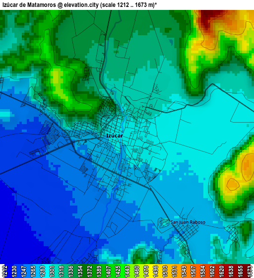
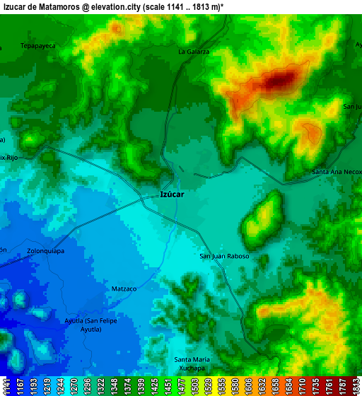
Below is the Elevation map of Izúcar de Matamoros, which displays elevation range with different colors. Scale of the first map is from 1212 to 1673 m (3976 to 5489 ft) with average elevation of 1311.7 meters (=4303 ft) [note 1]
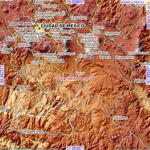
These maps also provides idea of topography and contour of this city, they are displayed at different zoom levels. More info about maps, scale and edge coordinates you can find below images.
| \ | Map #1 | Map #2 | Topo.Map |
| Scale [m] | 1212..1673 m | 1141..1813 m | × |
| Scale [ft] | 3976..5489 ft | 3743..5948 ft | × |
| Average | 1311.7 m = 4303 ft | 1349.2 m = 4427 ft | × |
| Width | 9.26 km = 5.8 mi | 18.52 km = 11.5 mi | 296.4 km = 184.2 mi |
| Height | 9.26 km = 5.8 mi | 18.52 km = 11.5 mi | 296.4 km = 184.2 mi |
| ↑Max Latitude | 18.643214° | 18.684849° | 19.92903° |
| Latitude at center | 18.60157° | 18.60157° | 18.60157° |
| ↓Min Latitude | 18.559915° | 18.51825° | 17.26367° |
| ← Min Longitude | -98.505465° | -98.549411° | -99.86777° |
| Longitude center | -98.46152° | -98.46152° | -98.46152° |
| →Max Longitude | -98.417575° | -98.373629° | -97.05527° |
Nearby cities:
Cities around Izúcar de Matamoros sort by population:
• La Galarza elevation 1396 m
7.4 km,  5°
5°
• San Juan Raboso 1272 m
4.1 km,  145°
145°
• Ayutla 1208 m
7.8 km,  216°
216°
• San Nicolás Tolentino 1211 m
7.2 km, 218°
• Tilapa 1238 m
9.5 km,  267°
267°
• Matzaco 1229 m
5.5 km,  211°
211°
• Colucan 1258 m
10.5 km,  191°
191°
• San Juan Epatlán 1353 m
10.4 km,  63°
63°
• Xuchapa 1273 m
8.4 km,  176°
176°
• Zolonquiapa 1205 m
7.5 km,  247°
247°
• San Félix Rijo 1283 m
9.6 km,  282°
282°
• Santa Ana Necoxtla 1326 m
8.4 km,  81°
81°
Multilingual:
 En español:
Izúcar, Izucar elevación 1292 m.
 En France:
Izúcar de Matamoros élévation 1292 m.
 Auf Deutsch:
Izúcar de Matamoros höhe über dem Meeresspiegel ist 1292 m.
 На русском:
Исукар-де-Матаморос высота над уровнем моря 1292 м
Sources and notes:
- [note 1] Map square and city borders are not equal. Map elevation data is calculated only from area inside that square.
- [src 1] Elevation data from geonames database provided with same terms of usage.
- [src 2] The elevation map of Izúcar de Matamoros is generated using elevation data from NASA's 3 arcsec (90m) resolution SRTM data.
- [src 3] Base (background) map © OpenStreetMap contributors tiles are generated by Geofabrik and OpenTopoMap.
Copyright & License:
This Izúcar de Matamoros Elevation Map is licensed under CC BY-SA. You may reuse any part from this page, if you give a proper credit by linking to this URL:
 More info on terms of use page.