Los Naranjos elevation
Los Naranjos (Veracruz, Tres Valles), Mexico elevation is 32 meters and Los Naranjos elevation in feet is 105 ft above sea level [src 1]. Los Naranjos is a populated place (feature code) with elevation that is 1282 meters (4206 ft) smaller than average city elevation in Mexico.
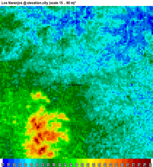
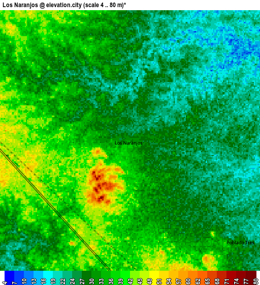
Below is the Elevation map of Los Naranjos, which displays elevation range with different colors. Scale of the first map is from 15 to 80 m (49 to 262 ft) with average elevation of 32.6 meters (=107 ft) [note 1]
These maps also provides idea of topography and contour of this city, they are displayed at different zoom levels. More info about maps, scale and edge coordinates you can find below images.
| \ | Map #1 | Map #2 | Topo.Map |
| Scale [m] | 15..80 m | 4..80 m | × |
| Scale [ft] | 49..262 ft | 13..262 ft | × |
| Average | 32.6 m = 107 ft | 31.9 m = 105 ft | × |
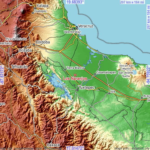
| Width | 9.28 km = 5.8 mi | 18.55 km = 11.5 mi | 296.8 km = 184.4 mi |
| Height | 9.28 km = 5.8 mi | 18.55 km = 11.5 mi | 296.8 km = 184.4 mi |
| ↑Max Latitude | 18.396185° | 18.437879° | 19.68393° |
| Latitude at center | 18.35448° | 18.35448° | 18.35448° |
| ↓Min Latitude | 18.312765° | 18.271041° | 17.01472° |
| ← Min Longitude | -96.209415° | -96.253361° | -97.57172° |
| Longitude center | -96.16547° | -96.16547° | -96.16547° |
| →Max Longitude | -96.121525° | -96.077579° | -94.75922° |
Nearby cities:
Cities around Los Naranjos sort by population:
• Tres Valles elevation 26 m
13.2 km,  166°
166°
• Novara 49 m
18.2 km,  160°
160°
• Poblado Dos 20 m
13.8 km,  106°
106°
• Poblado Tres 30 m
10.7 km,  132°
132°
• Las Margaritas 30 m
16.7 km,  228°
228°
• Colonia Adolfo Ruiz Cortines (Colonia Obrera) 32 m
10.9 km,  177°
177°
• Nuevo San José Independencia 22 m
11.7 km,  70°
70°
• La Guadalupe 46 m
13.8 km, 177°
• La Reforma 41 m
16.9 km,  250°
250°
• El Capulín (La Nueva Pochota) 44 m
18.3 km,  220°
220°
• Corral de Piedra 61 m
19.1 km, 230°
• Rancho Grande 50 m
19.4 km,  269°
269°
Multilingual:
 En español:
Los Naranjos elevación 32 m.
 En France:
Los Naranjos élévation 32 m.
 Auf Deutsch:
Los Naranjos höhe über dem Meeresspiegel ist 32 m.

Sources and notes:
- [note 1] Map square and city borders are not equal. Map elevation data is calculated only from area inside that square.
- [src 1] Elevation data from geonames database provided with same terms of usage.
- [src 2] The elevation map of Los Naranjos is generated using elevation data from NASA's 3 arcsec (90m) resolution SRTM data.
- [src 3] Base (background) map © OpenStreetMap contributors tiles are generated by Geofabrik and OpenTopoMap.
Copyright & License:
This Los Naranjos Elevation Map is licensed under CC BY-SA. You may reuse any part from this page, if you give a proper credit by linking to this URL:
 More info on terms of use page.