Mapastepec elevation
Mapastepec (Chiapas), Mexico elevation is 44 meters and Mapastepec elevation in feet is 144 ft above sea level [src 1]. Mapastepec is a populated place (feature code) with elevation that is 1270 meters (4167 ft) smaller than average city elevation in Mexico.
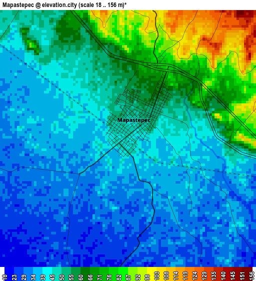
Below is the Elevation map of Mapastepec, which displays elevation range with different colors. Scale of the first map is from 18 to 156 m (59 to 512 ft) with average elevation of 48.8 meters (=160 ft) [note 1]
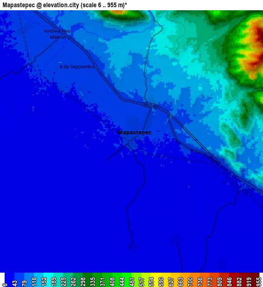
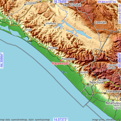
These maps also provides idea of topography and contour of this city, they are displayed at different zoom levels. More info about maps, scale and edge coordinates you can find below images.
| \ | Map #1 | Map #2 | Topo.Map |
| Scale [m] | 18..156 m | 6..955 m | × |
| Scale [ft] | 59..512 ft | 20..3133 ft | × |
| Average | 48.8 m = 160 ft | 83.3 m = 273 ft | × |
| Width | 9.42 km = 5.9 mi | 18.84 km = 11.7 mi | 301.4 km = 187.3 mi |
| Height | 9.42 km = 5.9 mi | 18.84 km = 11.7 mi | 301.4 km = 187.3 mi |
| ↑Max Latitude | 15.475936° | 15.518284° | 16.78458° |
| Latitude at center | 15.43358° | 15.43358° | 15.43358° |
| ↓Min Latitude | 15.391215° | 15.348841° | 14.07373° |
| ← Min Longitude | -92.944335° | -92.988281° | -94.30664° |
| Longitude center | -92.90039° | -92.90039° | -92.90039° |
| →Max Longitude | -92.856445° | -92.812499° | -91.49414° |
Nearby cities:
Cities around Mapastepec sort by population:
• Acacoyagua elevation 90 m
26.3 km,  113°
113°
• Acapetahua 33 m
28.2 km,  126°
126°
• Soconusco 32 m
22.8 km, 125°
• Nueva Sesecapa 37 m
9.1 km, 112°
• El Consuelo Ulapa 45 m
12.7 km, 114°
• Nuevo Milenio Valdivia 66 m
9.3 km,  326°
326°
• Las Brisas 10 m
25.1 km,  291°
291°
• Joaquín Miguel Gutiérrez (Margaritas) 26 m
24.4 km,  302°
302°
• Hidalgo 51 m
19.4 km,  118°
118°
• Hermenegildo Galeana 87 m
17.5 km,  318°
318°
• Jiquilpan (Estación Bonanza) 39 m
19.3 km, 121°
• La Esperanza 10 m
28.2 km,  273°
273°
Multilingual:
 En español:
Mapastepec elevación 44 m.
 En France:
Mapastepec élévation 44 m.
 Auf Deutsch:
Mapastepec höhe über dem Meeresspiegel ist 44 m.

Sources and notes:
- [note 1] Map square and city borders are not equal. Map elevation data is calculated only from area inside that square.
- [src 1] Elevation data from geonames database provided with same terms of usage.
- [src 2] The elevation map of Mapastepec is generated using elevation data from NASA's 3 arcsec (90m) resolution SRTM data.
- [src 3] Base (background) map © OpenStreetMap contributors tiles are generated by Geofabrik and OpenTopoMap.
Copyright & License:
This Mapastepec Elevation Map is licensed under CC BY-SA. You may reuse any part from this page, if you give a proper credit by linking to this URL:
 More info on terms of use page.