Mezcala elevation
Mezcala (Guerrero, Eduardo Neri), Mexico elevation is 494 meters and Mezcala elevation in feet is 1621 ft above sea level [src 1]. Mezcala is a populated place (feature code) with elevation that is 820 meters (2690 ft) smaller than average city elevation in Mexico.
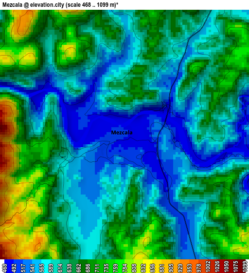
Below is the Elevation map of Mezcala, which displays elevation range with different colors. Scale of the first map is from 468 to 1099 m (1535 to 3606 ft) with average elevation of 633.5 meters (=2078 ft) [note 1]
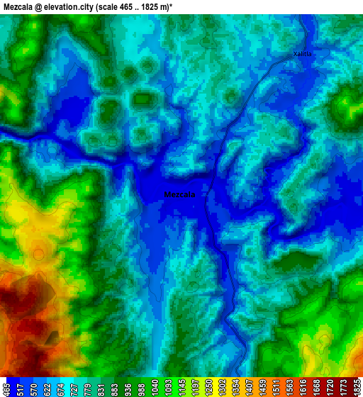
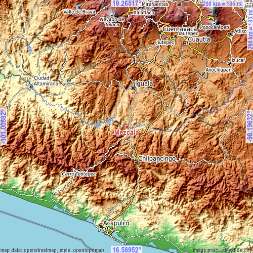
These maps also provides idea of topography and contour of this city, they are displayed at different zoom levels. More info about maps, scale and edge coordinates you can find below images.
| \ | Map #1 | Map #2 | Topo.Map |
| Scale [m] | 468..1099 m | 465..1825 m | × |
| Scale [ft] | 1535..3606 ft | 1526..5988 ft | × |
| Average | 633.5 m = 2078 ft | 809.5 m = 2656 ft | × |
| Width | 9.3 km = 5.8 mi | 18.6 km = 11.6 mi | 297.5 km = 184.9 mi |
| Height | 9.3 km = 5.8 mi | 18.6 km = 11.6 mi | 297.5 km = 184.9 mi |
| ↑Max Latitude | 17.974206° | 18.016001° | 19.26517° |
| Latitude at center | 17.9324° | 17.9324° | 17.9324° |
| ↓Min Latitude | 17.890585° | 17.848759° | 16.58952° |
| ← Min Longitude | -99.646515° | -99.690461° | -101.00882° |
| Longitude center | -99.60257° | -99.60257° | -99.60257° |
| →Max Longitude | -99.558625° | -99.514679° | -98.19632° |
Nearby cities:
Cities around Mezcala sort by population:
• Xochipala elevation 1070 m
14 km,  196°
196°
• Coacoyula de Álvarez 873 m
16.3 km,  349°
349°
• San Agustín Oapan 514 m
17.5 km,  82°
82°
• Nuevo Balsas 487 m
20 km,  303°
303°
• San Miguel Tecuiciapan 529 m
20.1 km, 80°
• Xalitla 557 m
9.5 km,  40°
40°
• Axaxacualco 1467 m
20.6 km,  133°
133°
• Maxela 939 m
13.5 km,  3°
3°
• Tlanipatla 1494 m
21.1 km, 130°
• Carrizalillo 1520 m
14.8 km,  232°
232°
• Ahuehuepan 867 m
13.6 km,  52°
52°
• Tonalapa del Sur 718 m
18.9 km,  13°
13°
Multilingual:
 En español:
Mexcala elevación 494 m.
 En France:
Mezcala élévation 494 m.


Sources and notes:
- [note 1] Map square and city borders are not equal. Map elevation data is calculated only from area inside that square.
- [src 1] Elevation data from geonames database provided with same terms of usage.
- [src 2] The elevation map of Mezcala is generated using elevation data from NASA's 3 arcsec (90m) resolution SRTM data.
- [src 3] Base (background) map © OpenStreetMap contributors tiles are generated by Geofabrik and OpenTopoMap.
Copyright & License:
This Mezcala Elevation Map is licensed under CC BY-SA. You may reuse any part from this page, if you give a proper credit by linking to this URL:
 More info on terms of use page.