Pachuca de Soto elevation
Pachuca de Soto (Hidalgo), Mexico elevation is 2393 meters and Pachuca de Soto elevation in feet is 7851 ft above sea level [src 1]. Pachuca de Soto is a seat of a first-order administrative division (feature code) with elevation that is 1079 meters (3540 ft) bigger than average city elevation in Mexico.
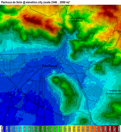
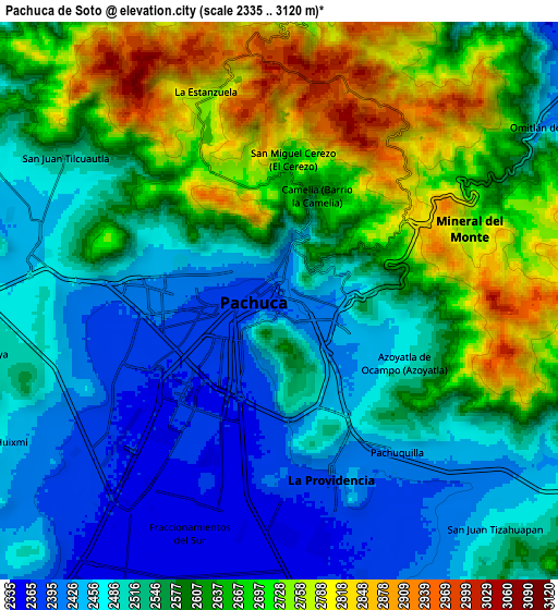
Below is the Elevation map of Pachuca de Soto, which displays elevation range with different colors. Scale of the first map is from 2346 to 2950 m (7697 to 9678 ft) with average elevation of 2512.5 meters (=8243 ft) [note 1]
These maps also provides idea of topography and contour of this city, they are displayed at different zoom levels. More info about maps, scale and edge coordinates you can find below images.
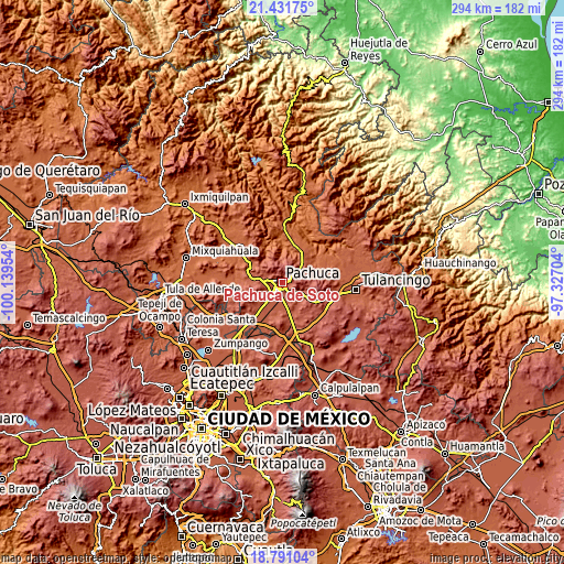
| \ | Map #1 | Map #2 | Topo.Map |
| Scale [m] | 2346..2950 m | 2335..3120 m | × |
| Scale [ft] | 7697..9678 ft | 7661..10236 ft | × |
| Average | 2512.5 m = 8243 ft | 2576.4 m = 8453 ft | × |
| Width | 9.18 km = 5.7 mi | 18.35 km = 11.4 mi | 293.6 km = 182.4 mi |
| Height | 9.18 km = 5.7 mi | 18.35 km = 11.4 mi | 293.6 km = 182.4 mi |
| ↑Max Latitude | 20.158229° | 20.199477° | 21.43175° |
| Latitude at center | 20.11697° | 20.11697° | 20.11697° |
| ↓Min Latitude | 20.0757° | 20.03442° | 18.79104° |
| ← Min Longitude | -98.777235° | -98.821181° | -100.13954° |
| Longitude center | -98.73329° | -98.73329° | -98.73329° |
| →Max Longitude | -98.689345° | -98.645399° | -97.32704° |
Nearby cities:
Cities around Pachuca de Soto sort by population:
• Campestre Villas del Álamo elevation 2429 m
3.2 km,  122°
122°
• Unidad Minera 11 de Julio 2420 m
1.7 km,  141°
141°
• PRI Chacón 2375 m
4 km,  185°
185°
• Manuel Ávila Camacho 2499 m
2.8 km,  101°
101°
• Guadalupe Minerva 2492 m
2.3 km,  64°
64°
• Santiago Jaltepec 2441 m
2.5 km,  109°
109°
• Colonia Militar 2510 m
3.2 km, 101°
• Carboneras 2454 m
4.2 km, 135°
• Rio de la Soledad 2458 m
2.2 km, 95°
• Privada del Álamo 2455 m
4 km, 121°
• Camelia (Barrio la Camelia) 2580 m
3.8 km,  17°
17°
• San Cristóbal Chacón 2393 m
4.1 km,  179°
179°
Multilingual:
 En español:
Pachuca, Pachuca de Soto elevación 2393 m.
 En France:
Pachuca élévation 2393 m.
 Auf Deutsch:
Pachuca de Soto höhe über dem Meeresspiegel ist 2393 m.

Sources and notes:
- [note 1] Map square and city borders are not equal. Map elevation data is calculated only from area inside that square.
- [src 1] Elevation data from geonames database provided with same terms of usage.
- [src 2] The elevation map of Pachuca de Soto is generated using elevation data from NASA's 3 arcsec (90m) resolution SRTM data.
- [src 3] Base (background) map © OpenStreetMap contributors tiles are generated by Geofabrik and OpenTopoMap.
Copyright & License:
This Pachuca de Soto Elevation Map is licensed under CC BY-SA. You may reuse any part from this page, if you give a proper credit by linking to this URL:
 More info on terms of use page.