Palmillas elevation
Palmillas (State of Mexico, Toluca), Mexico elevation is 2634 meters and Palmillas elevation in feet is 8642 ft above sea level [src 1]. Palmillas is a populated place (feature code) with elevation that is 1320 meters (4331 ft) bigger than average city elevation in Mexico.
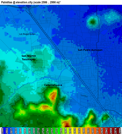
Below is the Elevation map of Palmillas, which displays elevation range with different colors. Scale of the first map is from 2586 to 2990 m (8484 to 9810 ft) with average elevation of 2649.7 meters (=8693 ft) [note 1]
These maps also provides idea of topography and contour of this city, they are displayed at different zoom levels. More info about maps, scale and edge coordinates you can find below images.
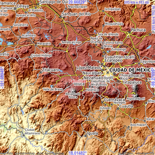
| \ | Map #1 | Topo.Map |
| Scale [m] | 2586..2990 m | × |
| Scale [ft] | 8484..9810 ft | × |
| Average | 2649.7 m = 8693 ft | × |
| Width | 9.22 km = 5.7 mi | 295 km = 183.3 mi |
| Height | 9.22 km = 5.7 mi | 295.1 km = 183.4 mi |
| ↑Max Latitude | 19.388408° | 20.66829° |
| Latitude at center | 19.34695° | 19.34695° |
| ↓Min Latitude | 19.305481° | 18.01482° |
| ← Min Longitude | -99.727145° | -101.08945° |
| Longitude center | -99.6832° | -99.6832° |
| →Max Longitude | -99.639255° | -98.27695° |
Nearby cities:
Cities around Palmillas sort by population:
• San Pablo Autopan elevation 2613 m
2.9 km,  68°
68°
• Calixtlahuaca 2645 m
1.3 km,  208°
208°
• Santiaguito Tlalcilalcalli 2703 m
4.7 km,  260°
260°
• San Marcos Yachihuacaltepec 2639 m
2.7 km,  170°
170°
• Barrio Santa Cruz 2618 m
2.2 km,  77°
77°
• Tecaxic 2711 m
4.3 km,  231°
231°
• San Martín Toltepec 2685 m
2.4 km,  283°
283°
• Barrio de Jesús Fracción Primera 2619 m
2.3 km,  350°
350°
• Barrio Bordo Nuevo 2606 m
3.7 km,  16°
16°
• Colonia Aviación Autopan 2622 m
3.7 km,  344°
344°
• San Carlos Autopan 2614 m
4.3 km, 354°
• La Planada (El Arenal) 2631 m
1.7 km,  156°
156°
Multilingual:
 En español:
Palmillas elevación 2634 m.
 En France:
Palmillas élévation 2634 m.
 Auf Deutsch:
Palmillas höhe über dem Meeresspiegel ist 2634 m.

Sources and notes:
- [note 1] Map square and city borders are not equal. Map elevation data is calculated only from area inside that square.
- [src 1] Elevation data from geonames database provided with same terms of usage.
- [src 2] The elevation map of Palmillas is generated using elevation data from NASA's 3 arcsec (90m) resolution SRTM data.
- [src 3] Base (background) map © OpenStreetMap contributors tiles are generated by Geofabrik and OpenTopoMap.
Copyright & License:
This Palmillas Elevation Map is licensed under CC BY-SA. You may reuse any part from this page, if you give a proper credit by linking to this URL:
 More info on terms of use page.