Paso del Toro elevation
Paso del Toro (Veracruz, Medellín), Mexico elevation is 15 meters and Paso del Toro elevation in feet is 49 ft above sea level [src 1]. Paso del Toro is a populated place (feature code) with elevation that is 1299 meters (4262 ft) smaller than average city elevation in Mexico.
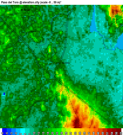
Below is the Elevation map of Paso del Toro, which displays elevation range with different colors. Scale of the first map is from -8 to 59 m (-26 to 194 ft) with average elevation of 14.3 meters (=47 ft) [note 1]
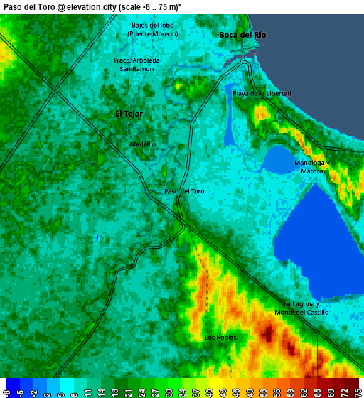
These maps also provides idea of topography and contour of this city, they are displayed at different zoom levels. More info about maps, scale and edge coordinates you can find below images.
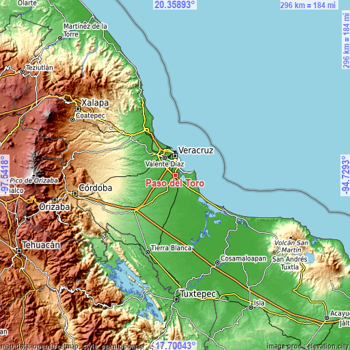
| \ | Map #1 | Map #2 | Topo.Map |
| Scale [m] | -8..59 m | -8..75 m | × |
| Scale [ft] | -26..194 ft | -26..246 ft | × |
| Average | 14.3 m = 47 ft | 16.4 m = 54 ft | × |
| Width | 9.24 km = 5.7 mi | 18.48 km = 11.5 mi | 295.6 km = 183.7 mi |
| Height | 9.24 km = 5.7 mi | 18.48 km = 11.5 mi | 295.6 km = 183.7 mi |
| ↑Max Latitude | 19.076537° | 19.118064° | 20.35893° |
| Latitude at center | 19.035° | 19.035° | 19.035° |
| ↓Min Latitude | 18.993452° | 18.951895° | 17.70043° |
| ← Min Longitude | -96.179495° | -96.223441° | -97.5418° |
| Longitude center | -96.13555° | -96.13555° | -96.13555° |
| →Max Longitude | -96.091605° | -96.047659° | -94.7293° |
Nearby cities:
Cities around Paso del Toro sort by population:
• Las Amapolas elevation 19 m
14.6 km,  333°
333°
• El Tejar 15 m
5.1 km, 328°
• Boca del Rio 1 m
8.4 km,  23°
23°
• Fraccionamiento Arboledas San Ramón 8 m
6.9 km,  341°
341°
• Antón Lizardo 9 m
15.3 km,  79°
79°
• Jamapa 23 m
11.2 km,  273°
273°
• Los Robles 30 m
7.1 km,  164°
164°
• Medellín de Bravo 15 m
3.5 km,  318°
318°
• La Laguna y Monte del Castillo 14 m
8.3 km,  133°
133°
• Hacienda Sotavento 24 m
12 km, 336°
• Rancho del Padre 20 m
5.2 km,  310°
310°
• Playa de la Libertad 21 m
6.7 km,  36°
36°
Multilingual:
 En español:
Paso del Toro elevación 15 m.
 En France:
Paso del Toro élévation 15 m.
 Auf Deutsch:
Paso del Toro höhe über dem Meeresspiegel ist 15 m.

Sources and notes:
- [note 1] Map square and city borders are not equal. Map elevation data is calculated only from area inside that square.
- [src 1] Elevation data from geonames database provided with same terms of usage.
- [src 2] The elevation map of Paso del Toro is generated using elevation data from NASA's 3 arcsec (90m) resolution SRTM data.
- [src 3] Base (background) map © OpenStreetMap contributors tiles are generated by Geofabrik and OpenTopoMap.
Copyright & License:
This Paso del Toro Elevation Map is licensed under CC BY-SA. You may reuse any part from this page, if you give a proper credit by linking to this URL:
 More info on terms of use page.