Piste elevation
Piste (Yucatán, Tinum), Mexico elevation is 25 meters and Piste elevation in feet is 82 ft above sea level [src 1]. Piste is a populated place (feature code) with elevation that is 1289 meters (4229 ft) smaller than average city elevation in Mexico.
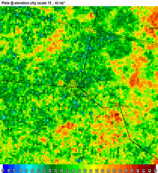
Below is the Elevation map of Piste, which displays elevation range with different colors. Scale of the first map is from 15 to 43 m (49 to 141 ft) with average elevation of 28.6 meters (=94 ft) [note 1]
These maps also provides idea of topography and contour of this city, they are displayed at different zoom levels. More info about maps, scale and edge coordinates you can find below images.
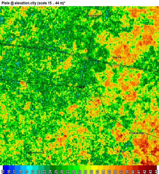
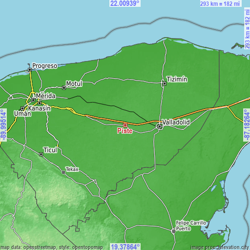
| \ | Map #1 | Map #2 | Topo.Map |
| Scale [m] | 15..43 m | 15..44 m | × |
| Scale [ft] | 49..141 ft | 49..144 ft | × |
| Average | 28.6 m = 94 ft | 29.4 m = 96 ft | × |
| Width | 9.14 km = 5.7 mi | 18.28 km = 11.4 mi | 292.5 km = 181.8 mi |
| Height | 9.14 km = 5.7 mi | 18.28 km = 11.4 mi | 292.5 km = 181.8 mi |
| ↑Max Latitude | 20.740823° | 20.781915° | 22.00939° |
| Latitude at center | 20.69972° | 20.69972° | 20.69972° |
| ↓Min Latitude | 20.658606° | 20.617481° | 19.37864° |
| ← Min Longitude | -88.632835° | -88.676781° | -89.99514° |
| Longitude center | -88.58889° | -88.58889° | -88.58889° |
| →Max Longitude | -88.544945° | -88.500999° | -87.18264° |
Nearby cities:
Cities around Piste sort by population:
• Chichén-Itzá elevation 27 m
4.3 km,  147°
147°
• Cenotillo 24 m
29.7 km,  356°
356°
• Uayma 26 m
28.4 km,  85°
85°
• Yaxcabá 27 m
30 km,  235°
235°
• Dzitás 33 m
16.9 km,  21°
21°
• Tunkas 18 m
28.2 km,  323°
323°
• Kaua 30 m
20 km,  115°
115°
• Tinum 29 m
21.9 km,  69°
69°
• Libre Unión 24 m
23 km,  271°
271°
• San Francisco Grande 27 m
12 km, 89°
• Cuncunul 31 m
31 km,  102°
102°
• Quintana Roo 17 m
19.4 km,  346°
346°
Multilingual:
 En español:
Piste elevación 25 m.
 En France:
Piste élévation 25 m.


Sources and notes:
- [note 1] Map square and city borders are not equal. Map elevation data is calculated only from area inside that square.
- [src 1] Elevation data from geonames database provided with same terms of usage.
- [src 2] The elevation map of Piste is generated using elevation data from NASA's 3 arcsec (90m) resolution SRTM data.
- [src 3] Base (background) map © OpenStreetMap contributors tiles are generated by Geofabrik and OpenTopoMap.
Copyright & License:
This Piste Elevation Map is licensed under CC BY-SA. You may reuse any part from this page, if you give a proper credit by linking to this URL:
 More info on terms of use page.