Rafael J. García elevation
Rafael J. García (Puebla, Chilchotla), Mexico elevation is 2191 meters and Rafael J. García elevation in feet is 7188 ft above sea level [src 1]. Rafael J. García is a seat of a second-order administrative division (feature code) with elevation that is 877 meters (2877 ft) bigger than average city elevation in Mexico.
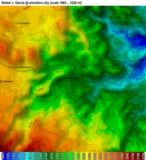
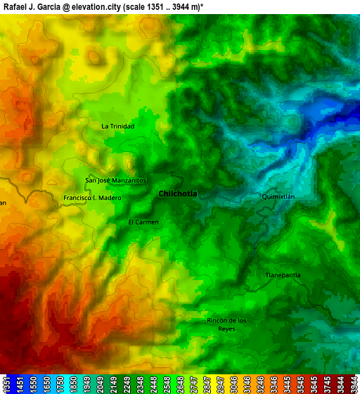
Below is the Elevation map of Rafael J. García, which displays elevation range with different colors. Scale of the first map is from 1663 to 3226 m (5456 to 10584 ft) with average elevation of 2422.7 meters (=7948 ft) [note 1]
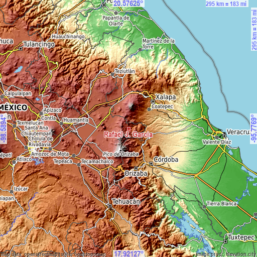
These maps also provides idea of topography and contour of this city, they are displayed at different zoom levels. More info about maps, scale and edge coordinates you can find below images.
| \ | Map #1 | Map #2 | Topo.Map |
| Scale [m] | 1663..3226 m | 1351..3944 m | × |
| Scale [ft] | 5456..10584 ft | 4432..12940 ft | × |
| Average | 2422.7 m = 7948 ft | 2604 m = 8543 ft | × |
| Width | 9.23 km = 5.7 mi | 18.45 km = 11.5 mi | 295.2 km = 183.4 mi |
| Height | 9.23 km = 5.7 mi | 18.45 km = 11.5 mi | 295.2 km = 183.4 mi |
| ↑Max Latitude | 19.295612° | 19.337083° | 20.57625° |
| Latitude at center | 19.25413° | 19.25413° | 19.25413° |
| ↓Min Latitude | 19.212638° | 19.171135° | 17.92127° |
| ← Min Longitude | -97.227095° | -97.271041° | -98.5894° |
| Longitude center | -97.18315° | -97.18315° | -97.18315° |
| →Max Longitude | -97.139205° | -97.095259° | -95.7769° |
Nearby cities:
Cities around Rafael J. García sort by population:
• Francisco I. Madero elevation 2731 m
4.6 km,  264°
264°
• San Antonio Xoquitla 2179 m
9.8 km,  11°
11°
• Tlanepantla 2394 m
6.6 km,  128°
128°
• El Carmen 2353 m
2.3 km,  233°
233°
• San José Manzanitos 2642 m
3.4 km,  283°
283°
• San Antonio 2401 m
1.9 km,  347°
347°
• Rincón de los Reyes 2399 m
7 km,  160°
160°
• Tlanalapan 2986 m
9.8 km,  267°
267°
• Buenavista 2086 m
11.3 km,  88°
88°
• Xacaxomulco 2330 m
8.2 km,  152°
152°
• Tozihuic 2049 m
9.1 km, 91°
• Ignacio Zaragoza 2594 m
3.2 km,  328°
328°
Multilingual:
 En español:
Rafael J. García elevación 2191 m.
 En France:
Rafael J. García élévation 2191 m.
 Auf Deutsch:
Rafael J. García höhe über dem Meeresspiegel ist 2191 m.

Sources and notes:
- [note 1] Map square and city borders are not equal. Map elevation data is calculated only from area inside that square.
- [src 1] Elevation data from geonames database provided with same terms of usage.
- [src 2] The elevation map of Rafael J. García is generated using elevation data from NASA's 3 arcsec (90m) resolution SRTM data.
- [src 3] Base (background) map © OpenStreetMap contributors tiles are generated by Geofabrik and OpenTopoMap.
Copyright & License:
This Rafael J. García Elevation Map is licensed under CC BY-SA. You may reuse any part from this page, if you give a proper credit by linking to this URL:
 More info on terms of use page.