Sacalum elevation
Sacalum (Yucatán), Mexico elevation is 18 meters and Sacalum elevation in feet is 59 ft above sea level [src 1]. Sacalum is a populated place (feature code) with elevation that is 1296 meters (4252 ft) smaller than average city elevation in Mexico.
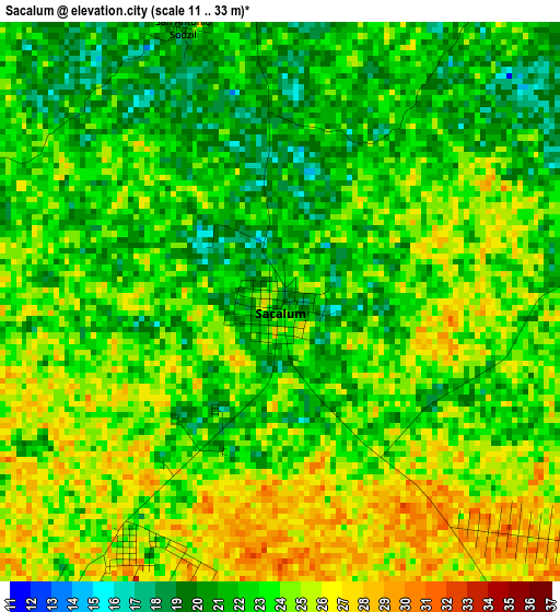
Below is the Elevation map of Sacalum, which displays elevation range with different colors. Scale of the first map is from 11 to 33 m (36 to 108 ft) with average elevation of 22.9 meters (=75 ft) [note 1]
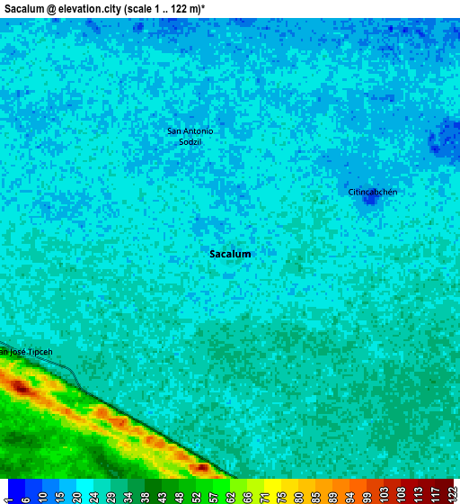
These maps also provides idea of topography and contour of this city, they are displayed at different zoom levels. More info about maps, scale and edge coordinates you can find below images.
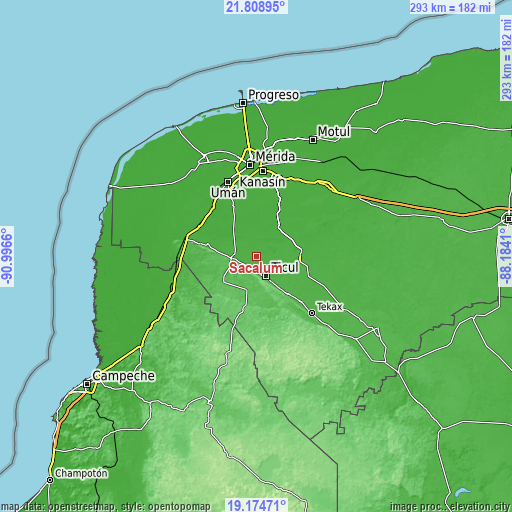
| \ | Map #1 | Map #2 | Topo.Map |
| Scale [m] | 11..33 m | 1..122 m | × |
| Scale [ft] | 36..108 ft | 3..400 ft | × |
| Average | 22.9 m = 75 ft | 25.6 m = 84 ft | × |
| Width | 9.15 km = 5.7 mi | 18.31 km = 11.4 mi | 292.9 km = 182 mi |
| Height | 9.15 km = 5.7 mi | 18.31 km = 11.4 mi | 292.9 km = 182 mi |
| ↑Max Latitude | 20.538647° | 20.579794° | 21.80895° |
| Latitude at center | 20.49749° | 20.49749° | 20.49749° |
| ↓Min Latitude | 20.456321° | 20.415142° | 19.17471° |
| ← Min Longitude | -89.634295° | -89.678241° | -90.9966° |
| Longitude center | -89.59035° | -89.59035° | -89.59035° |
| →Max Longitude | -89.546405° | -89.502459° | -88.1841° |
Nearby cities:
Cities around Sacalum sort by population:
• Ticul elevation 30 m
12.4 km,  152°
152°
• Muna 25 m
12.9 km,  265°
265°
• Dzan 31 m
17.5 km,  133°
133°
• Mani 32 m
24 km,  120°
120°
• Santa Elena 44 m
19.6 km,  196°
196°
• Mama 23 m
23.6 km,  95°
95°
• Pustunich 29 m
16.4 km, 150°
• Uayalceh de Peón 18 m
21.8 km,  358°
358°
• Yotholin 32 m
23.6 km,  143°
143°
• Chapab 16 m
14.5 km,  107°
107°
• Abala 17 m
19.2 km,  330°
330°
• Telchaquillo 17 m
21.2 km,  38°
38°
Multilingual:
 En español:
Sacalum elevación 18 m.
 En France:
Sacalum élévation 18 m.


Sources and notes:
- [note 1] Map square and city borders are not equal. Map elevation data is calculated only from area inside that square.
- [src 1] Elevation data from geonames database provided with same terms of usage.
- [src 2] The elevation map of Sacalum is generated using elevation data from NASA's 3 arcsec (90m) resolution SRTM data.
- [src 3] Base (background) map © OpenStreetMap contributors tiles are generated by Geofabrik and OpenTopoMap.
Copyright & License:
This Sacalum Elevation Map is licensed under CC BY-SA. You may reuse any part from this page, if you give a proper credit by linking to this URL:
 More info on terms of use page.