San José Atlán elevation
San José Atlán (Hidalgo, Huichapan), Mexico elevation is 2154 meters and San José Atlán elevation in feet is 7067 ft above sea level [src 1]. San José Atlán is a populated place (feature code) with elevation that is 840 meters (2756 ft) bigger than average city elevation in Mexico.
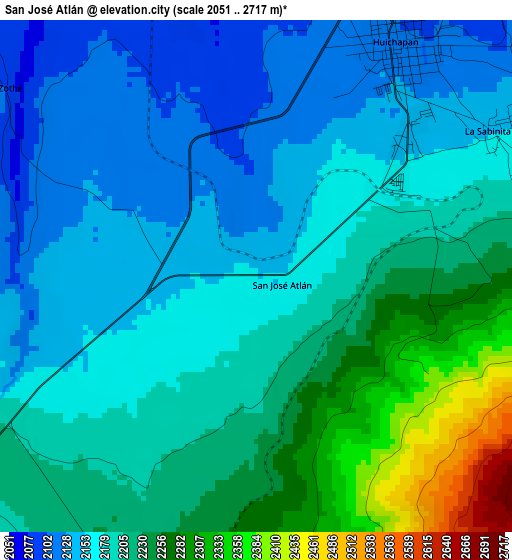
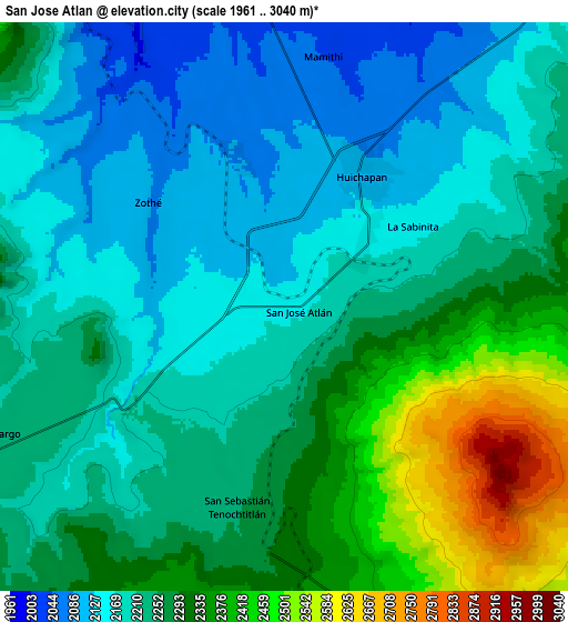
Below is the Elevation map of San José Atlán, which displays elevation range with different colors. Scale of the first map is from 2051 to 2717 m (6729 to 8914 ft) with average elevation of 2198.2 meters (=7212 ft) [note 1]
These maps also provides idea of topography and contour of this city, they are displayed at different zoom levels. More info about maps, scale and edge coordinates you can find below images.
| \ | Map #1 | Map #2 | Topo.Map |
| Scale [m] | 2051..2717 m | 1961..3040 m | × |
| Scale [ft] | 6729..8914 ft | 6434..9974 ft | × |
| Average | 2198.2 m = 7212 ft | 2249.4 m = 7380 ft | × |
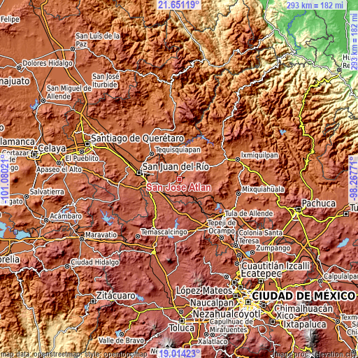
| Width | 9.16 km = 5.7 mi | 18.33 km = 11.4 mi | 293.2 km = 182.2 mi |
| Height | 9.16 km = 5.7 mi | 18.33 km = 11.4 mi | 293.2 km = 182.2 mi |
| ↑Max Latitude | 20.37953° | 20.420719° | 21.65119° |
| Latitude at center | 20.33833° | 20.33833° | 20.33833° |
| ↓Min Latitude | 20.297119° | 20.255897° | 19.01423° |
| ← Min Longitude | -99.717905° | -99.761851° | -101.08021° |
| Longitude center | -99.67396° | -99.67396° | -99.67396° |
| →Max Longitude | -99.630015° | -99.586069° | -98.26771° |
Nearby cities:
Cities around San José Atlán sort by population:
• Huichapan elevation 2107 m
4.9 km,  32°
32°
• Tlaxcalilla 2213 m
15.4 km,  286°
286°
• La Sabinita 2144 m
5 km,  56°
56°
• Llano Largo 2239 m
10.4 km,  246°
246°
• San Sebastián Tenochtitlán 2247 m
6.7 km,  193°
193°
• Mamithi 2035 m
8.1 km,  11°
11°
• San Francisco 1850 m
16.3 km,  337°
337°
• Bondojito 1963 m
12.1 km,  346°
346°
• Zothé 2088 m
5.6 km,  308°
308°
• El Jagüey 2527 m
11.9 km,  148°
148°
• Nopala de Villagran 2400 m
10.1 km,  162°
162°
• Dantzibojay 2147 m
14.5 km,  39°
39°
Multilingual:
 En español:
San José Atlán elevación 2154 m.
 En France:
San José Atlán élévation 2154 m.
 Auf Deutsch:
San José Atlán höhe über dem Meeresspiegel ist 2154 m.

Sources and notes:
- [note 1] Map square and city borders are not equal. Map elevation data is calculated only from area inside that square.
- [src 1] Elevation data from geonames database provided with same terms of usage.
- [src 2] The elevation map of San José Atlán is generated using elevation data from NASA's 3 arcsec (90m) resolution SRTM data.
- [src 3] Base (background) map © OpenStreetMap contributors tiles are generated by Geofabrik and OpenTopoMap.
Copyright & License:
This San José Atlán Elevation Map is licensed under CC BY-SA. You may reuse any part from this page, if you give a proper credit by linking to this URL:
 More info on terms of use page.