Teotihuacán elevation
Teotihuacán (State of Mexico), Mexico elevation is 2280 meters and Teotihuacán elevation in feet is 7480 ft above sea level [src 1]. Teotihuacán is a seat of a second-order administrative division (feature code) with elevation that is 966 meters (3169 ft) bigger than average city elevation in Mexico.
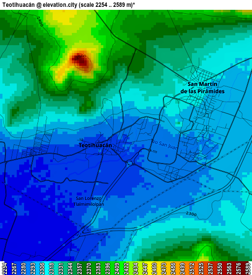
Below is the Elevation map of Teotihuacán, which displays elevation range with different colors. Scale of the first map is from 2254 to 2589 m (7395 to 8494 ft) with average elevation of 2318.7 meters (=7607 ft) [note 1]
These maps also provides idea of topography and contour of this city, they are displayed at different zoom levels. More info about maps, scale and edge coordinates you can find below images.
| \ | Map #1 | Map #2 | Topo.Map |
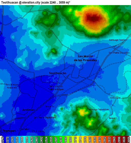
| Scale [m] | 2254..2589 m | 2240..3059 m | × |
| Scale [ft] | 7395..8494 ft | 7349..10036 ft | × |
| Average | 2318.7 m = 7607 ft | 2376.9 m = 7798 ft | × |
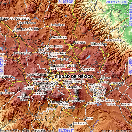
| Width | 9.2 km = 5.7 mi | 18.4 km = 11.4 mi | 294.4 km = 182.9 mi |
| Height | 9.2 km = 5.7 mi | 18.4 km = 11.4 mi | 294.4 km = 182.9 mi |
| ↑Max Latitude | 19.729991° | 19.771351° | 21.00708° |
| Latitude at center | 19.68862° | 19.68862° | 19.68862° |
| ↓Min Latitude | 19.647238° | 19.605846° | 18.35921° |
| ← Min Longitude | -98.905045° | -98.948991° | -100.26735° |
| Longitude center | -98.8611° | -98.8611° | -98.8611° |
| →Max Longitude | -98.817155° | -98.773209° | -97.45485° |
Nearby cities:
Cities around Teotihuacán sort by population:
• Teotihuacán de Arista elevation 2284 m
0.1 km,  13°
13°
• San Martín de las Pirámides 2311 m
3.3 km,  54°
54°
• San Lorenzo Tlalmimilolpan 2281 m
2.6 km,  206°
206°
• San Sebastián Xolalpa 2286 m
2.1 km,  129°
129°
• San Bartolo 2263 m
5.7 km,  229°
229°
• Atlatongo 2263 m
5.1 km,  242°
242°
• Xometla 2271 m
5.5 km,  202°
202°
• San Francisco Mazapa 2294 m
2.8 km,  83°
83°
• Santa María Palapa 2425 m
5.4 km, 14°
• Santiago Tepetitlán 2384 m
7.2 km,  141°
141°
• Cozotlán Norte 2349 m
2.2 km,  3°
3°
• San Antonio de las Palmas 2370 m
3.3 km, 7°
Multilingual:
 En español:
Teotihuacán de Arista elevación 2280 m.
 En France:
Teotihuacán élévation 2280 m.
 Auf Deutsch:
Teotihuacán höhe über dem Meeresspiegel ist 2280 m.

Sources and notes:
- [note 1] Map square and city borders are not equal. Map elevation data is calculated only from area inside that square.
- [src 1] Elevation data from geonames database provided with same terms of usage.
- [src 2] The elevation map of Teotihuacán is generated using elevation data from NASA's 3 arcsec (90m) resolution SRTM data.
- [src 3] Base (background) map © OpenStreetMap contributors tiles are generated by Geofabrik and OpenTopoMap.
Copyright & License:
This Teotihuacán Elevation Map is licensed under CC BY-SA. You may reuse any part from this page, if you give a proper credit by linking to this URL:
 More info on terms of use page.