San Luis Acatlán elevation
San Luis Acatlán (Guerrero), Mexico elevation is 292 meters and San Luis Acatlán elevation in feet is 958 ft above sea level [src 1]. San Luis Acatlán is a seat of a second-order administrative division (feature code) with elevation that is 1022 meters (3353 ft) smaller than average city elevation in Mexico.
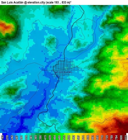
Below is the Elevation map of San Luis Acatlán, which displays elevation range with different colors. Scale of the first map is from 193 to 833 m (633 to 2733 ft) with average elevation of 362 meters (=1188 ft) [note 1]
These maps also provides idea of topography and contour of this city, they are displayed at different zoom levels. More info about maps, scale and edge coordinates you can find below images.
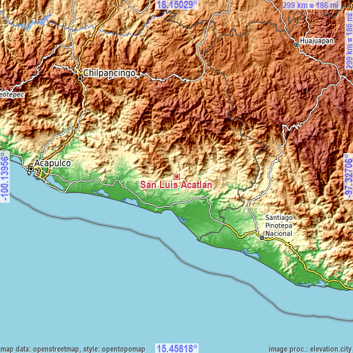
| \ | Map #1 | Map #2 | Topo.Map |
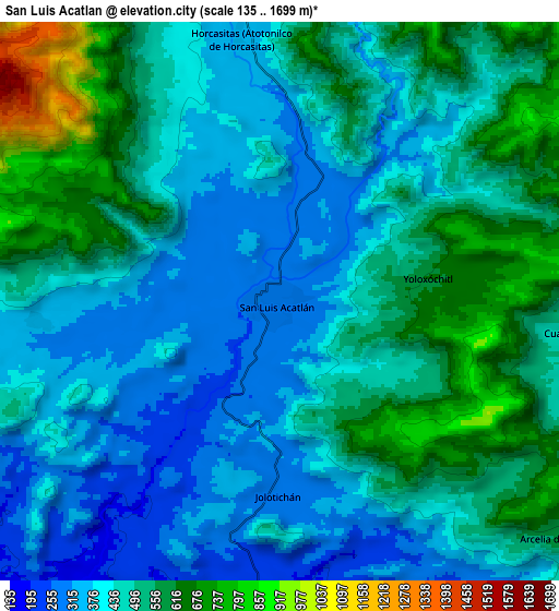
| Scale [m] | 193..833 m | 135..1699 m | × |
| Scale [ft] | 633..2733 ft | 443..5574 ft | × |
| Average | 362 m = 1188 ft | 471.5 m = 1547 ft | × |
| Width | 9.35 km = 5.8 mi | 18.71 km = 11.6 mi | 299.3 km = 186 mi |
| Height | 9.35 km = 5.8 mi | 18.71 km = 11.6 mi | 299.4 km = 186 mi |
| ↑Max Latitude | 16.851073° | 16.893127° | 18.15029° |
| Latitude at center | 16.80901° | 16.80901° | 16.80901° |
| ↓Min Latitude | 16.766938° | 16.724856° | 15.45818° |
| ← Min Longitude | -98.777255° | -98.821201° | -100.13956° |
| Longitude center | -98.73331° | -98.73331° | -98.73331° |
| →Max Longitude | -98.689365° | -98.645419° | -97.32706° |
Nearby cities:
Cities around San Luis Acatlán sort by population:
• Azoyú elevation 369 m
16.4 km,  121°
121°
• Pueblo Hidalgo 912 m
17.9 km,  27°
27°
• Yoloxóchitl 618 m
5.1 km,  81°
81°
• Cuanacaxtitlán 473 m
10 km,  96°
96°
• El Rincón (Santa Cruz del Rincón) 610 m
20.8 km,  359°
359°
• Horcasitas 360 m
8.9 km,  351°
351°
• Jolotichán 281 m
6.3 km,  177°
177°
• El Potrerillo (Potrerillo del Rincón) 691 m
16.6 km,  0°
0°
• Tlaxcalixtlahuaca 536 m
19.8 km, 345°
• Arcelia de Rodríguez 573 m
12.4 km,  130°
130°
• Agua Zarca 168 m
20.9 km,  170°
170°
• Zoyatlán 160 m
11.1 km, 180°
Multilingual:
 En español:
San Luis Acatlán elevación 292 m.
 En France:
San Luis Acatlán élévation 292 m.
 Auf Deutsch:
San Luis Acatlán höhe über dem Meeresspiegel ist 292 m.

Sources and notes:
- [note 1] Map square and city borders are not equal. Map elevation data is calculated only from area inside that square.
- [src 1] Elevation data from geonames database provided with same terms of usage.
- [src 2] The elevation map of San Luis Acatlán is generated using elevation data from NASA's 3 arcsec (90m) resolution SRTM data.
- [src 3] Base (background) map © OpenStreetMap contributors tiles are generated by Geofabrik and OpenTopoMap.
Copyright & License:
This San Luis Acatlán Elevation Map is licensed under CC BY-SA. You may reuse any part from this page, if you give a proper credit by linking to this URL:
 More info on terms of use page.