San Pablo Villa de Mitla elevation
San Pablo Villa de Mitla (Oaxaca), Mexico elevation is 1688 meters and San Pablo Villa de Mitla elevation in feet is 5538 ft above sea level [src 1]. San Pablo Villa de Mitla is a seat of a second-order administrative division (feature code) with elevation that is 374 meters (1227 ft) bigger than average city elevation in Mexico.
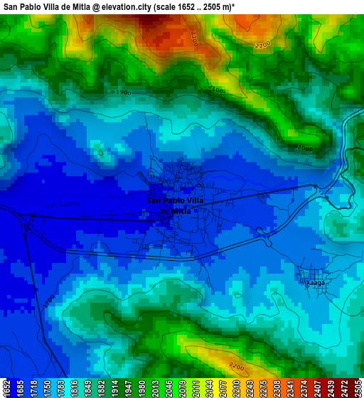
Below is the Elevation map of San Pablo Villa de Mitla, which displays elevation range with different colors. Scale of the first map is from 1652 to 2505 m (5420 to 8219 ft) with average elevation of 1844.3 meters (=6051 ft) [note 1]
These maps also provides idea of topography and contour of this city, they are displayed at different zoom levels. More info about maps, scale and edge coordinates you can find below images.
| \ | Map #1 | Map #2 | Topo.Map |
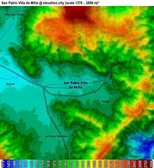
| Scale [m] | 1652..2505 m | 1378..2808 m | × |
| Scale [ft] | 5420..8219 ft | 4521..9213 ft | × |
| Average | 1844.3 m = 6051 ft | 1961.1 m = 6434 ft | × |
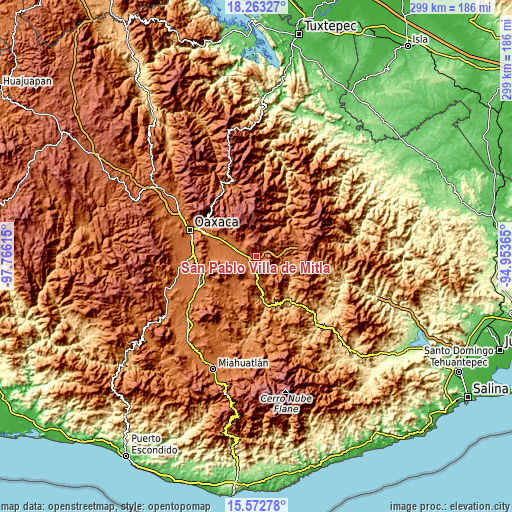
| Width | 9.35 km = 5.8 mi | 18.7 km = 11.6 mi | 299.2 km = 185.9 mi |
| Height | 9.35 km = 5.8 mi | 18.7 km = 11.6 mi | 299.2 km = 185.9 mi |
| ↑Max Latitude | 16.964868° | 17.006896° | 18.26327° |
| Latitude at center | 16.92283° | 16.92283° | 16.92283° |
| ↓Min Latitude | 16.880783° | 16.838726° | 15.57278° |
| ← Min Longitude | -96.403845° | -96.447791° | -97.76615° |
| Longitude center | -96.3599° | -96.3599° | -96.3599° |
| →Max Longitude | -96.315955° | -96.272009° | -94.95365° |
Nearby cities:
Cities around San Pablo Villa de Mitla sort by population:
• Tlacolula de Matamoros elevation 1625 m
12.8 km,  286°
286°
• San Dionisio Ocotepec 1694 m
13.6 km,  195°
195°
• Santiago Matatlán 1728 m
6.9 km, 200°
• San Baltazar Guelavila 1607 m
15.2 km,  157°
157°
• San Miguel del Valle 1782 m
12.5 km,  330°
330°
• Villa Díaz Ordaz 1717 m
11.2 km,  316°
316°
• Fraccionamiento Ciudad Yagul 1664 m
12.4 km,  299°
299°
• San Bartolomé Quialana 1791 m
15.2 km,  261°
261°
• Santa Ana del Valle 1671 m
14.3 km, 304°
• San Lucas Quiavini 1743 m
11.9 km, 255°
• San Lorenzo Albarradas 1824 m
10.9 km,  96°
96°
• Xaaga 1755 m
4 km,  121°
121°
Multilingual:
 En español:
Mitla elevación 1688 m.
 En France:
Mitla élévation 1688 m.
 Auf Deutsch:
San Pablo Villa de Mitla höhe über dem Meeresspiegel ist 1688 m.
 На русском:
San Pablo Villa de Mitla высота над уровнем моря 1688 м
Sources and notes:
- [note 1] Map square and city borders are not equal. Map elevation data is calculated only from area inside that square.
- [src 1] Elevation data from geonames database provided with same terms of usage.
- [src 2] The elevation map of San Pablo Villa de Mitla is generated using elevation data from NASA's 3 arcsec (90m) resolution SRTM data.
- [src 3] Base (background) map © OpenStreetMap contributors tiles are generated by Geofabrik and OpenTopoMap.
Copyright & License:
This San Pablo Villa de Mitla Elevation Map is licensed under CC BY-SA. You may reuse any part from this page, if you give a proper credit by linking to this URL:
 More info on terms of use page.