Tepatlaxco de Hidalgo elevation
Tepatlaxco de Hidalgo (Puebla, Acajete), Mexico elevation is 2351 meters and Tepatlaxco de Hidalgo elevation in feet is 7713 ft above sea level [src 1]. Tepatlaxco de Hidalgo is a populated place (feature code) with elevation that is 1037 meters (3402 ft) bigger than average city elevation in Mexico.
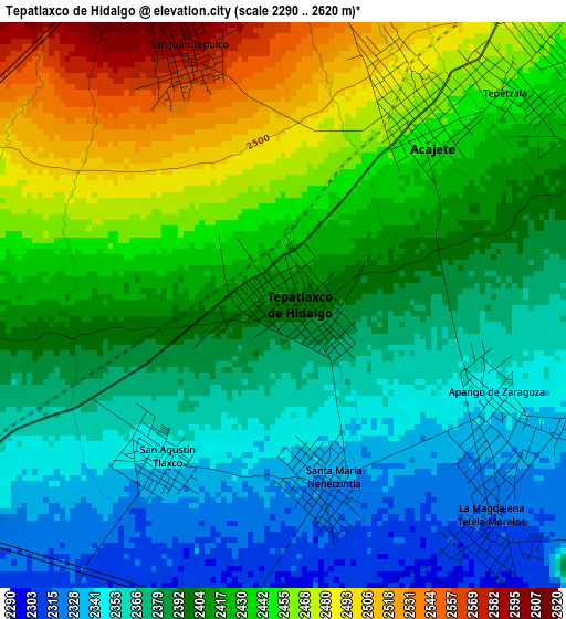
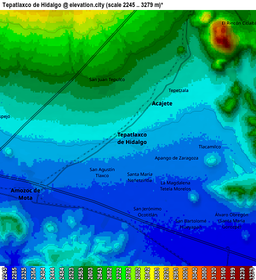
Below is the Elevation map of Tepatlaxco de Hidalgo, which displays elevation range with different colors. Scale of the first map is from 2290 to 2620 m (7513 to 8596 ft) with average elevation of 2406.8 meters (=7896 ft) [note 1]
These maps also provides idea of topography and contour of this city, they are displayed at different zoom levels. More info about maps, scale and edge coordinates you can find below images.
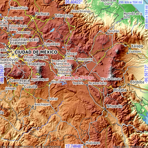
| \ | Map #1 | Map #2 | Topo.Map |
| Scale [m] | 2290..2620 m | 2245..3279 m | × |
| Scale [ft] | 7513..8596 ft | 7365..10758 ft | × |
| Average | 2406.8 m = 7896 ft | 2457.5 m = 8063 ft | × |
| Width | 9.24 km = 5.7 mi | 18.47 km = 11.5 mi | 295.5 km = 183.6 mi |
| Height | 9.24 km = 5.7 mi | 18.47 km = 11.5 mi | 295.5 km = 183.6 mi |
| ↑Max Latitude | 19.122196° | 19.163711° | 20.40422° |
| Latitude at center | 19.08067° | 19.08067° | 19.08067° |
| ↓Min Latitude | 19.039134° | 18.997587° | 17.74646° |
| ← Min Longitude | -98.017325° | -98.061271° | -99.37963° |
| Longitude center | -97.97338° | -97.97338° | -97.97338° |
| →Max Longitude | -97.929435° | -97.885489° | -96.56713° |
Nearby cities:
Cities around Tepatlaxco de Hidalgo sort by population:
• Amozoc de Mota elevation 2316 m
8.5 km,  242°
242°
• Acajete 2468 m
4.1 km,  32°
32°
• San Juan Tepulco 2581 m
4.3 km,  338°
338°
• La Magdalena Tetela Morelos 2313 m
4.9 km,  136°
136°
• San Agustín Tlaxco 2341 m
3.3 km,  215°
215°
• San Jerónimo Ocotitla 2294 m
5.6 km,  169°
169°
• Santa María Nenetzintla 2328 m
3 km, 166°
• Tlacamilco 2358 m
6 km,  95°
95°
• Concepción Capulac (La Ex-Hacienda) 2429 m
9.4 km,  279°
279°
• Apango de Zaragoza 2353 m
3.7 km,  111°
111°
• San Bartolomé Hueyapan 2285 m
7.6 km, 143°
• San Antonio Tlacamilco 2344 m
5 km, 113°
Multilingual:
 En español:
Tepatlaxco de Hidalgo elevación 2351 m.
 En France:
Tepatlaxco de Hidalgo élévation 2351 m.
 Auf Deutsch:
Tepatlaxco de Hidalgo höhe über dem Meeresspiegel ist 2351 m.
 На русском:
Tepatlaxco de Hidalgo высота над уровнем моря 2351 м
Sources and notes:
- [note 1] Map square and city borders are not equal. Map elevation data is calculated only from area inside that square.
- [src 1] Elevation data from geonames database provided with same terms of usage.
- [src 2] The elevation map of Tepatlaxco de Hidalgo is generated using elevation data from NASA's 3 arcsec (90m) resolution SRTM data.
- [src 3] Base (background) map © OpenStreetMap contributors tiles are generated by Geofabrik and OpenTopoMap.
Copyright & License:
This Tepatlaxco de Hidalgo Elevation Map is licensed under CC BY-SA. You may reuse any part from this page, if you give a proper credit by linking to this URL:
 More info on terms of use page.