Tocatlán elevation
Tocatlán (Tlaxcala), Mexico elevation is 2634 meters and Tocatlán elevation in feet is 8642 ft above sea level [src 1]. Tocatlán is a seat of a second-order administrative division (feature code) with elevation that is 1320 meters (4331 ft) bigger than average city elevation in Mexico.
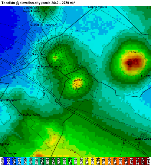
Below is the Elevation map of Tocatlán, which displays elevation range with different colors. Scale of the first map is from 2442 to 2739 m (8012 to 8986 ft) with average elevation of 2524.9 meters (=8284 ft) [note 1]
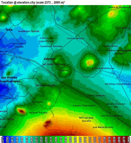
These maps also provides idea of topography and contour of this city, they are displayed at different zoom levels. More info about maps, scale and edge coordinates you can find below images.
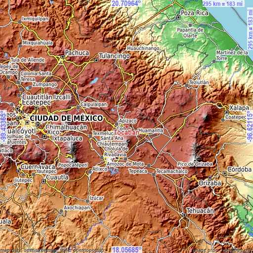
| \ | Map #1 | Map #2 | Topo.Map |
| Scale [m] | 2442..2739 m | 2373..2899 m | × |
| Scale [ft] | 8012..8986 ft | 7785..9511 ft | × |
| Average | 2524.9 m = 8284 ft | 2541.6 m = 8339 ft | × |
| Width | 9.22 km = 5.7 mi | 18.44 km = 11.5 mi | 295 km = 183.3 mi |
| Height | 9.22 km = 5.7 mi | 18.44 km = 11.5 mi | 295 km = 183.3 mi |
| ↑Max Latitude | 19.430098° | 19.471535° | 20.70964° |
| Latitude at center | 19.38865° | 19.38865° | 19.38865° |
| ↓Min Latitude | 19.347192° | 19.305723° | 18.05685° |
| ← Min Longitude | -98.071345° | -98.115291° | -99.43365° |
| Longitude center | -98.0274° | -98.0274° | -98.0274° |
| →Max Longitude | -97.983455° | -97.939509° | -96.62115° |
Nearby cities:
Cities around Tocatlán sort by population:
• Xaloztoc elevation 2517 m
2.9 km,  317°
317°
• Santa María Texcalac 2425 m
7.3 km,  301°
301°
• San José Teacalco 2609 m
7.1 km,  213°
213°
• San Pedro Tlacotepec 2517 m
2.1 km,  292°
292°
• Cuaxomulco 2440 m
8.3 km,  241°
241°
• Colonia Venustiano Carranza 2474 m
3.5 km, 291°
• El Carmen Xalpatlahuaya 2501 m
4.8 km,  85°
85°
• Tzompantepec 2488 m
6.7 km,  258°
258°
• Nicolás Bravo 2518 m
7.3 km,  59°
59°
• San Juan Quetzalcoapan 2514 m
4.7 km, 257°
• Lázaro Cárdenas 2525 m
5.3 km,  128°
128°
• Guadalupe Texcalac 2454 m
7.7 km, 316°
Multilingual:
 En español:
Tocatlán elevación 2634 m.
 En France:
Tocatlán élévation 2634 m.
 Auf Deutsch:
Tocatlán höhe über dem Meeresspiegel ist 2634 m.

Sources and notes:
- [note 1] Map square and city borders are not equal. Map elevation data is calculated only from area inside that square.
- [src 1] Elevation data from geonames database provided with same terms of usage.
- [src 2] The elevation map of Tocatlán is generated using elevation data from NASA's 3 arcsec (90m) resolution SRTM data.
- [src 3] Base (background) map © OpenStreetMap contributors tiles are generated by Geofabrik and OpenTopoMap.
Copyright & License:
This Tocatlán Elevation Map is licensed under CC BY-SA. You may reuse any part from this page, if you give a proper credit by linking to this URL:
 More info on terms of use page.