Tres Picos elevation
Tres Picos (Chiapas, Tonalá), Mexico elevation is 28 meters and Tres Picos elevation in feet is 92 ft above sea level [src 1]. Tres Picos is a populated place (feature code) with elevation that is 1286 meters (4219 ft) smaller than average city elevation in Mexico.
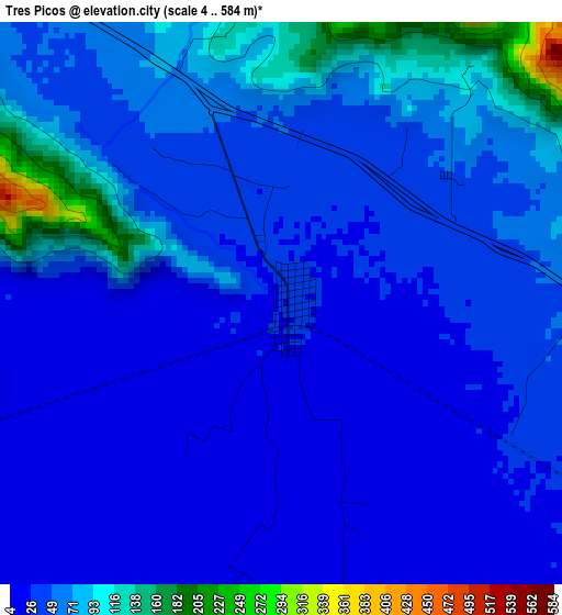
Below is the Elevation map of Tres Picos, which displays elevation range with different colors. Scale of the first map is from 4 to 584 m (13 to 1916 ft) with average elevation of 49.5 meters (=162 ft) [note 1]
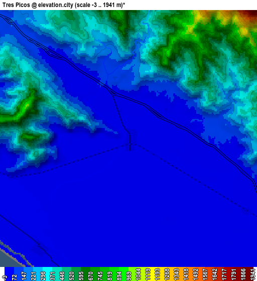
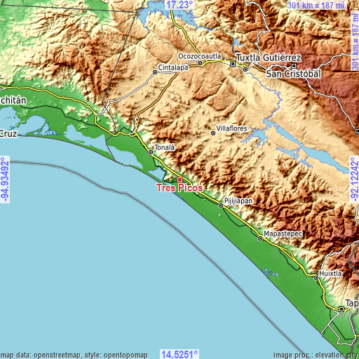
These maps also provides idea of topography and contour of this city, they are displayed at different zoom levels. More info about maps, scale and edge coordinates you can find below images.
| \ | Map #1 | Map #2 | Topo.Map |
| Scale [m] | 4..584 m | -3..1941 m | × |
| Scale [ft] | 13..1916 ft | -10..6368 ft | × |
| Average | 49.5 m = 162 ft | 175.9 m = 577 ft | × |
| Width | 9.4 km = 5.8 mi | 18.8 km = 11.7 mi | 300.8 km = 186.9 mi |
| Height | 9.4 km = 5.8 mi | 18.8 km = 11.7 mi | 300.8 km = 186.9 mi |
| ↑Max Latitude | 15.924353° | 15.966608° | 17.23° |
| Latitude at center | 15.88209° | 15.88209° | 15.88209° |
| ↓Min Latitude | 15.839818° | 15.797537° | 14.5251° |
| ← Min Longitude | -93.572615° | -93.616561° | -94.93492° |
| Longitude center | -93.52867° | -93.52867° | -93.52867° |
| →Max Longitude | -93.484725° | -93.440779° | -92.12242° |
Nearby cities:
Cities around Tres Picos sort by population:
• Tonalá elevation 50 m
33.4 km,  313°
313°
• Pijijiapan 47 m
40.5 km,  122°
122°
• Paredón 7 m
40.7 km,  297°
297°
• Cabeza de Toro 8 m
27.8 km,  282°
282°
• Manuel Ávila Camacho (Ponte Duro) 9 m
10.3 km,  218°
218°
• San Isidro 23 m
24.3 km,  129°
129°
• Tamaulipas 10 m
17.9 km, 133°
• Huizachal 23 m
34.6 km, 303°
• Francisco Villa 606 m
42.2 km,  29°
29°
• Monterrey 686 m
26.3 km,  40°
40°
• Doctor Belisario Domínguez (La Barra) 10 m
18.8 km,  272°
272°
• San Luqueño 5 m
36.9 km,  293°
293°
Multilingual:
 En español:
Tres Picos elevación 28 m.
 En France:
Tres Picos élévation 28 m.
 Auf Deutsch:
Tres Picos höhe über dem Meeresspiegel ist 28 m.

Sources and notes:
- [note 1] Map square and city borders are not equal. Map elevation data is calculated only from area inside that square.
- [src 1] Elevation data from geonames database provided with same terms of usage.
- [src 2] The elevation map of Tres Picos is generated using elevation data from NASA's 3 arcsec (90m) resolution SRTM data.
- [src 3] Base (background) map © OpenStreetMap contributors tiles are generated by Geofabrik and OpenTopoMap.
Copyright & License:
This Tres Picos Elevation Map is licensed under CC BY-SA. You may reuse any part from this page, if you give a proper credit by linking to this URL:
 More info on terms of use page.