Xonacatlán elevation
Xonacatlán (State of Mexico, Xonacatlan), Mexico elevation is 2585 meters and Xonacatlán elevation in feet is 8481 ft above sea level [src 1]. Xonacatlán is a seat of a second-order administrative division (feature code) with elevation that is 1271 meters (4170 ft) bigger than average city elevation in Mexico.
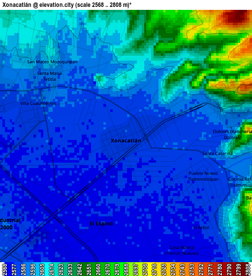
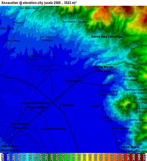
Below is the Elevation map of Xonacatlán, which displays elevation range with different colors. Scale of the first map is from 2568 to 2808 m (8425 to 9213 ft) with average elevation of 2599.5 meters (=8529 ft) [note 1]
These maps also provides idea of topography and contour of this city, they are displayed at different zoom levels. More info about maps, scale and edge coordinates you can find below images.
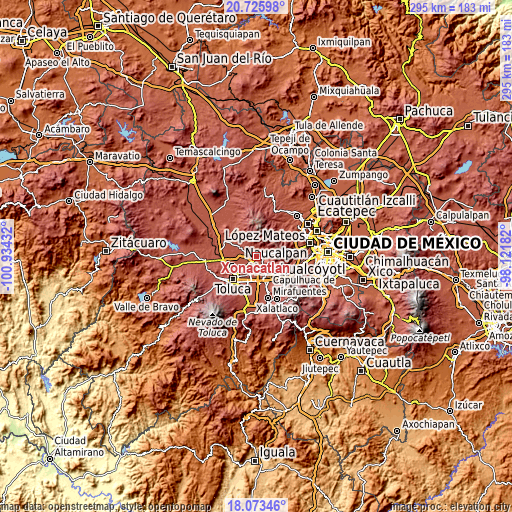
| \ | Map #1 | Map #2 | Topo.Map |
| Scale [m] | 2568..2808 m | 2568..3523 m | × |
| Scale [ft] | 8425..9213 ft | 8425..11558 ft | × |
| Average | 2599.5 m = 8529 ft | 2691.6 m = 8831 ft | × |
| Width | 9.22 km = 5.7 mi | 18.43 km = 11.5 mi | 294.9 km = 183.2 mi |
| Height | 9.22 km = 5.7 mi | 18.43 km = 11.5 mi | 295 km = 183.3 mi |
| ↑Max Latitude | 19.446574° | 19.488007° | 20.72598° |
| Latitude at center | 19.40513° | 19.40513° | 19.40513° |
| ↓Min Latitude | 19.363676° | 19.322211° | 18.07346° |
| ← Min Longitude | -99.572015° | -99.615961° | -100.93432° |
| Longitude center | -99.52807° | -99.52807° | -99.52807° |
| →Max Longitude | -99.484125° | -99.440179° | -98.12182° |
Nearby cities:
Cities around Xonacatlán sort by population:
• Villa Cuauhtémoc elevation 2586 m
3.5 km,  291°
291°
• Santa María Zolotepec 2636 m
3.9 km,  69°
69°
• San Mateo Mozoquilpan 2607 m
4.3 km,  319°
319°
• Colonia Álvaro Obregón 2593 m
4.7 km,  131°
131°
• Santa Ana Mayorazgo 2604 m
3.2 km,  30°
30°
• Colonia Emiliano Zapata 2579 m
1.6 km,  169°
169°
• Ejido de Mozoquilpan 2615 m
2.1 km,  359°
359°
• Santa Catarina 2598 m
3.5 km,  98°
98°
• Pueblo Nuevo Tlalmimilolpan 2580 m
3.1 km,  117°
117°
• Barrio de la Barranca 2603 m
4.7 km, 317°
• Barrio de San Juan 2581 m
1.4 km, 316°
• Colonia Reforma Tlalmimilolpan 2593 m
4.5 km,  114°
114°
Multilingual:
 En español:
Xonacatlán elevación 2585 m.
 En France:
Xonacatlán élévation 2585 m.
 Auf Deutsch:
Xonacatlán höhe über dem Meeresspiegel ist 2585 m.

Sources and notes:
- [note 1] Map square and city borders are not equal. Map elevation data is calculated only from area inside that square.
- [src 1] Elevation data from geonames database provided with same terms of usage.
- [src 2] The elevation map of Xonacatlán is generated using elevation data from NASA's 3 arcsec (90m) resolution SRTM data.
- [src 3] Base (background) map © OpenStreetMap contributors tiles are generated by Geofabrik and OpenTopoMap.
Copyright & License:
This Xonacatlán Elevation Map is licensed under CC BY-SA. You may reuse any part from this page, if you give a proper credit by linking to this URL:
 More info on terms of use page.