Grand Bois elevation
Grand Bois (Savanne), Mauritius elevation is 407 meters and Grand Bois elevation in feet is 1335 ft above sea level [src 1]. Grand Bois is a populated place (feature code) with elevation that is 258 meters (846 ft) bigger than average city elevation in Mauritius.
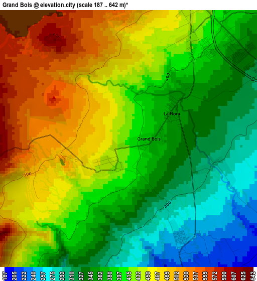
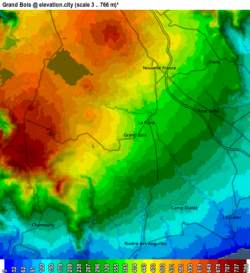
Below is the Elevation map of Grand Bois, which displays elevation range with different colors. Scale of the first map is from 187 to 642 m (614 to 2106 ft) with average elevation of 408.1 meters (=1339 ft) [note 1]
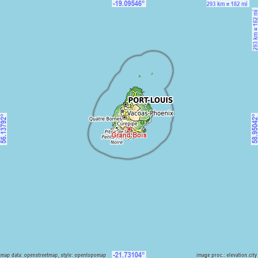
These maps also provides idea of topography and contour of this city, they are displayed at different zoom levels. More info about maps, scale and edge coordinates you can find below images.
| \ | Map #1 | Map #2 | Topo.Map |
| Scale [m] | 187..642 m | 3..766 m | × |
| Scale [ft] | 614..2106 ft | 10..2513 ft | × |
| Average | 408.1 m = 1339 ft | 362.7 m = 1190 ft | × |
| Width | 9.16 km = 5.7 mi | 18.32 km = 11.4 mi | 293 km = 182.1 mi |
| Height | 9.16 km = 5.7 mi | 18.32 km = 11.4 mi | 293.1 km = 182.1 mi |
| ↑Max Latitude | -20.3777° | -20.3365° | -19.09546° |
| Latitude at center | -20.41889° | -20.41889° | -20.41889° |
| ↓Min Latitude | -20.460069° | -20.501236° | -21.73104° |
| ← Min Longitude | 57.500225° | 57.456279° | 56.13792° |
| Longitude center | 57.54417° | 57.54417° | 57.54417° |
| →Max Longitude | 57.588115° | 57.632061° | 58.95042° |
Nearby cities:
Cities around Grand Bois sort by population:
• Rose Belle elevation 286 m
5.8 km,  69°
69°
• Chemin Grenier 74 m
11.2 km,  227°
227°
• Surinam 28 m
10.9 km,  201°
201°
• New Grove 241 m
7.3 km,  81°
81°
• Rivière des Anguilles 148 m
7.4 km,  174°
174°
• Nouvelle France 461 m
5.7 km,  18°
18°
• Camp Diable 198 m
6.1 km,  143°
143°
• Chamouny 131 m
10.8 km, 229°
• Midlands 435 m
11.4 km,  13°
13°
• Souillac 18 m
11.2 km,  194°
194°
• Saint Aubin 120 m
8.6 km,  175°
175°
• Cluny 317 m
8.5 km,  47°
47°
Multilingual:
 En español:
Grand Bois elevación 407 m.
 En France:
Grand Bois élévation 407 m.
 Auf Deutsch:
Grand Bois höhe über dem Meeresspiegel ist 407 m.

Sources and notes:
- [note 1] Map square and city borders are not equal. Map elevation data is calculated only from area inside that square.
- [src 1] Elevation data from geonames database provided with same terms of usage.
- [src 2] The elevation map of Grand Bois is generated using elevation data from NASA's 3 arcsec (90m) resolution SRTM data.
- [src 3] Base (background) map © OpenStreetMap contributors tiles are generated by Geofabrik and OpenTopoMap.
Copyright & License:
This Grand Bois Elevation Map is licensed under CC BY-SA. You may reuse any part from this page, if you give a proper credit by linking to this URL:
 More info on terms of use page.