Midlands elevation
Midlands (Plaines Wilhems), Mauritius elevation is 435 meters and Midlands elevation in feet is 1427 ft above sea level [src 1]. Midlands is a populated place (feature code) with elevation that is 286 meters (938 ft) bigger than average city elevation in Mauritius.
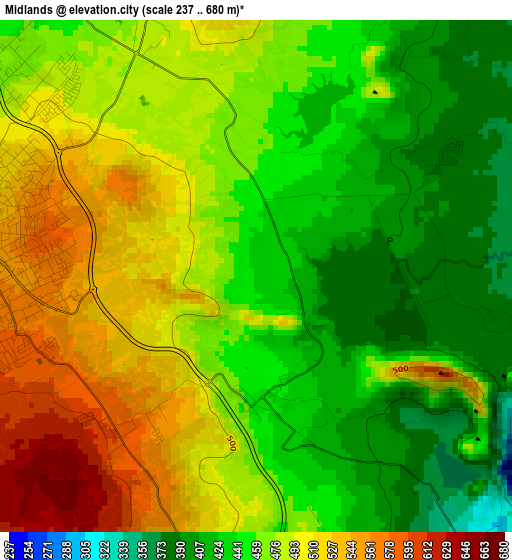
Below is the Elevation map of Midlands, which displays elevation range with different colors. Scale of the first map is from 237 to 680 m (778 to 2231 ft) with average elevation of 470.3 meters (=1543 ft) [note 1]
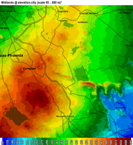
These maps also provides idea of topography and contour of this city, they are displayed at different zoom levels. More info about maps, scale and edge coordinates you can find below images.
| \ | Map #1 | Map #2 | Topo.Map |
| Scale [m] | 237..680 m | 95..680 m | × |
| Scale [ft] | 778..2231 ft | 312..2231 ft | × |
| Average | 470.3 m = 1543 ft | 416.2 m = 1365 ft | × |
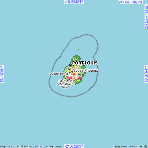
| Width | 9.16 km = 5.7 mi | 18.33 km = 11.4 mi | 293.2 km = 182.2 mi |
| Height | 9.16 km = 5.7 mi | 18.33 km = 11.4 mi | 293.3 km = 182.2 mi |
| ↑Max Latitude | -20.277854° | -20.236627° | -18.99481° |
| Latitude at center | -20.31907° | -20.31907° | -20.31907° |
| ↓Min Latitude | -20.360275° | -20.40147° | -21.63209° |
| ← Min Longitude | 57.526215° | 57.482269° | 56.16391° |
| Longitude center | 57.57016° | 57.57016° | 57.57016° |
| →Max Longitude | 57.614105° | 57.658051° | 58.97641° |
Nearby cities:
Cities around Midlands sort by population:
• Vacoas elevation 390 m
9.9 km,  283°
283°
• Curepipe 382 m
4.6 km,  273°
273°
• Rose Belle 286 m
9.4 km,  162°
162°
• Nouvelle France 461 m
5.8 km,  189°
189°
• Dagotière 446 m
8.3 km,  354°
354°
• Quartier Militaire 418 m
8.4 km,  19°
19°
• Saint Hubert 148 m
8.7 km,  125°
125°
• Providence 395 m
9.4 km,  27°
27°
• Dubreuil 389 m
3.6 km,  56°
56°
• Verdun 433 m
9.6 km, 350°
• Melrose 346 m
8.5 km,  49°
49°
• Cluny 317 m
6.4 km,  146°
146°
Multilingual:
 En español:
Midlands elevación 435 m.
 En France:
Midlands élévation 435 m.
 Auf Deutsch:
Midlands höhe über dem Meeresspiegel ist 435 m.

Sources and notes:
- [note 1] Map square and city borders are not equal. Map elevation data is calculated only from area inside that square.
- [src 1] Elevation data from geonames database provided with same terms of usage.
- [src 2] The elevation map of Midlands is generated using elevation data from NASA's 3 arcsec (90m) resolution SRTM data.
- [src 3] Base (background) map © OpenStreetMap contributors tiles are generated by Geofabrik and OpenTopoMap.
Copyright & License:
This Midlands Elevation Map is licensed under CC BY-SA. You may reuse any part from this page, if you give a proper credit by linking to this URL:
 More info on terms of use page.