Pailles elevation
Pailles (Moka), Mauritius elevation is 73 meters and Pailles elevation in feet is 240 ft above sea level [src 1]. Pailles is a populated place (feature code) with elevation that is 76 meters (249 ft) smaller than average city elevation in Mauritius.
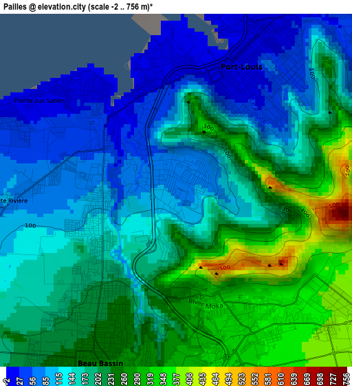
Below is the Elevation map of Pailles, which displays elevation range with different colors. Scale of the first map is from -2 to 756 m (-7 to 2480 ft) with average elevation of 183.9 meters (=603 ft) [note 1]
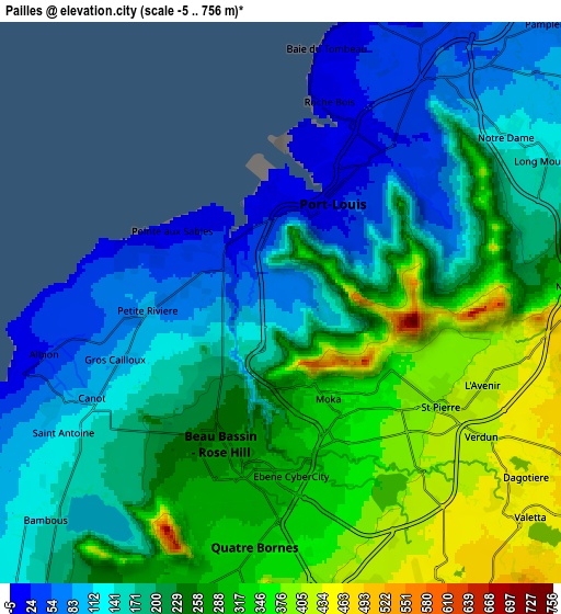
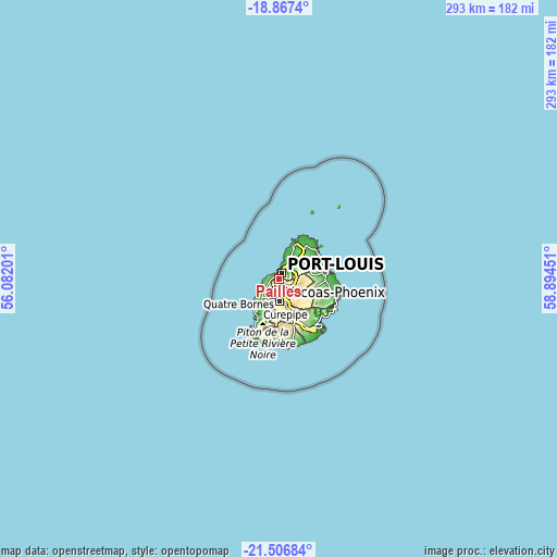
These maps also provides idea of topography and contour of this city, they are displayed at different zoom levels. More info about maps, scale and edge coordinates you can find below images.
| \ | Map #1 | Map #2 | Topo.Map |
| Scale [m] | -2..756 m | -5..756 m | × |
| Scale [ft] | -7..2480 ft | -16..2480 ft | × |
| Average | 183.9 m = 603 ft | 221 m = 725 ft | × |
| Width | 9.17 km = 5.7 mi | 18.34 km = 11.4 mi | 293.5 km = 182.4 mi |
| Height | 9.17 km = 5.7 mi | 18.34 km = 11.4 mi | 293.5 km = 182.4 mi |
| ↑Max Latitude | -20.15146° | -20.1102° | -18.8674° |
| Latitude at center | -20.19271° | -20.19271° | -20.19271° |
| ↓Min Latitude | -20.233949° | -20.275177° | -21.50684° |
| ← Min Longitude | 57.444315° | 57.400369° | 56.08201° |
| Longitude center | 57.48826° | 57.48826° | 57.48826° |
| →Max Longitude | 57.532205° | 57.576151° | 58.89451° |
Nearby cities:
Cities around Pailles sort by population:
• Port Louis elevation 3 m
3.6 km,  17°
17°
• Beau Bassin-Rose Hill 249 m
5.1 km,  207°
207°
• Quatre Bornes 335 m
8 km,  186°
186°
• Saint Pierre 369 m
4.4 km,  129°
129°
• Le Hochet 30 m
7.3 km,  28°
28°
• Terre Rouge 40 m
8.3 km, 27°
• Moka 322 m
3 km,  164°
164°
• Petite Rivière 86 m
4.4 km,  265°
265°
• Gros Cailloux 71 m
6.3 km,  255°
255°
• Crève Coeur 467 m
7.2 km,  88°
88°
• Verdun 433 m
8.3 km,  123°
123°
• Ebene 312 m
5.8 km,  176°
176°
Multilingual:
 En español:
Pailles elevación 73 m.
 En France:
Pailles élévation 73 m.


Sources and notes:
- [note 1] Map square and city borders are not equal. Map elevation data is calculated only from area inside that square.
- [src 1] Elevation data from geonames database provided with same terms of usage.
- [src 2] The elevation map of Pailles is generated using elevation data from NASA's 3 arcsec (90m) resolution SRTM data.
- [src 3] Base (background) map © OpenStreetMap contributors tiles are generated by Geofabrik and OpenTopoMap.
Copyright & License:
This Pailles Elevation Map is licensed under CC BY-SA. You may reuse any part from this page, if you give a proper credit by linking to this URL:
 More info on terms of use page.