Aioun elevation
Aioun (Hodh El Gharbi), Mauritania elevation is 235 meters and Aioun elevation in feet is 771 ft above sea level [src 1]. Aioun is a seat of a first-order administrative division (feature code) with elevation that is 109 meters (358 ft) bigger than average city elevation in Mauritania.
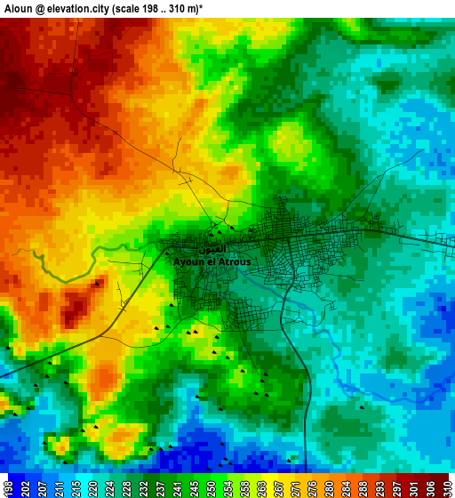
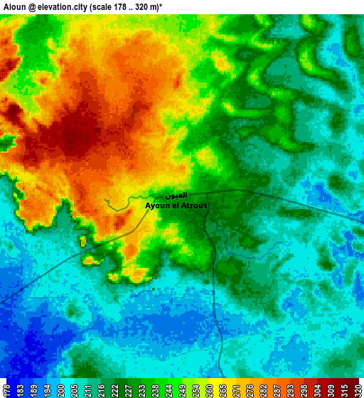
Below is the Elevation map of Aioun, which displays elevation range with different colors. Scale of the first map is from 198 to 310 m (650 to 1017 ft) with average elevation of 246.1 meters (=807 ft) [note 1]
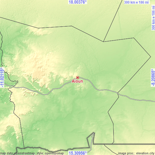
These maps also provides idea of topography and contour of this city, they are displayed at different zoom levels. More info about maps, scale and edge coordinates you can find below images.
| \ | Map #1 | Map #2 | Topo.Map |
| Scale [m] | 198..310 m | 178..320 m | × |
| Scale [ft] | 650..1017 ft | 584..1050 ft | × |
| Average | 246.1 m = 807 ft | 232 m = 761 ft | × |
| Width | 9.36 km = 5.8 mi | 18.72 km = 11.6 mi | 299.6 km = 186.2 mi |
| Height | 9.36 km = 5.8 mi | 18.72 km = 11.6 mi | 299.6 km = 186.2 mi |
| ↑Max Latitude | 16.703496° | 16.745582° | 18.00376° |
| Latitude at center | 16.6614° | 16.6614° | 16.6614° |
| ↓Min Latitude | 16.619295° | 16.577181° | 15.30956° |
| ← Min Longitude | -9.658845° | -9.702791° | -11.02115° |
| Longitude center | -9.6149° | -9.6149° | -9.6149° |
| →Max Longitude | -9.570955° | -9.527009° | -8.20865° |
Nearby cities:
Cities around Aioun sort by population:
• Néma elevation 266 m
251.3 km,  91°
91°
• Kaédi 25 m
418.7 km,  262°
262°
• Kiffa 127 m
190.4 km,  268°
268°
• Sélibaby 64 m
321.6 km,  238°
238°
• Tidjikja 398 m
285.1 km,  317°
317°
• Barkéwol 74 m
307.2 km, 269°
Multilingual:
 En español:
Aioun elevación 235 m.
 En France:
Aioun élévation 235 m.


Sources and notes:
- [note 1] Map square and city borders are not equal. Map elevation data is calculated only from area inside that square.
- [src 1] Elevation data from geonames database provided with same terms of usage.
- [src 2] The elevation map of Aioun is generated using elevation data from NASA's 3 arcsec (90m) resolution SRTM data.
- [src 3] Base (background) map © OpenStreetMap contributors tiles are generated by Geofabrik and OpenTopoMap.
Copyright & License:
This Aioun Elevation Map is licensed under CC BY-SA. You may reuse any part from this page, if you give a proper credit by linking to this URL:
 More info on terms of use page.