Saynshand elevation
Saynshand (East Gobi Aymag), Mongolia elevation is 947 meters and Saynshand elevation in feet is 3107 ft above sea level [src 1]. Saynshand is a seat of a first-order administrative division (feature code) with elevation that is 466 meters (1529 ft) smaller than average city elevation in Mongolia.
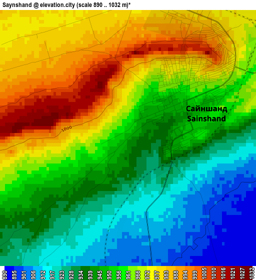
Below is the Elevation map of Saynshand, which displays elevation range with different colors. Scale of the first map is from 890 to 1032 m (2920 to 3386 ft) with average elevation of 953 meters (=3127 ft) [note 1]
These maps also provides idea of topography and contour of this city, they are displayed at different zoom levels. More info about maps, scale and edge coordinates you can find below images.
| \ | Map #1 | Map #2 | Topo.Map |
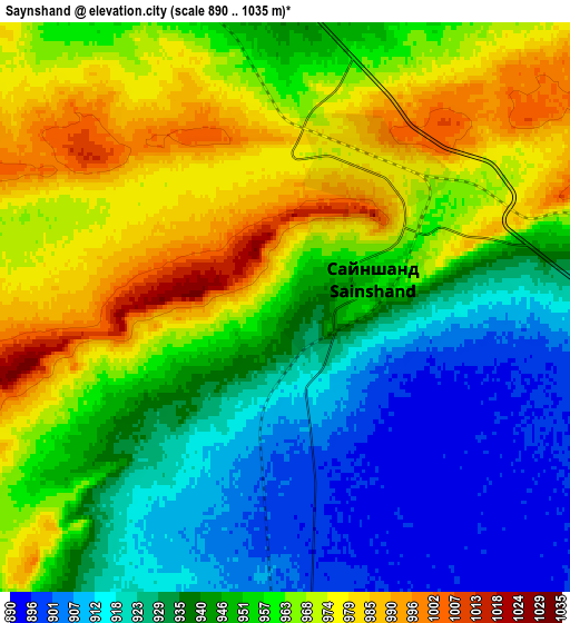
| Scale [m] | 890..1032 m | 890..1035 m | × |
| Scale [ft] | 2920..3386 ft | 2920..3396 ft | × |
| Average | 953 m = 3127 ft | 949.9 m = 3116 ft | × |
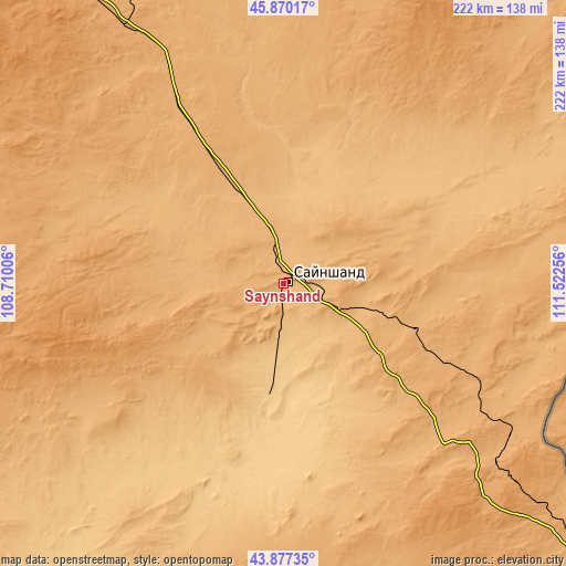
| Width | 6.92 km = 4.3 mi | 13.85 km = 8.6 mi | 221.6 km = 137.7 mi |
| Height | 6.92 km = 4.3 mi | 13.85 km = 8.6 mi | 221.6 km = 137.7 mi |
| ↑Max Latitude | 44.913519° | 44.944632° | 45.87017° |
| Latitude at center | 44.88239° | 44.88239° | 44.88239° |
| ↓Min Latitude | 44.851244° | 44.820081° | 43.87735° |
| ← Min Longitude | 110.072365° | 110.028419° | 108.71006° |
| Longitude center | 110.11631° | 110.11631° | 110.11631° |
| →Max Longitude | 110.160255° | 110.204201° | 111.52256° |
Nearby cities:
Cities around Saynshand sort by population:
• Naran-mandokhu Somon elevation 1312 m
157.1 km,  250°
250°
• Bayan 1163 m
152.1 km,  1°
1°
• Böhöt 1177 m
149.2 km,  285°
285°
• Nüden 1015 m
147.1 km,  169°
169°
• Khuvsget 996 m
146.9 km,  195°
195°
• Tsomog 1096 m
141.2 km,  324°
324°
• Hongor 1077 m
132.6 km,  39°
39°
• Tsagaandörvölj 1051 m
119.4 km,  328°
328°
• Ulaan-Uul 999 m
107.4 km,  124°
124°
• Öldziyt 1245 m
89.6 km,  255°
255°
• Chandmanĭ 956 m
77.4 km,  20°
20°
• Senj 1004 m
54.5 km,  109°
109°
Multilingual:
 En español:
Saynshand elevación 947 m.
 En France:
Saynshand élévation 947 m.
 Auf Deutsch:
Sainshand höhe über dem Meeresspiegel ist 947 m.

Sources and notes:
- [note 1] Map square and city borders are not equal. Map elevation data is calculated only from area inside that square.
- [src 1] Elevation data from geonames database provided with same terms of usage.
- [src 2] The elevation map of Saynshand is generated using elevation data from NASA's 3 arcsec (90m) resolution SRTM data.
- [src 3] Base (background) map © OpenStreetMap contributors tiles are generated by Geofabrik and OpenTopoMap.
Copyright & License:
This Saynshand Elevation Map is licensed under CC BY-SA. You may reuse any part from this page, if you give a proper credit by linking to this URL:
 More info on terms of use page.