Myaydo elevation
Myaydo (Magway, Thayet District), Myanmar elevation is 48 meters and Myaydo elevation in feet is 157 ft above sea level [src 1]. Myaydo is a populated place (feature code) with elevation that is 131 meters (430 ft) smaller than average city elevation in Myanmar.
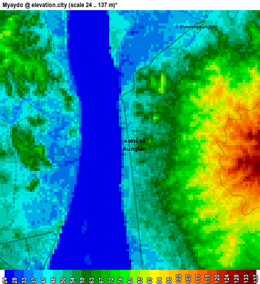
Below is the Elevation map of Myaydo, which displays elevation range with different colors. Scale of the first map is from 24 to 137 m (79 to 449 ft) with average elevation of 54 meters (=177 ft) [note 1]
These maps also provides idea of topography and contour of this city, they are displayed at different zoom levels. More info about maps, scale and edge coordinates you can find below images.
| \ | Map #1 | Map #2 | Topo.Map |
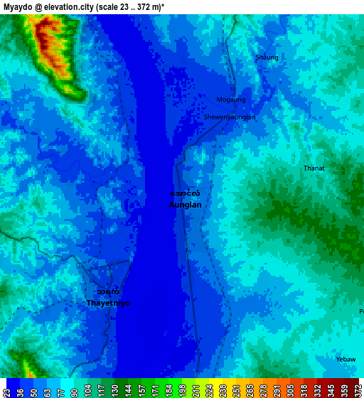
| Scale [m] | 24..137 m | 23..372 m | × |
| Scale [ft] | 79..449 ft | 75..1220 ft | × |
| Average | 54 m = 177 ft | 72 m = 236 ft | × |
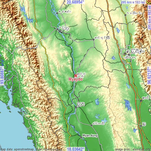
| Width | 9.22 km = 5.7 mi | 18.44 km = 11.5 mi | 295 km = 183.3 mi |
| Height | 9.22 km = 5.7 mi | 18.44 km = 11.5 mi | 295 km = 183.3 mi |
| ↑Max Latitude | 19.409833° | 19.451275° | 20.68954° |
| Latitude at center | 19.36838° | 19.36838° | 19.36838° |
| ↓Min Latitude | 19.326916° | 19.285442° | 18.03642° |
| ← Min Longitude | 95.171175° | 95.127229° | 93.80887° |
| Longitude center | 95.21512° | 95.21512° | 95.21512° |
| →Max Longitude | 95.259065° | 95.303011° | 96.62137° |
Nearby cities:
Cities around Myaydo sort by population:
• Nay Pyi Taw elevation 122 m
104.6 km,  66°
66°
• Pyay 32 m
60.5 km,  179°
179°
• Yenangyaung 56 m
127.1 km,  343°
343°
• Taungoo 56 m
136.5 km,  110°
110°
• Thayetmyo 47 m
6.3 km,  212°
212°
• Pyinmana 101 m
111.8 km, 68°
• Magway 60 m
91.8 km, 341°
• Taungdwingyi 143 m
78.9 km,  25°
25°
• Yamethin 203 m
152.7 km,  39°
39°
• Minbu 49 m
97 km, 338°
• Myanaung 26 m
120.8 km,  174°
174°
• Paungde 35 m
102.2 km,  162°
162°
Multilingual:
 En español:
Myaydo elevación 48 m.
 En France:
Myaydo élévation 48 m.


Sources and notes:
- [note 1] Map square and city borders are not equal. Map elevation data is calculated only from area inside that square.
- [src 1] Elevation data from geonames database provided with same terms of usage.
- [src 2] The elevation map of Myaydo is generated using elevation data from NASA's 3 arcsec (90m) resolution SRTM data.
- [src 3] Base (background) map © OpenStreetMap contributors tiles are generated by Geofabrik and OpenTopoMap.
Copyright & License:
This Myaydo Elevation Map is licensed under CC BY-SA. You may reuse any part from this page, if you give a proper credit by linking to this URL:
 More info on terms of use page.